Koygorodok elevation
Koygorodok (Komi), Russia elevation is 150 meters and Koygorodok elevation in feet is 492 ft above sea level [src 1]. Koygorodok is a populated place (feature code) with elevation that is 49 meters (161 ft) smaller than average city elevation in Russia.
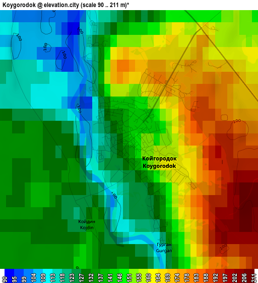
Below is the Elevation map of Koygorodok, which displays elevation range with different colors. Scale of the first map is from 90 to 211 m (295 to 692 ft) with average elevation of 145.1 meters (=476 ft) [note 1]
These maps also provides idea of topography and contour of this city, they are displayed at different zoom levels. More info about maps, scale and edge coordinates you can find below images.
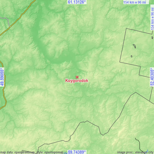
| \ | Map #1 | Topo.Map |
| Scale [m] | 90..211 m | × |
| Scale [ft] | 295..692 ft | × |
| Average | 145.1 m = 476 ft | × |
| Width | 4.82 km = 3 mi | 154.3 km = 95.9 mi |
| Height | 4.82 km = 3 mi | 154.2 km = 95.8 mi |
| ↑Max Latitude | 60.466649° | 61.13126° |
| Latitude at center | 60.44498° | 60.44498° |
| ↓Min Latitude | 60.423296° | 59.74389° |
| ← Min Longitude | 50.952855° | 49.59055° |
| Longitude center | 50.9968° | 50.9968° |
| →Max Longitude | 51.040745° | 52.40305° |
Nearby cities:
Cities around Koygorodok sort by population:
• Syktyvkar elevation 146 m
135.9 km,  355°
355°
• Raduzhnyy 182 m
130.6 km,  215°
215°
• Lesnoy 174 m
96.9 km,  139°
139°
• Vizinga 108 m
85.2 km,  325°
325°
• Rudnichnyy 183 m
123.2 km, 138°
• Nagorsk 138 m
125.8 km,  184°
184°
• Verkhnyaya Maksakovka 109 m
132.3 km, 359°
• Svetlopolyansk 178 m
137.1 km,  146°
146°
• Letka 154 m
128.2 km, 222°
• Sozimskiy 160 m
104.5 km, 138°
• Dubrovka 142 m
135.5 km, 176°
• Mordino 134 m
112.1 km,  25°
25°
Multilingual:
 En español:
Koygorodok elevación 150 m.
 En France:
Koygorodok élévation 150 m.
 Auf Deutsch:
Koygorodok höhe über dem Meeresspiegel ist 150 m.

Sources and notes:
- [note 1] Map square and city borders are not equal. Map elevation data is calculated only from area inside that square.
- [src 1] Elevation data from geonames database provided with same terms of usage.
- [src 2] The elevation map of Koygorodok is generated using GMTED2010 database with 7.5 arcsec (225m) resolution.
- [src 3] Base (background) map © OpenStreetMap contributors tiles are generated by Geofabrik and OpenTopoMap.
Copyright & License:
This Koygorodok Elevation Map is licensed under CC BY-SA. You may reuse any part from this page, if you give a proper credit by linking to this URL:
 More info on terms of use page.