Luga elevation
Luga (Leningradskaya Oblast'), Russia elevation is 59 meters and Luga elevation in feet is 194 ft above sea level [src 1]. Luga is a populated place (feature code) with elevation that is 140 meters (459 ft) smaller than average city elevation in Russia.
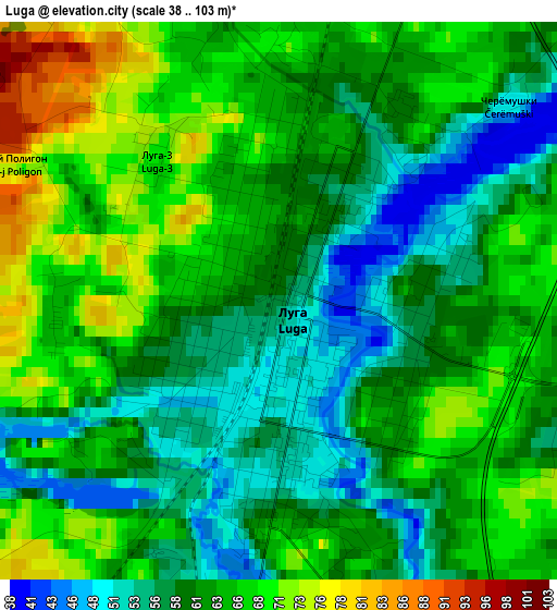
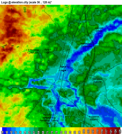
Below is the Elevation map of Luga, which displays elevation range with different colors. Scale of the first map is from 38 to 103 m (125 to 338 ft) with average elevation of 61.8 meters (=203 ft) [note 1]
These maps also provides idea of topography and contour of this city, they are displayed at different zoom levels. More info about maps, scale and edge coordinates you can find below images.
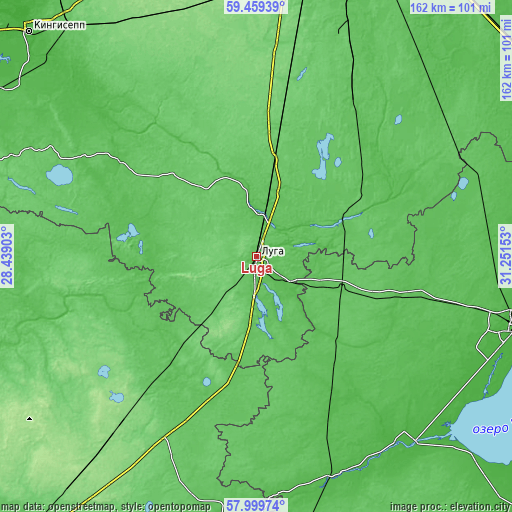
| \ | Map #1 | Map #2 | Topo.Map |
| Scale [m] | 38..103 m | 36..128 m | × |
| Scale [ft] | 125..338 ft | 118..420 ft | × |
| Average | 61.8 m = 203 ft | 70.7 m = 232 ft | × |
| Width | 5.07 km = 3.2 mi | 10.14 km = 6.3 mi | 162.3 km = 100.8 mi |
| Height | 5.07 km = 3.2 mi | 10.14 km = 6.3 mi | 162.3 km = 100.8 mi |
| ↑Max Latitude | 58.760019° | 58.782802° | 59.45939° |
| Latitude at center | 58.73722° | 58.73722° | 58.73722° |
| ↓Min Latitude | 58.714406° | 58.691578° | 57.99974° |
| ← Min Longitude | 29.801335° | 29.757389° | 28.43903° |
| Longitude center | 29.84528° | 29.84528° | 29.84528° |
| →Max Longitude | 29.889225° | 29.933171° | 31.25153° |
Nearby cities:
Cities around Luga sort by population:
• Siverskiy elevation 102 m
69.9 km,  10°
10°
• Sol’tsy 23 m
73.7 km,  157°
157°
• Strugi-Krasnyye 127 m
67.4 km,  219°
219°
• Shimsk 29 m
77.2 km,  139°
139°
• Plyussa 70 m
44 km, 219°
• Druzhnaya Gorka 89 m
62.5 km, 14°
• Mshinskaya 79 m
31.4 km, 10°
• Tolmachevo 62 m
14.1 km,  15°
15°
• Batetskiy 69 m
28.3 km,  110°
110°
• Rozhdestveno 100 m
64.8 km, 5°
• Utorgosh 45 m
56 km,  154°
154°
• Kobrinskoye 85 m
77.8 km, 11°
Multilingual:
 En español:
Luga elevación 59 m.
 En France:
Louga élévation 59 m.


Sources and notes:
- [note 1] Map square and city borders are not equal. Map elevation data is calculated only from area inside that square.
- [src 1] Elevation data from geonames database provided with same terms of usage.
- [src 2] The elevation map of Luga is generated using elevation data from NASA's 3 arcsec (90m) resolution SRTM data.
- [src 3] Base (background) map © OpenStreetMap contributors tiles are generated by Geofabrik and OpenTopoMap.
Copyright & License:
This Luga Elevation Map is licensed under CC BY-SA. You may reuse any part from this page, if you give a proper credit by linking to this URL:
 More info on terms of use page.