Ozëry elevation
Ozëry (Moscow Oblast), Russia elevation is 132 meters and Ozëry elevation in feet is 433 ft above sea level [src 1]. Ozëry is a populated place (feature code) with elevation that is 67 meters (220 ft) smaller than average city elevation in Russia.
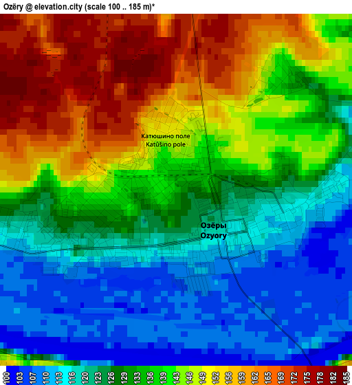
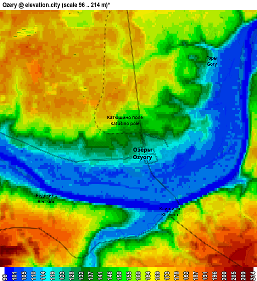
Below is the Elevation map of Ozëry, which displays elevation range with different colors. Scale of the first map is from 100 to 185 m (328 to 607 ft) with average elevation of 134.9 meters (=443 ft) [note 1]
These maps also provides idea of topography and contour of this city, they are displayed at different zoom levels. More info about maps, scale and edge coordinates you can find below images.
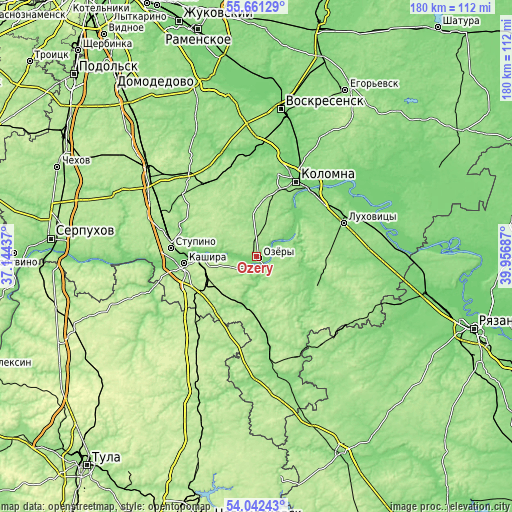
| \ | Map #1 | Map #2 | Topo.Map |
| Scale [m] | 100..185 m | 96..214 m | × |
| Scale [ft] | 328..607 ft | 315..702 ft | × |
| Average | 134.9 m = 443 ft | 148.3 m = 487 ft | × |
| Width | 5.62 km = 3.5 mi | 11.25 km = 7 mi | 180 km = 111.8 mi |
| Height | 5.62 km = 3.5 mi | 11.25 km = 7 mi | 180 km = 111.8 mi |
| ↑Max Latitude | 54.885266° | 54.910536° | 55.66129° |
| Latitude at center | 54.85998° | 54.85998° | 54.85998° |
| ↓Min Latitude | 54.834678° | 54.80936° | 54.04243° |
| ← Min Longitude | 38.506675° | 38.462729° | 37.14437° |
| Longitude center | 38.55062° | 38.55062° | 38.55062° |
| →Max Longitude | 38.594565° | 38.638511° | 39.95687° |
Nearby cities:
Cities around Ozëry sort by population:
• Kolomna elevation 144 m
28.4 km,  30°
30°
• Stupino 186 m
31 km,  278°
278°
• Kashira 152 m
24.6 km,  265°
265°
• Lukhovitsy 118 m
34.1 km,  67°
67°
• Zaraysk 167 m
23.7 km,  117°
117°
• Ozherel’ye 220 m
19.8 km,  247°
247°
• Malino 157 m
36.9 km,  319°
319°
• Uzunovo 152 m
36 km,  173°
173°
• Sychëvo 145 m
24.8 km,  24°
24°
• Raduzhnyy 114 m
32.8 km, 20°
• Biorki 182 m
21.8 km,  9°
9°
• Pervomayskiy 163 m
24.1 km, 17°
Multilingual:
 En español:
Ozëry elevación 132 m.
 En France:
Ozëry élévation 132 m.


Sources and notes:
- [note 1] Map square and city borders are not equal. Map elevation data is calculated only from area inside that square.
- [src 1] Elevation data from geonames database provided with same terms of usage.
- [src 2] The elevation map of Ozëry is generated using elevation data from NASA's 3 arcsec (90m) resolution SRTM data.
- [src 3] Base (background) map © OpenStreetMap contributors tiles are generated by Geofabrik and OpenTopoMap.
Copyright & License:
This Ozëry Elevation Map is licensed under CC BY-SA. You may reuse any part from this page, if you give a proper credit by linking to this URL:
 More info on terms of use page.