Stupino elevation
Stupino (Moscow Oblast), Russia elevation is 186 meters and Stupino elevation in feet is 610 ft above sea level [src 1]. Stupino is a populated place (feature code) with elevation that is 13 meters (43 ft) smaller than average city elevation in Russia.
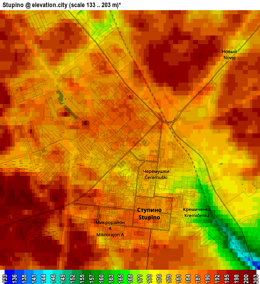
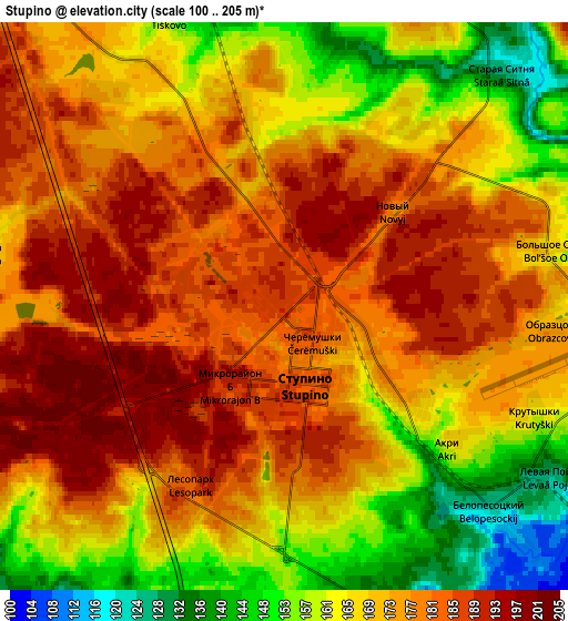
Below is the Elevation map of Stupino, which displays elevation range with different colors. Scale of the first map is from 133 to 203 m (436 to 666 ft) with average elevation of 185.4 meters (=608 ft) [note 1]
These maps also provides idea of topography and contour of this city, they are displayed at different zoom levels. More info about maps, scale and edge coordinates you can find below images.
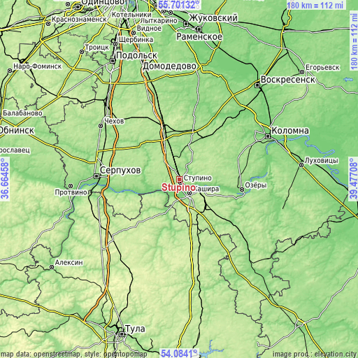
| \ | Map #1 | Map #2 | Topo.Map |
| Scale [m] | 133..203 m | 100..205 m | × |
| Scale [ft] | 436..666 ft | 328..673 ft | × |
| Average | 185.4 m = 608 ft | 171.9 m = 564 ft | × |
| Width | 5.62 km = 3.5 mi | 11.24 km = 7 mi | 179.8 km = 111.7 mi |
| Height | 5.62 km = 3.5 mi | 11.24 km = 7 mi | 179.8 km = 111.7 mi |
| ↑Max Latitude | 54.92609° | 54.951335° | 55.70132° |
| Latitude at center | 54.90083° | 54.90083° | 54.90083° |
| ↓Min Latitude | 54.875554° | 54.850262° | 54.0841° |
| ← Min Longitude | 38.026885° | 37.982939° | 36.66458° |
| Longitude center | 38.07083° | 38.07083° | 38.07083° |
| →Max Longitude | 38.114775° | 38.158721° | 39.47708° |
Nearby cities:
Cities around Stupino sort by population:
• Kashira elevation 152 m
8.8 km,  135°
135°
• Ozëry 132 m
31 km,  98°
98°
• Pushchino 191 m
30.3 km,  255°
255°
• Mikhnëvo 173 m
26.3 km,  343°
343°
• Ozherel’ye 220 m
17.4 km,  134°
134°
• Malino 157 m
24.4 km,  15°
15°
• Melikhovo 185 m
35.9 km,  311°
311°
• Novyy Byt 179 m
34 km,  301°
301°
• Zhilëvo 166 m
13.2 km, 343°
• Popovo 137 m
32.2 km, 306°
• Bol’shoye Gryzlovo 204 m
29.8 km,  247°
247°
• Danki 168 m
32.1 km,  273°
273°
Multilingual:
 En español:
Stúpino elevación 186 m.
 En France:
Stoupino élévation 186 m.


Sources and notes:
- [note 1] Map square and city borders are not equal. Map elevation data is calculated only from area inside that square.
- [src 1] Elevation data from geonames database provided with same terms of usage.
- [src 2] The elevation map of Stupino is generated using elevation data from NASA's 3 arcsec (90m) resolution SRTM data.
- [src 3] Base (background) map © OpenStreetMap contributors tiles are generated by Geofabrik and OpenTopoMap.
Copyright & License:
This Stupino Elevation Map is licensed under CC BY-SA. You may reuse any part from this page, if you give a proper credit by linking to this URL:
 More info on terms of use page.