Peschanokopskoye elevation
Peschanokopskoye (Rostov), Russia elevation is 76 meters and Peschanokopskoye elevation in feet is 249 ft above sea level [src 1]. Peschanokopskoye is a seat of a second-order administrative division (feature code) with elevation that is 123 meters (404 ft) smaller than average city elevation in Russia.
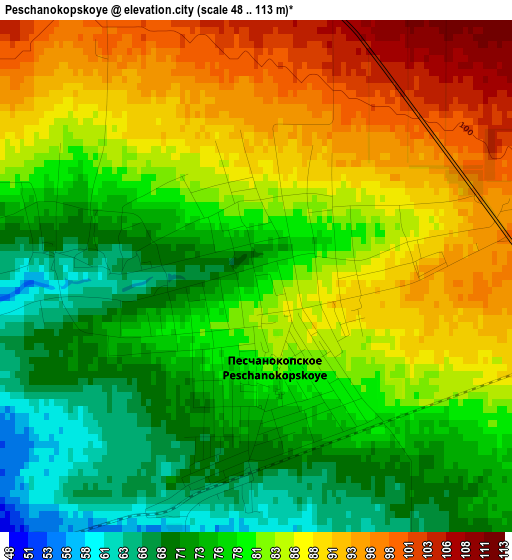
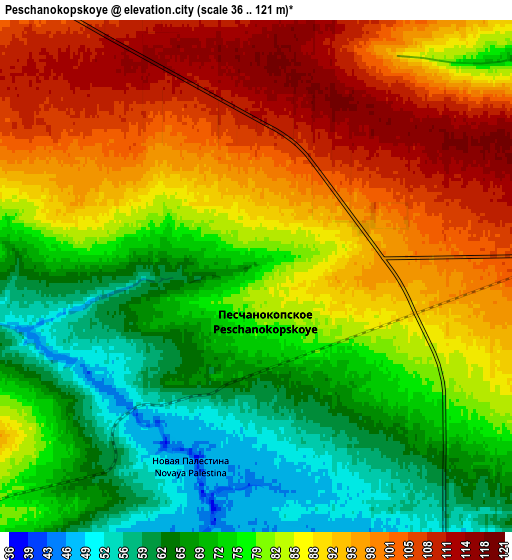
Below is the Elevation map of Peschanokopskoye, which displays elevation range with different colors. Scale of the first map is from 48 to 113 m (157 to 371 ft) with average elevation of 80.8 meters (=265 ft) [note 1]
These maps also provides idea of topography and contour of this city, they are displayed at different zoom levels. More info about maps, scale and edge coordinates you can find below images.
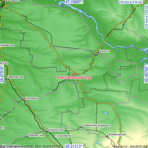
| \ | Map #1 | Map #2 | Topo.Map |
| Scale [m] | 48..113 m | 36..121 m | × |
| Scale [ft] | 157..371 ft | 118..397 ft | × |
| Average | 80.8 m = 265 ft | 82.9 m = 272 ft | × |
| Width | 6.76 km = 4.2 mi | 13.53 km = 8.4 mi | 216.5 km = 134.5 mi |
| Height | 6.76 km = 4.2 mi | 13.53 km = 8.4 mi | 216.5 km = 134.5 mi |
| ↑Max Latitude | 46.225581° | 46.255975° | 47.15997° |
| Latitude at center | 46.19517° | 46.19517° | 46.19517° |
| ↓Min Latitude | 46.164742° | 46.134298° | 45.21313° |
| ← Min Longitude | 41.037485° | 40.993539° | 39.67518° |
| Longitude center | 41.08143° | 41.08143° | 41.08143° |
| →Max Longitude | 41.125375° | 41.169321° | 42.48768° |
Nearby cities:
Cities around Peschanokopskoye sort by population:
• Sal’sk elevation 38 m
47 km,  48°
48°
• Novopokrovskaya 61 m
40 km,  227°
227°
• Belaya Glina 51 m
21.1 km, 231°
• Yegorlykskaya 98 m
52.5 km,  321°
321°
• Krasnogvardeyskoye 51 m
51.5 km,  138°
138°
• Tselina 108 m
37.8 km,  354°
354°
• Gigant 71 m
40 km,  29°
29°
• Kalnibolotskaya 47 m
52.6 km,  246°
246°
• Uspenskaya 68 m
47.9 km,  181°
181°
• Krasnaya Polyana 37 m
33.6 km,  105°
105°
• Kubanskiy 96 m
48.7 km, 232°
• Letnik 44 m
24.9 km,  145°
145°
Multilingual:
 En español:
Peschanokopskoye elevación 76 m.
 En France:
Peschanokopskoye élévation 76 m.
 Auf Deutsch:
Peschanokopskoye höhe über dem Meeresspiegel ist 76 m.

Sources and notes:
- [note 1] Map square and city borders are not equal. Map elevation data is calculated only from area inside that square.
- [src 1] Elevation data from geonames database provided with same terms of usage.
- [src 2] The elevation map of Peschanokopskoye is generated using elevation data from NASA's 3 arcsec (90m) resolution SRTM data.
- [src 3] Base (background) map © OpenStreetMap contributors tiles are generated by Geofabrik and OpenTopoMap.
Copyright & License:
This Peschanokopskoye Elevation Map is licensed under CC BY-SA. You may reuse any part from this page, if you give a proper credit by linking to this URL:
 More info on terms of use page.