Rakhmanovo elevation
Rakhmanovo (Moscow Oblast), Russia elevation is 135 meters and Rakhmanovo elevation in feet is 443 ft above sea level [src 1]. Rakhmanovo is a populated place (feature code) with elevation that is 64 meters (210 ft) smaller than average city elevation in Russia.
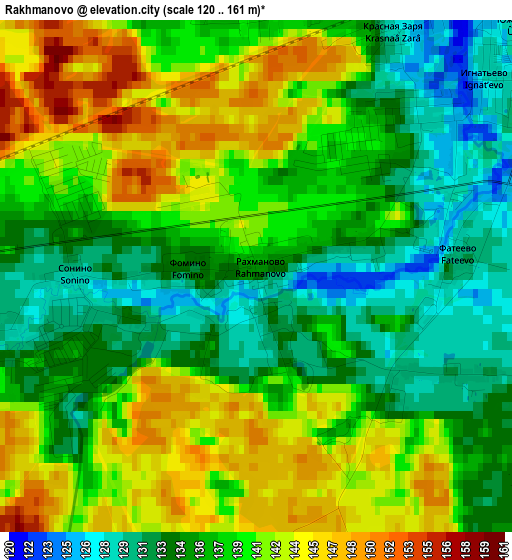
Below is the Elevation map of Rakhmanovo, which displays elevation range with different colors. Scale of the first map is from 120 to 161 m (394 to 528 ft) with average elevation of 138.1 meters (=453 ft) [note 1]
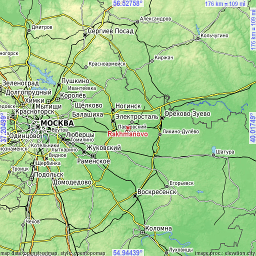
These maps also provides idea of topography and contour of this city, they are displayed at different zoom levels. More info about maps, scale and edge coordinates you can find below images.
| \ | Map #1 | Topo.Map |
| Scale [m] | 120..161 m | × |
| Scale [ft] | 394..528 ft | × |
| Average | 138.1 m = 453 ft | × |
| Width | 5.5 km = 3.4 mi | 176 km = 109.4 mi |
| Height | 5.5 km = 3.4 mi | 176 km = 109.4 mi |
| ↑Max Latitude | 55.768739° | 56.52758° |
| Latitude at center | 55.74401° | 55.74401° |
| ↓Min Latitude | 55.719266° | 54.94439° |
| ← Min Longitude | 38.567295° | 37.20499° |
| Longitude center | 38.61124° | 38.61124° |
| →Max Longitude | 38.655185° | 40.01749° |
Nearby cities:
Cities around Rakhmanovo sort by population:
• Elektrostal’ elevation 157 m
11.5 km,  296°
296°
• Noginsk 129 m
17.2 km,  322°
322°
• Pavlovskiy Posad 130 m
4.9 km,  30°
30°
• Fryazevo 138 m
9.3 km,  262°
262°
• Kabanovo 134 m
20.3 km,  88°
88°
• Elektrogorsk 136 m
19.1 km,  35°
35°
• Drezna 125 m
14.8 km, 90°
• Davydovo 126 m
21.7 km,  133°
133°
• Gzhel’ 133 m
20.2 km,  222°
222°
• Demikhovo 124 m
18 km,  70°
70°
• Imeni Vorovskogo 137 m
18.1 km,  265°
265°
• Rechitsy 138 m
18.5 km,  208°
208°
Multilingual:
 En español:
Rakhmanovo elevación 135 m.
 En France:
Rakhmanovo élévation 135 m.
 Auf Deutsch:
Rakhmanovo höhe über dem Meeresspiegel ist 135 m.

Sources and notes:
- [note 1] Map square and city borders are not equal. Map elevation data is calculated only from area inside that square.
- [src 1] Elevation data from geonames database provided with same terms of usage.
- [src 2] The elevation map of Rakhmanovo is generated using elevation data from NASA's 3 arcsec (90m) resolution SRTM data.
- [src 3] Base (background) map © OpenStreetMap contributors tiles are generated by Geofabrik and OpenTopoMap.
Copyright & License:
This Rakhmanovo Elevation Map is licensed under CC BY-SA. You may reuse any part from this page, if you give a proper credit by linking to this URL:
 More info on terms of use page.