Gzhel’ elevation
Gzhel’ (Moscow Oblast), Russia elevation is 133 meters and Gzhel’ elevation in feet is 436 ft above sea level [src 1]. Gzhel’ is a populated place (feature code) with elevation that is 66 meters (217 ft) smaller than average city elevation in Russia.
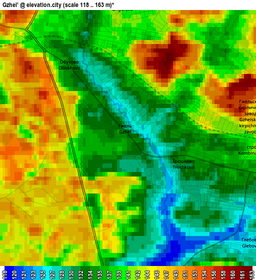
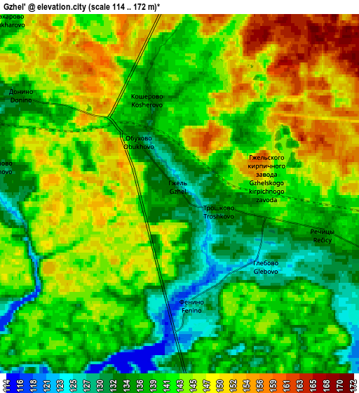
Below is the Elevation map of Gzhel’, which displays elevation range with different colors. Scale of the first map is from 118 to 163 m (387 to 535 ft) with average elevation of 139.5 meters (=458 ft) [note 1]
These maps also provides idea of topography and contour of this city, they are displayed at different zoom levels. More info about maps, scale and edge coordinates you can find below images.
| \ | Map #1 | Map #2 | Topo.Map |
| Scale [m] | 118..163 m | 114..172 m | × |
| Scale [ft] | 387..535 ft | 374..564 ft | × |
| Average | 139.5 m = 458 ft | 141.8 m = 465 ft | × |
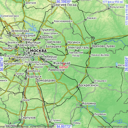
| Width | 5.52 km = 3.4 mi | 11.04 km = 6.9 mi | 176.6 km = 109.7 mi |
| Height | 5.52 km = 3.4 mi | 11.04 km = 6.9 mi | 176.6 km = 109.7 mi |
| ↑Max Latitude | 55.634893° | 55.659691° | 56.39635° |
| Latitude at center | 55.61008° | 55.61008° | 55.61008° |
| ↓Min Latitude | 55.585251° | 55.560406° | 54.80773° |
| ← Min Longitude | 38.350045° | 38.306099° | 36.98774° |
| Longitude center | 38.39399° | 38.39399° | 38.39399° |
| →Max Longitude | 38.437935° | 38.481881° | 39.80024° |
Nearby cities:
Cities around Gzhel’ sort by population:
• Zhukovskiy elevation 137 m
17.3 km,  264°
264°
• Ramenskoye 130 m
11.4 km,  245°
245°
• Fryazevo 138 m
14.4 km,  17°
17°
• Elektrougli 145 m
17.2 km,  317°
317°
• Beloozërskiy 123 m
17 km,  169°
169°
• Bykovo 136 m
19.9 km,  278°
278°
• Il’inskiy 134 m
17.3 km,  273°
273°
• Kratovo 144 m
13.7 km, 264°
• Imeni Vorovskogo 137 m
14.2 km,  341°
341°
• Rechitsy 138 m
5.1 km,  106°
106°
• Bykovo 133 m
19.8 km, 273°
• Malyshevo 114 m
13.1 km,  191°
191°
Multilingual:
 En español:
Gzhel’ elevación 133 m.
 En France:
Gzhel’ élévation 133 m.


Sources and notes:
- [note 1] Map square and city borders are not equal. Map elevation data is calculated only from area inside that square.
- [src 1] Elevation data from geonames database provided with same terms of usage.
- [src 2] The elevation map of Gzhel’ is generated using elevation data from NASA's 3 arcsec (90m) resolution SRTM data.
- [src 3] Base (background) map © OpenStreetMap contributors tiles are generated by Geofabrik and OpenTopoMap.
Copyright & License:
This Gzhel’ Elevation Map is licensed under CC BY-SA. You may reuse any part from this page, if you give a proper credit by linking to this URL:
 More info on terms of use page.