Elektrogorsk elevation
Elektrogorsk (Moscow Oblast), Russia elevation is 136 meters and Elektrogorsk elevation in feet is 446 ft above sea level [src 1]. Elektrogorsk is a populated place (feature code) with elevation that is 63 meters (207 ft) smaller than average city elevation in Russia.
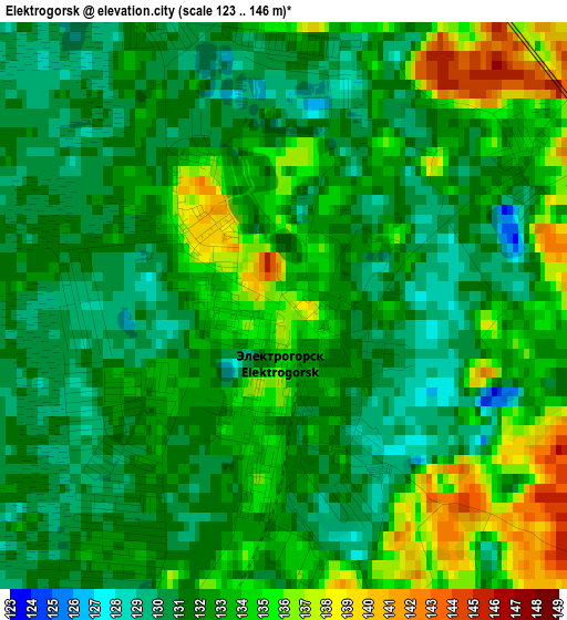
Below is the Elevation map of Elektrogorsk, which displays elevation range with different colors. Scale of the first map is from 123 to 146 m (404 to 479 ft) with average elevation of 132.3 meters (=434 ft) [note 1]
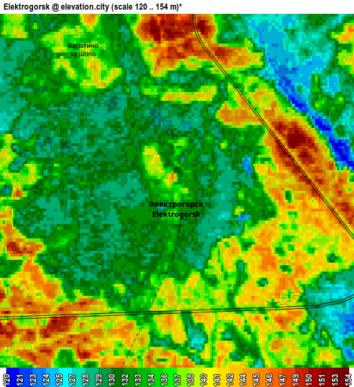
These maps also provides idea of topography and contour of this city, they are displayed at different zoom levels. More info about maps, scale and edge coordinates you can find below images.
| \ | Map #1 | Map #2 | Topo.Map |
| Scale [m] | 123..146 m | 120..154 m | × |
| Scale [ft] | 404..479 ft | 394..505 ft | × |
| Average | 132.3 m = 434 ft | 135.2 m = 444 ft | × |
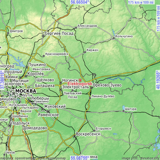
| Width | 5.48 km = 3.4 mi | 10.96 km = 6.8 mi | 175.4 km = 109 mi |
| Height | 5.48 km = 3.4 mi | 10.96 km = 6.8 mi | 175.4 km = 109 mi |
| ↑Max Latitude | 55.90895° | 55.933574° | 56.66504° |
| Latitude at center | 55.88431° | 55.88431° | 55.88431° |
| ↓Min Latitude | 55.859655° | 55.834984° | 55.08755° |
| ← Min Longitude | 38.742455° | 38.698509° | 37.38015° |
| Longitude center | 38.7864° | 38.7864° | 38.7864° |
| →Max Longitude | 38.830345° | 38.874291° | 40.19265° |
Nearby cities:
Cities around Elektrogorsk sort by population:
• Elektrostal’ elevation 157 m
23.7 km,  243°
243°
• Orekhovo-Zuyevo 123 m
13.9 km,  128°
128°
• Noginsk 129 m
21.5 km,  264°
264°
• Pavlovskiy Posad 130 m
14.2 km,  216°
216°
• Likino-Dulevo 135 m
22.2 km,  151°
151°
• Kabanovo 134 m
17.8 km, 148°
• Drezna 125 m
16.3 km,  166°
166°
• Demikhovo 124 m
11.5 km, 147°
• Rakhmanovo 135 m
19.1 km, 215°
• Vereya 125 m
23 km,  122°
122°
• Malaya Dubna 127 m
10.5 km,  93°
93°
• Yamkino 137 m
24.2 km,  279°
279°
Multilingual:
 En español:
Elektrogorsk elevación 136 m.
 En France:
Elektrogorsk élévation 136 m.
 Auf Deutsch:
Elektrogorsk höhe über dem Meeresspiegel ist 136 m.

Sources and notes:
- [note 1] Map square and city borders are not equal. Map elevation data is calculated only from area inside that square.
- [src 1] Elevation data from geonames database provided with same terms of usage.
- [src 2] The elevation map of Elektrogorsk is generated using elevation data from NASA's 3 arcsec (90m) resolution SRTM data.
- [src 3] Base (background) map © OpenStreetMap contributors tiles are generated by Geofabrik and OpenTopoMap.
Copyright & License:
This Elektrogorsk Elevation Map is licensed under CC BY-SA. You may reuse any part from this page, if you give a proper credit by linking to this URL:
 More info on terms of use page.