Shemursha elevation
Shemursha (Chuvashia), Russia elevation is 160 meters and Shemursha elevation in feet is 525 ft above sea level [src 1]. Shemursha is a populated place (feature code) with elevation that is 39 meters (128 ft) smaller than average city elevation in Russia.
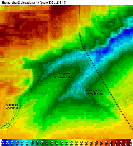
Below is the Elevation map of Shemursha, which displays elevation range with different colors. Scale of the first map is from 133 to 214 m (436 to 702 ft) with average elevation of 175.2 meters (=575 ft) [note 1]
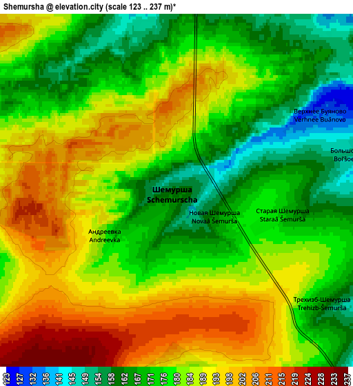
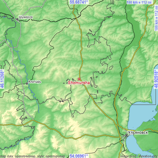
These maps also provides idea of topography and contour of this city, they are displayed at different zoom levels. More info about maps, scale and edge coordinates you can find below images.
| \ | Map #1 | Map #2 | Topo.Map |
| Scale [m] | 133..214 m | 123..237 m | × |
| Scale [ft] | 436..702 ft | 404..778 ft | × |
| Average | 175.2 m = 575 ft | 181.3 m = 595 ft | × |
| Width | 5.62 km = 3.5 mi | 11.24 km = 7 mi | 179.9 km = 111.8 mi |
| Height | 5.62 km = 3.5 mi | 11.24 km = 7 mi | 179.9 km = 111.8 mi |
| ↑Max Latitude | 54.911899° | 54.937153° | 55.68741° |
| Latitude at center | 54.88663° | 54.88663° | 54.88663° |
| ↓Min Latitude | 54.861345° | 54.836044° | 54.06961° |
| ← Min Longitude | 47.474985° | 47.431039° | 46.11268° |
| Longitude center | 47.51893° | 47.51893° | 47.51893° |
| →Max Longitude | 47.562875° | 47.606821° | 48.92518° |
Nearby cities:
Cities around Shemursha sort by population:
• Alatyr’ elevation 135 m
60.2 km,  265°
265°
• Buinsk 93 m
50.3 km,  79°
79°
• Ibresi 191 m
55.3 km,  326°
326°
• Surskoye 122 m
68.2 km,  228°
228°
• Batyrevo 102 m
21 km,  16°
16°
• Yazykovo 167 m
66.6 km,  187°
187°
• Komsomol'skoye 118 m
41.2 km,  2°
2°
• Tsil’na 102 m
51.4 km,  129°
129°
• Undory 129 m
64 km,  118°
118°
• Staroye Drozhzhanoye 178 m
18.1 km,  170°
170°
• Kirya 216 m
47.2 km,  297°
297°
• Buinsk 164 m
45 km,  319°
319°
Multilingual:
 En español:
Shemursha elevación 160 m.
 En France:
Shemursha élévation 160 m.
 Auf Deutsch:
Shemursha höhe über dem Meeresspiegel ist 160 m.

Sources and notes:
- [note 1] Map square and city borders are not equal. Map elevation data is calculated only from area inside that square.
- [src 1] Elevation data from geonames database provided with same terms of usage.
- [src 2] The elevation map of Shemursha is generated using elevation data from NASA's 3 arcsec (90m) resolution SRTM data.
- [src 3] Base (background) map © OpenStreetMap contributors tiles are generated by Geofabrik and OpenTopoMap.
Copyright & License:
This Shemursha Elevation Map is licensed under CC BY-SA. You may reuse any part from this page, if you give a proper credit by linking to this URL:
 More info on terms of use page.