Smyshlyayevka elevation
Smyshlyayevka (Samara Oblast), Russia elevation is 36 meters and Smyshlyayevka elevation in feet is 118 ft above sea level [src 1]. Smyshlyayevka is a populated place (feature code) with elevation that is 163 meters (535 ft) smaller than average city elevation in Russia.
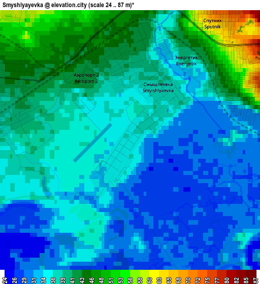
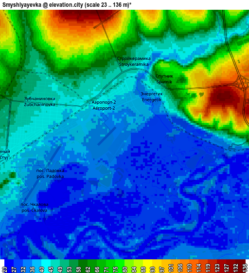
Below is the Elevation map of Smyshlyayevka, which displays elevation range with different colors. Scale of the first map is from 24 to 87 m (79 to 285 ft) with average elevation of 36.8 meters (=121 ft) [note 1]
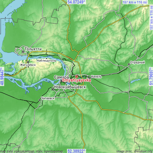
These maps also provides idea of topography and contour of this city, they are displayed at different zoom levels. More info about maps, scale and edge coordinates you can find below images.
| \ | Map #1 | Map #2 | Topo.Map |
| Scale [m] | 24..87 m | 23..136 m | × |
| Scale [ft] | 79..285 ft | 75..446 ft | × |
| Average | 36.8 m = 121 ft | 48.3 m = 158 ft | × |
| Width | 5.85 km = 3.6 mi | 11.7 km = 7.3 mi | 187.2 km = 116.3 mi |
| Height | 5.85 km = 3.6 mi | 11.7 km = 7.3 mi | 187.1 km = 116.3 mi |
| ↑Max Latitude | 53.265422° | 53.291698° | 54.07249° |
| Latitude at center | 53.23913° | 53.23913° | 53.23913° |
| ↓Min Latitude | 53.212822° | 53.186497° | 52.38922° |
| ← Min Longitude | 50.346775° | 50.302829° | 48.98447° |
| Longitude center | 50.39072° | 50.39072° | 50.39072° |
| →Max Longitude | 50.434665° | 50.478611° | 51.79697° |
Nearby cities:
Cities around Smyshlyayevka sort by population:
• Samara elevation 117 m
16.6 km,  254°
254°
• Novokuybyshevsk 110 m
33.6 km,  241°
241°
• Kinel’ 38 m
15.9 km,  95°
95°
• Roschinskiy 113 m
22.1 km,  161°
161°
• Novosemeykino 166 m
14.8 km,  350°
350°
• Krasnyy Yar 37 m
29 km,  0°
0°
• Mirnyy 41 m
30.7 km, 345°
• Volzhskiy 47 m
27.9 km,  319°
319°
• Petra-Dubrava 148 m
6.6 km, 345°
• Rozhdestveno 39 m
22 km,  269°
269°
• Spiridonovka 37 m
23.6 km,  133°
133°
• Dubovyy Umët 137 m
30.1 km,  193°
193°
Multilingual:
 En español:
Smyshlyayevka elevación 36 m.
 En France:
Smyshlyayevka élévation 36 m.
 Auf Deutsch:
Smyshlyayevka höhe über dem Meeresspiegel ist 36 m.

Sources and notes:
- [note 1] Map square and city borders are not equal. Map elevation data is calculated only from area inside that square.
- [src 1] Elevation data from geonames database provided with same terms of usage.
- [src 2] The elevation map of Smyshlyayevka is generated using elevation data from NASA's 3 arcsec (90m) resolution SRTM data.
- [src 3] Base (background) map © OpenStreetMap contributors tiles are generated by Geofabrik and OpenTopoMap.
Copyright & License:
This Smyshlyayevka Elevation Map is licensed under CC BY-SA. You may reuse any part from this page, if you give a proper credit by linking to this URL:
 More info on terms of use page.