Sovetskaya elevation
Sovetskaya (Stavropol’ Kray), Russia elevation is 217 meters and Sovetskaya elevation in feet is 712 ft above sea level [src 1]. Sovetskaya is a populated place (feature code) with elevation that is 18 meters (59 ft) bigger than average city elevation in Russia.
Below is the Elevation map of Sovetskaya, which displays elevation range with different colors. Scale of the first map is from 196 to 244 m (643 to 801 ft) with average elevation of 218.9 meters (=718 ft) [note 1]
These maps also provides idea of topography and contour of this city, they are displayed at different zoom levels. More info about maps, scale and edge coordinates you can find below images.
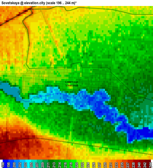
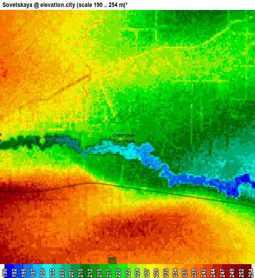
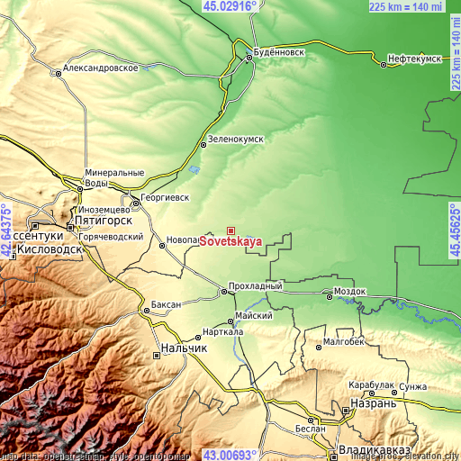
| \ | Map #1 | Map #2 | Topo.Map |
| Scale [m] | 196..244 m | 190..254 m | × |
| Scale [ft] | 643..801 ft | 623..833 ft | × |
| Average | 218.9 m = 718 ft | 225.7 m = 740 ft | × |
| Width | 7.03 km = 4.4 mi | 14.05 km = 8.7 mi | 224.9 km = 139.7 mi |
| Height | 7.03 km = 4.4 mi | 14.05 km = 8.7 mi | 224.8 km = 139.7 mi |
| ↑Max Latitude | 44.058259° | 44.089831° | 45.02916° |
| Latitude at center | 44.02667° | 44.02667° | 44.02667° |
| ↓Min Latitude | 43.995064° | 43.963442° | 43.00693° |
| ← Min Longitude | 44.006055° | 43.962109° | 42.64375° |
| Longitude center | 44.05° | 44.05° | 44.05° |
| →Max Longitude | 44.093945° | 44.137891° | 45.45625° |
Nearby cities:
Cities around Sovetskaya sort by population:
• Prokhladnyy elevation 208 m
30 km,  183°
183°
• Novopavlovsk 331 m
34 km,  257°
257°
• Kurskaya 172 m
32.1 km,  85°
85°
• Soldato-Aleksandrovskoye 185 m
35.4 km,  318°
318°
• Karagach 269 m
33 km,  221°
221°
• Altud 237 m
37 km,  203°
203°
• Primalkinskoye 207 m
31.3 km,  186°
186°
• Soldatskaya 270 m
29.8 km, 218°
• Otkaznoye 157 m
36.6 km,  335°
335°
• Komsomolets 320 m
38.4 km,  268°
268°
• Solomenskoye 163 m
32.1 km,  48°
48°
• Vostochny 220 m
34.1 km,  20°
20°
Multilingual:
 En español:
Sovetskaya elevación 217 m.
 En France:
Sovetskaya élévation 217 m.
 Auf Deutsch:
Sovetskaya höhe über dem Meeresspiegel ist 217 m.

Sources and notes:
- [note 1] Map square and city borders are not equal. Map elevation data is calculated only from area inside that square.
- [src 1] Elevation data from geonames database provided with same terms of usage.
- [src 2] The elevation map of Sovetskaya is generated using elevation data from NASA's 3 arcsec (90m) resolution SRTM data.
- [src 3] Base (background) map © OpenStreetMap contributors tiles are generated by Geofabrik and OpenTopoMap.
Copyright & License:
This Sovetskaya Elevation Map is licensed under CC BY-SA. You may reuse any part from this page, if you give a proper credit by linking to this URL:
 More info on terms of use page.