Altud elevation
Altud (Kabardino-Balkariya Republic), Russia elevation is 237 meters and Altud elevation in feet is 778 ft above sea level [src 1]. Altud is a populated place (feature code) with elevation that is 38 meters (125 ft) bigger than average city elevation in Russia.
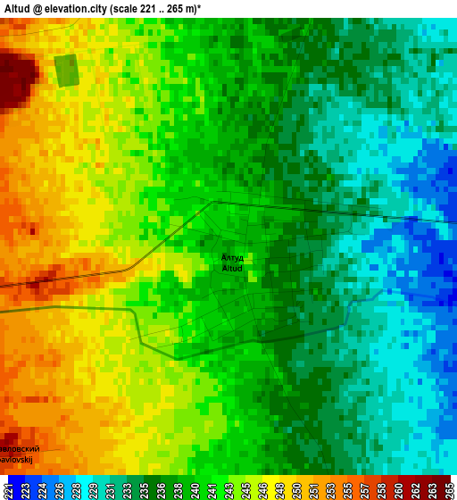
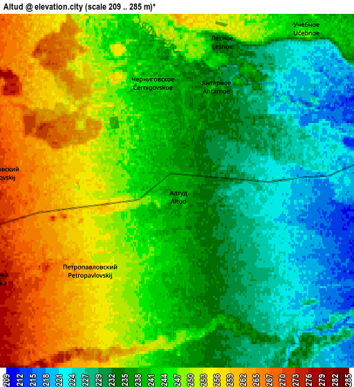
Below is the Elevation map of Altud, which displays elevation range with different colors. Scale of the first map is from 221 to 265 m (725 to 869 ft) with average elevation of 239.8 meters (=787 ft) [note 1]
These maps also provides idea of topography and contour of this city, they are displayed at different zoom levels. More info about maps, scale and edge coordinates you can find below images.
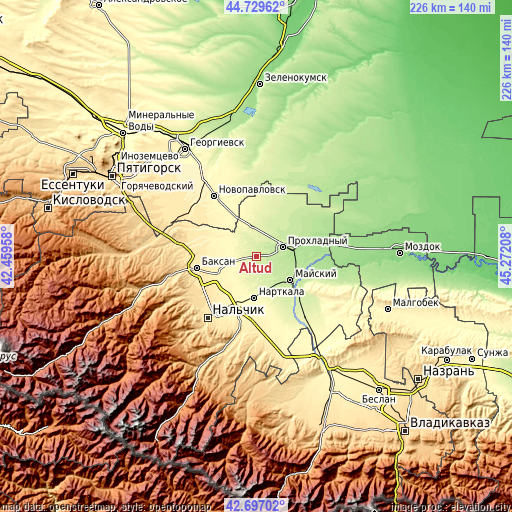
| \ | Map #1 | Map #2 | Topo.Map |
| Scale [m] | 221..265 m | 209..285 m | × |
| Scale [ft] | 725..869 ft | 686..935 ft | × |
| Average | 239.8 m = 787 ft | 242.4 m = 795 ft | × |
| Width | 7.06 km = 4.4 mi | 14.13 km = 8.8 mi | 226 km = 140.4 mi |
| Height | 7.06 km = 4.4 mi | 14.13 km = 8.8 mi | 226 km = 140.4 mi |
| ↑Max Latitude | 43.753691° | 43.785425° | 44.72962° |
| Latitude at center | 43.72194° | 43.72194° | 43.72194° |
| ↓Min Latitude | 43.690172° | 43.658388° | 42.69702° |
| ← Min Longitude | 43.821885° | 43.777939° | 42.45958° |
| Longitude center | 43.86583° | 43.86583° | 43.86583° |
| →Max Longitude | 43.909775° | 43.953721° | 45.27208° |
Nearby cities:
Cities around Altud sort by population:
• Prokhladnyy elevation 208 m
13.7 km,  73°
73°
• Nartkala 291 m
18.3 km,  183°
183°
• Kakhun 297 m
19.9 km, 177°
• Baksanenok 354 m
17.3 km,  258°
258°
• Karagach 269 m
11.8 km,  321°
321°
• Primalkinskoye 207 m
11.8 km,  76°
76°
• Soldatskaya 270 m
11.4 km,  339°
339°
• Kishpek 359 m
19.6 km,  247°
247°
• Germenchik 298 m
16.3 km,  209°
209°
• Kotlyarevskaya 228 m
22.8 km,  136°
136°
• Staropavlovskaya 328 m
23.4 km,  307°
307°
• Mayskiy 211 m
16.5 km,  122°
122°
Multilingual:
 En español:
Altud elevación 237 m.
 En France:
Altud élévation 237 m.


Sources and notes:
- [note 1] Map square and city borders are not equal. Map elevation data is calculated only from area inside that square.
- [src 1] Elevation data from geonames database provided with same terms of usage.
- [src 2] The elevation map of Altud is generated using elevation data from NASA's 3 arcsec (90m) resolution SRTM data.
- [src 3] Base (background) map © OpenStreetMap contributors tiles are generated by Geofabrik and OpenTopoMap.
Copyright & License:
This Altud Elevation Map is licensed under CC BY-SA. You may reuse any part from this page, if you give a proper credit by linking to this URL:
 More info on terms of use page.