Yurino elevation
Yurino (Mariy-El Republic), Russia elevation is 65 meters and Yurino elevation in feet is 213 ft above sea level [src 1]. Yurino is a populated place (feature code) with elevation that is 134 meters (440 ft) smaller than average city elevation in Russia.
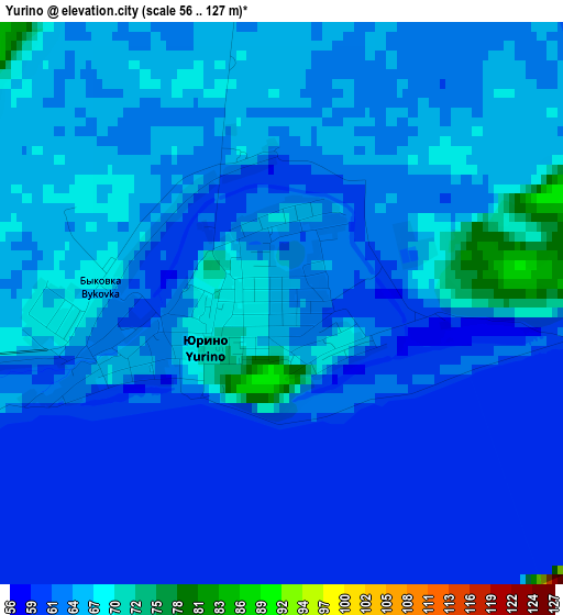
Below is the Elevation map of Yurino, which displays elevation range with different colors. Scale of the first map is from 56 to 127 m (184 to 417 ft) with average elevation of 63.7 meters (=209 ft) [note 1]
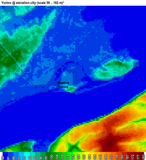
These maps also provides idea of topography and contour of this city, they are displayed at different zoom levels. More info about maps, scale and edge coordinates you can find below images.
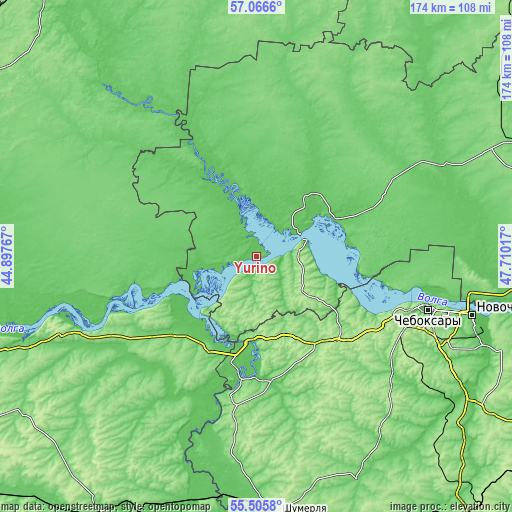
| \ | Map #1 | Map #2 | Topo.Map |
| Scale [m] | 56..127 m | 56..182 m | × |
| Scale [ft] | 184..417 ft | 184..597 ft | × |
| Average | 63.7 m = 209 ft | 78.2 m = 257 ft | × |
| Width | 5.42 km = 3.4 mi | 10.85 km = 6.7 mi | 173.5 km = 107.8 mi |
| Height | 5.42 km = 3.4 mi | 10.85 km = 6.7 mi | 173.5 km = 107.8 mi |
| ↑Max Latitude | 56.318549° | 56.342912° | 57.0666° |
| Latitude at center | 56.29417° | 56.29417° | 56.29417° |
| ↓Min Latitude | 56.269776° | 56.245366° | 55.5058° |
| ← Min Longitude | 46.259975° | 46.216029° | 44.89767° |
| Longitude center | 46.30392° | 46.30392° | 46.30392° |
| →Max Longitude | 46.347865° | 46.391811° | 47.71017° |
Nearby cities:
Cities around Yurino sort by population:
• Cheboksary elevation 106 m
61.3 km,  107°
107°
• Koz’modem’yansk 109 m
16.9 km,  71°
71°
• Kugesi 187 m
67.9 km,  115°
115°
• Yadrin 77 m
39.8 km,  188°
188°
• Novyye Lapsary 193 m
61.7 km, 114°
• Vorotynets 93 m
37.7 km,  226°
226°
• Spasskoye 130 m
61.2 km,  217°
217°
• Kilemary 104 m
63.9 km,  32°
32°
• Ishley 164 m
55.2 km, 123°
• Morgaushi 154 m
46.8 km,  141°
141°
• Vilovatovo 187 m
22.8 km,  126°
126°
• Vasil’sursk 144 m
25.4 km, 224°
Multilingual:
 En español:
Yurino elevación 65 m.
 En France:
Yurino élévation 65 m.


Sources and notes:
- [note 1] Map square and city borders are not equal. Map elevation data is calculated only from area inside that square.
- [src 1] Elevation data from geonames database provided with same terms of usage.
- [src 2] The elevation map of Yurino is generated using elevation data from NASA's 3 arcsec (90m) resolution SRTM data.
- [src 3] Base (background) map © OpenStreetMap contributors tiles are generated by Geofabrik and OpenTopoMap.
Copyright & License:
This Yurino Elevation Map is licensed under CC BY-SA. You may reuse any part from this page, if you give a proper credit by linking to this URL:
 More info on terms of use page.