Tokur elevation
Tokur (Amur Oblast), Russia elevation is 551 meters and Tokur elevation in feet is 1808 ft above sea level [src 1]. Tokur is a populated place (feature code) with elevation that is 352 meters (1155 ft) bigger than average city elevation in Russia.
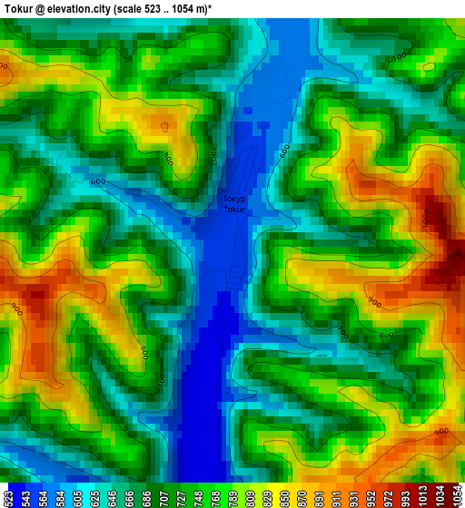
Below is the Elevation map of Tokur, which displays elevation range with different colors. Scale of the first map is from 523 to 1054 m (1716 to 3458 ft) with average elevation of 727.3 meters (=2386 ft) [note 1]
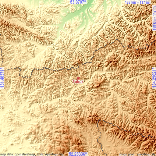
These maps also provides idea of topography and contour of this city, they are displayed at different zoom levels. More info about maps, scale and edge coordinates you can find below images.
| \ | Map #1 | Topo.Map |
| Scale [m] | 523..1054 m | × |
| Scale [ft] | 1716..3458 ft | × |
| Average | 727.3 m = 2386 ft | × |
| Width | 5.86 km = 3.6 mi | 187.6 km = 116.6 mi |
| Height | 5.86 km = 3.6 mi | 187.6 km = 116.6 mi |
| ↑Max Latitude | 53.161666° | 53.9707° |
| Latitude at center | 53.13531° | 53.13531° |
| ↓Min Latitude | 53.108938° | 52.28336° |
| ← Min Longitude | 132.846015° | 131.48371° |
| Longitude center | 132.88996° | 132.88996° |
| →Max Longitude | 132.933905° | 134.29621° |
Nearby cities:
Cities around Tokur sort by population:
• Chegdomyn elevation 426 m
223.3 km,  177°
177°
• Novyy Urgal 317 m
230.4 km, 184°
• Talakan 269 m
366.8 km,  209°
209°
• Berëzovyy 163 m
249.1 km,  130°
130°
• Imeni Poliny Osipenko 69 m
254.5 km,  108°
108°
• Tyrma 291 m
347.1 km,  188°
188°
• Chumikan 6 m
237.1 km,  42°
42°
• Ekimchan 497 m
8 km,  155°
155°
Multilingual:
 En español:
Tokur elevación 551 m.
 En France:
Tokur élévation 551 m.


Sources and notes:
- [note 1] Map square and city borders are not equal. Map elevation data is calculated only from area inside that square.
- [src 1] Elevation data from geonames database provided with same terms of usage.
- [src 2] The elevation map of Tokur is generated using elevation data from NASA's 3 arcsec (90m) resolution SRTM data.
- [src 3] Base (background) map © OpenStreetMap contributors tiles are generated by Geofabrik and OpenTopoMap.
Copyright & License:
This Tokur Elevation Map is licensed under CC BY-SA. You may reuse any part from this page, if you give a proper credit by linking to this URL:
 More info on terms of use page.