Ariceştii-Rahtivani elevation
Ariceştii-Rahtivani (Prahova, Comuna Ariceştii-Rahtivani), Romania elevation is 238 meters and Ariceştii-Rahtivani elevation in feet is 781 ft above sea level [src 1]. Ariceştii-Rahtivani is a seat of a second-order administrative division (feature code) with elevation that is 14 meters (46 ft) smaller than average city elevation in Romania.
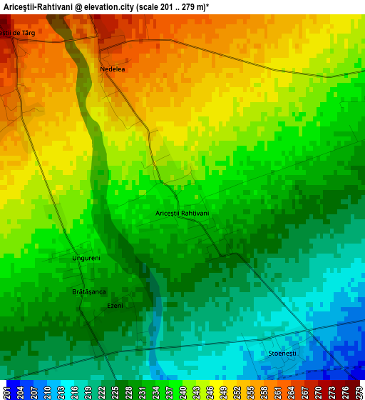
Below is the Elevation map of Ariceştii-Rahtivani, which displays elevation range with different colors. Scale of the first map is from 201 to 279 m (659 to 915 ft) with average elevation of 236.2 meters (=775 ft) [note 1]
These maps also provides idea of topography and contour of this city, they are displayed at different zoom levels. More info about maps, scale and edge coordinates you can find below images.
| \ | Map #1 | Map #2 | Topo.Map |
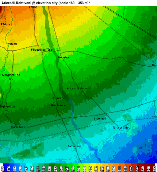
| Scale [m] | 201..279 m | 169..353 m | × |
| Scale [ft] | 659..915 ft | 554..1158 ft | × |
| Average | 236.2 m = 775 ft | 235.4 m = 772 ft | × |
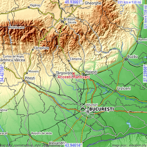
| Width | 6.92 km = 4.3 mi | 13.83 km = 8.6 mi | 221.3 km = 137.5 mi |
| Height | 6.92 km = 4.3 mi | 13.83 km = 8.6 mi | 221.3 km = 137.5 mi |
| ↑Max Latitude | 44.981093° | 45.012169° | 45.93661° |
| Latitude at center | 44.95° | 44.95° | 44.95° |
| ↓Min Latitude | 44.91889° | 44.887764° | 43.94614° |
| ← Min Longitude | 25.789385° | 25.745439° | 24.42708° |
| Longitude center | 25.83333° | 25.83333° | 25.83333° |
| →Max Longitude | 25.877275° | 25.921221° | 27.23958° |
Nearby cities:
Cities around Ariceştii-Rahtivani sort by population:
• Băicoi elevation 312 m
9.4 km,  8°
8°
• Filipeştii de Pădure 301 m
8.6 km,  310°
310°
• Dărmăneşti 222 m
5.4 km,  226°
226°
• Filipeştii de Târg 278 m
5.4 km, 313°
• Măneşti 184 m
9.4 km,  171°
171°
• Dițești 288 m
9 km,  291°
291°
• Mărginenii de Jos 261 m
5.9 km,  279°
279°
• Nedelea 260 m
2.8 km,  331°
331°
• Minieri 286 m
6.8 km,  303°
303°
• Stoenești 212 m
3.5 km,  145°
145°
• Cătina 300 m
7.7 km, 329°
• Mărginenii de Sus 237 m
6.7 km,  252°
252°
Multilingual:
 En español:
Ariceştii-Rahtivani elevación 238 m.
 En France:
Ariceştii-Rahtivani élévation 238 m.
 Auf Deutsch:
Ariceştii-Rahtivani höhe über dem Meeresspiegel ist 238 m.
 На русском:
Ariceştii-Rahtivani высота над уровнем моря 238 м
Sources and notes:
- [note 1] Map square and city borders are not equal. Map elevation data is calculated only from area inside that square.
- [src 1] Elevation data from geonames database provided with same terms of usage.
- [src 2] The elevation map of Ariceştii-Rahtivani is generated using elevation data from NASA's 3 arcsec (90m) resolution SRTM data.
- [src 3] Base (background) map © OpenStreetMap contributors tiles are generated by Geofabrik and OpenTopoMap.
Copyright & License:
This Ariceştii-Rahtivani Elevation Map is licensed under CC BY-SA. You may reuse any part from this page, if you give a proper credit by linking to this URL:
 More info on terms of use page.