Băicoi elevation
Băicoi (Prahova, Oraş Bãicoi), Romania elevation is 312 meters and Băicoi elevation in feet is 1024 ft above sea level [src 1]. Băicoi is a seat of a second-order administrative division (feature code) with elevation that is 60 meters (197 ft) bigger than average city elevation in Romania.
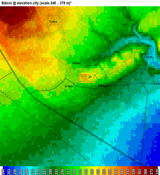
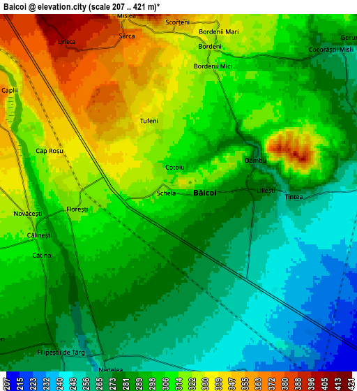
Below is the Elevation map of Băicoi, which displays elevation range with different colors. Scale of the first map is from 248 to 378 m (814 to 1240 ft) with average elevation of 300.5 meters (=986 ft) [note 1]
These maps also provides idea of topography and contour of this city, they are displayed at different zoom levels. More info about maps, scale and edge coordinates you can find below images.
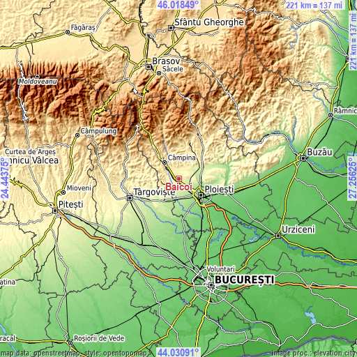
| \ | Map #1 | Map #2 | Topo.Map |
| Scale [m] | 248..378 m | 207..421 m | × |
| Scale [ft] | 814..1240 ft | 679..1381 ft | × |
| Average | 300.5 m = 986 ft | 297.1 m = 975 ft | × |
| Width | 6.91 km = 4.3 mi | 13.81 km = 8.6 mi | 221 km = 137.3 mi |
| Height | 6.91 km = 4.3 mi | 13.81 km = 8.6 mi | 221 km = 137.3 mi |
| ↑Max Latitude | 45.064378° | 45.095408° | 46.01849° |
| Latitude at center | 45.03333° | 45.03333° | 45.03333° |
| ↓Min Latitude | 45.002266° | 44.971184° | 44.03091° |
| ← Min Longitude | 25.806055° | 25.762109° | 24.44375° |
| Longitude center | 25.85° | 25.85° | 25.85° |
| →Max Longitude | 25.893945° | 25.937891° | 27.25625° |
Nearby cities:
Cities around Băicoi sort by population:
• Floreşti elevation 333 m
5.6 km,  289°
289°
• Scorţeni 410 m
7.4 km,  0°
0°
• Țintea 275 m
4.3 km,  88°
88°
• Urleta 400 m
7.5 km,  323°
323°
• Nedelea 260 m
7.3 km,  201°
201°
• Liliești 280 m
2.8 km, 87°
• Mislea 358 m
7.3 km,  344°
344°
• Bordenii Mari 333 m
6.4 km,  13°
13°
• Dâmbu 266 m
3.3 km,  66°
66°
• Cătina 300 m
5.8 km,  243°
243°
• Tufeni 329 m
2.8 km, 343°
• Lunca Prahovei 332 m
6.3 km,  283°
283°
Multilingual:
 En español:
Băicoi elevación 312 m.
 En France:
Băicoi élévation 312 m.


Sources and notes:
- [note 1] Map square and city borders are not equal. Map elevation data is calculated only from area inside that square.
- [src 1] Elevation data from geonames database provided with same terms of usage.
- [src 2] The elevation map of Băicoi is generated using elevation data from NASA's 3 arcsec (90m) resolution SRTM data.
- [src 3] Base (background) map © OpenStreetMap contributors tiles are generated by Geofabrik and OpenTopoMap.
Copyright & License:
This Băicoi Elevation Map is licensed under CC BY-SA. You may reuse any part from this page, if you give a proper credit by linking to this URL:
 More info on terms of use page.