Liliești elevation
Liliești (Prahova, Oraş Bãicoi), Romania elevation is 280 meters and Liliești elevation in feet is 919 ft above sea level [src 1]. Liliești is a populated place (feature code) with elevation that is 28 meters (92 ft) bigger than average city elevation in Romania.
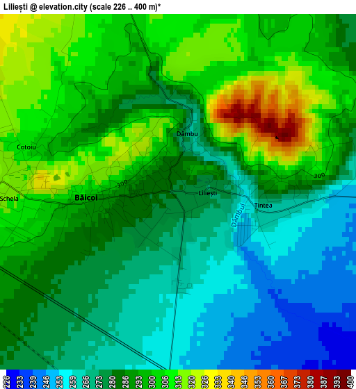
Below is the Elevation map of Liliești, which displays elevation range with different colors. Scale of the first map is from 226 to 400 m (741 to 1312 ft) with average elevation of 286.1 meters (=939 ft) [note 1]
These maps also provides idea of topography and contour of this city, they are displayed at different zoom levels. More info about maps, scale and edge coordinates you can find below images.
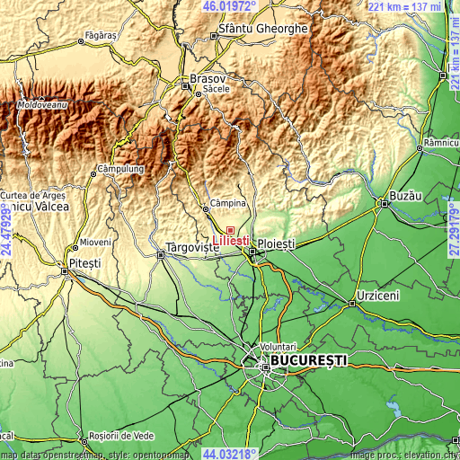
| \ | Map #1 | Topo.Map |
| Scale [m] | 226..400 m | × |
| Scale [ft] | 741..1312 ft | × |
| Average | 286.1 m = 939 ft | × |
| Width | 6.91 km = 4.3 mi | 221 km = 137.3 mi |
| Height | 6.91 km = 4.3 mi | 221 km = 137.3 mi |
| ↑Max Latitude | 45.065627° | 46.01972° |
| Latitude at center | 45.03458° | 45.03458° |
| ↓Min Latitude | 45.003516° | 44.03218° |
| ← Min Longitude | 25.841595° | 24.47929° |
| Longitude center | 25.88554° | 25.88554° |
| →Max Longitude | 25.929485° | 27.29179° |
Nearby cities:
Cities around Liliești sort by population:
• Băicoi elevation 312 m
2.8 km,  267°
267°
• Plopeni 254 m
5.5 km,  72°
72°
• Floreşti 333 m
8.2 km,  282°
282°
• Scorţeni 410 m
7.8 km,  339°
339°
• Țintea 275 m
1.5 km,  92°
92°
• Găgeni 249 m
5 km,  106°
106°
• Cocorăștii Mislii 279 m
6.3 km,  26°
26°
• Bordenii Mari 333 m
6.2 km,  348°
348°
• Plopeni 229 m
8.3 km, 65°
• Dâmbu 266 m
1.2 km,  11°
11°
• Tufeni 329 m
4.4 km,  305°
305°
• Goruna 283 m
7.3 km,  37°
37°
Multilingual:
 En español:
Liliești elevación 280 m.
 En France:
Liliești élévation 280 m.
 Auf Deutsch:
Liliești höhe über dem Meeresspiegel ist 280 m.

Sources and notes:
- [note 1] Map square and city borders are not equal. Map elevation data is calculated only from area inside that square.
- [src 1] Elevation data from geonames database provided with same terms of usage.
- [src 2] The elevation map of Liliești is generated using elevation data from NASA's 3 arcsec (90m) resolution SRTM data.
- [src 3] Base (background) map © OpenStreetMap contributors tiles are generated by Geofabrik and OpenTopoMap.
Copyright & License:
This Liliești Elevation Map is licensed under CC BY-SA. You may reuse any part from this page, if you give a proper credit by linking to this URL:
 More info on terms of use page.