Bărcăneşti elevation
Bărcăneşti (Neamţ, Comuna Cândeşti), Romania elevation is 259 meters and Bărcăneşti elevation in feet is 850 ft above sea level [src 1]. Bărcăneşti is a populated place (feature code) with elevation that is 7 meters (23 ft) bigger than average city elevation in Romania.
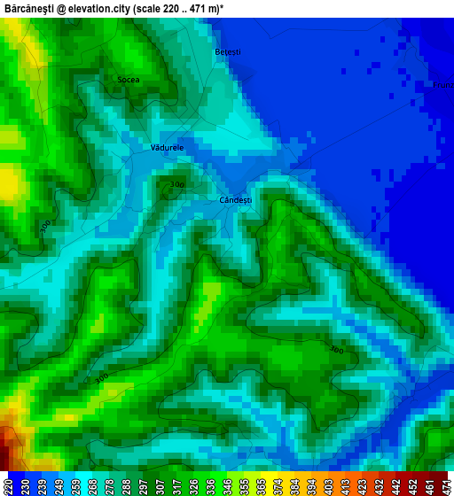
Below is the Elevation map of Bărcăneşti, which displays elevation range with different colors. Scale of the first map is from 220 to 471 m (722 to 1545 ft) with average elevation of 281.3 meters (=923 ft) [note 1]
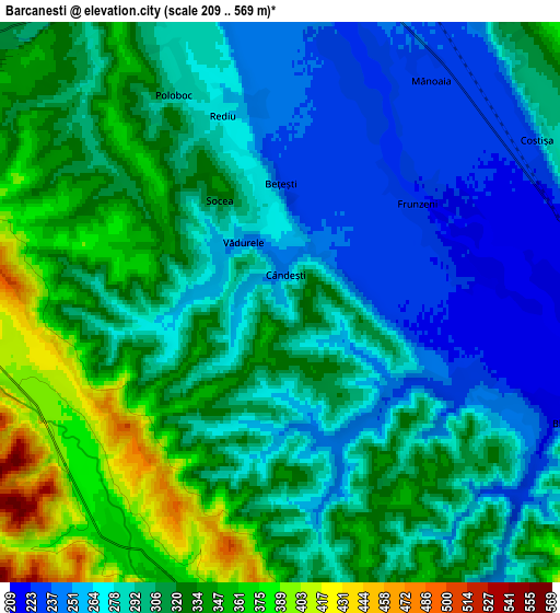
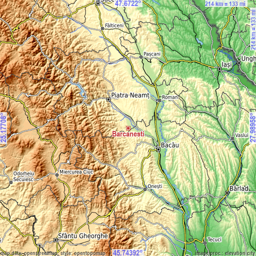
These maps also provides idea of topography and contour of this city, they are displayed at different zoom levels. More info about maps, scale and edge coordinates you can find below images.
| \ | Map #1 | Map #2 | Topo.Map |
| Scale [m] | 220..471 m | 209..569 m | × |
| Scale [ft] | 722..1545 ft | 686..1867 ft | × |
| Average | 281.3 m = 923 ft | 302.1 m = 991 ft | × |
| Width | 6.7 km = 4.2 mi | 13.4 km = 8.3 mi | 214.4 km = 133.2 mi |
| Height | 6.7 km = 4.2 mi | 13.4 km = 8.3 mi | 214.4 km = 133.2 mi |
| ↑Max Latitude | 46.746791° | 46.776895° | 47.6722° |
| Latitude at center | 46.71667° | 46.71667° | 46.71667° |
| ↓Min Latitude | 46.686532° | 46.656378° | 45.74392° |
| ← Min Longitude | 26.539385° | 26.495439° | 25.17708° |
| Longitude center | 26.58333° | 26.58333° | 26.58333° |
| →Max Longitude | 26.627275° | 26.671221° | 27.98958° |
Nearby cities:
Cities around Bărcăneşti sort by population:
• Buhuşi elevation 254 m
8.9 km,  90°
90°
• Borleşti 355 m
9.4 km,  306°
306°
• Blăgeşti 329 m
6.3 km,  126°
126°
• Podoleni 247 m
9.6 km,  15°
15°
• Rediu 276 m
4.6 km,  340°
340°
• Frumoasa 371 m
6.8 km,  207°
207°
• Costişa 224 m
6.3 km,  53°
53°
• Tazlău 440 m
8.9 km,  270°
270°
• Valea lui Ion 268 m
3.5 km,  114°
114°
• Poloboc 293 m
5.6 km,  332°
332°
• Vădurele 250 m
1.7 km, 328°
• Cândeşti 259 m
0 km,  0°
0°
Multilingual:
 En español:
Bărcăneşti elevación 259 m.
 En France:
Bărcăneşti élévation 259 m.
 Auf Deutsch:
Bărcăneşti höhe über dem Meeresspiegel ist 259 m.

Sources and notes:
- [note 1] Map square and city borders are not equal. Map elevation data is calculated only from area inside that square.
- [src 1] Elevation data from geonames database provided with same terms of usage.
- [src 2] The elevation map of Bărcăneşti is generated using elevation data from NASA's 3 arcsec (90m) resolution SRTM data.
- [src 3] Base (background) map © OpenStreetMap contributors tiles are generated by Geofabrik and OpenTopoMap.
Copyright & License:
This Bărcăneşti Elevation Map is licensed under CC BY-SA. You may reuse any part from this page, if you give a proper credit by linking to this URL:
 More info on terms of use page.