Rediu elevation
Rediu (Neamţ, Comuna Rediu), Romania elevation is 276 meters and Rediu elevation in feet is 906 ft above sea level [src 1]. Rediu is a seat of a second-order administrative division (feature code) with elevation that is 24 meters (79 ft) bigger than average city elevation in Romania.
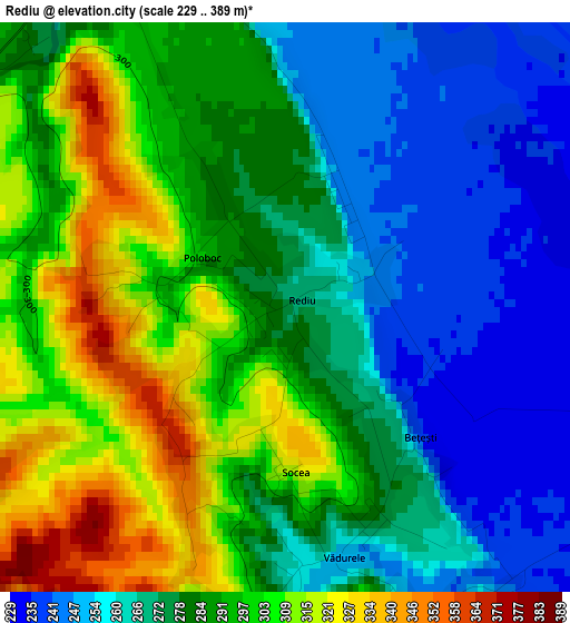
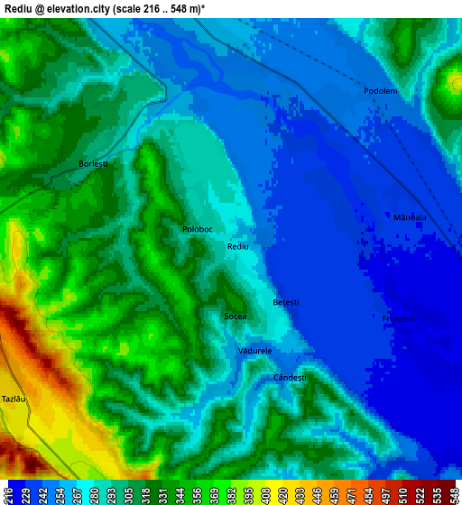
Below is the Elevation map of Rediu, which displays elevation range with different colors. Scale of the first map is from 229 to 389 m (751 to 1276 ft) with average elevation of 282.9 meters (=928 ft) [note 1]
These maps also provides idea of topography and contour of this city, they are displayed at different zoom levels. More info about maps, scale and edge coordinates you can find below images.
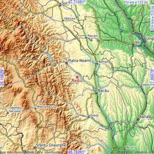
| \ | Map #1 | Map #2 | Topo.Map |
| Scale [m] | 229..389 m | 216..548 m | × |
| Scale [ft] | 751..1276 ft | 709..1798 ft | × |
| Average | 282.9 m = 928 ft | 294.6 m = 967 ft | × |
| Width | 6.7 km = 4.2 mi | 13.39 km = 8.3 mi | 214.2 km = 133.1 mi |
| Height | 6.7 km = 4.2 mi | 13.39 km = 8.3 mi | 214.2 km = 133.1 mi |
| ↑Max Latitude | 46.786079° | 46.816161° | 47.71081° |
| Latitude at center | 46.75598° | 46.75598° | 46.75598° |
| ↓Min Latitude | 46.725864° | 46.695732° | 45.78393° |
| ← Min Longitude | 26.518595° | 26.474649° | 25.15629° |
| Longitude center | 26.56254° | 26.56254° | 26.56254° |
| →Max Longitude | 26.606485° | 26.650431° | 27.96879° |
Nearby cities:
Cities around Rediu sort by population:
• Borleşti elevation 355 m
6.1 km,  281°
281°
• Zăneşti 261 m
6.8 km,  351°
351°
• Podoleni 247 m
6.4 km,  40°
40°
• Bărcăneşti 259 m
4.6 km,  160°
160°
• Costişa 224 m
6.7 km,  95°
95°
• Ruseni 257 m
5 km,  339°
339°
• Tazlău 440 m
8.5 km,  239°
239°
• Mastacăn 349 m
6.8 km,  302°
302°
• Valea lui Ion 268 m
7.5 km,  140°
140°
• Poloboc 293 m
1.1 km, 300°
• Vădurele 250 m
3 km,  166°
166°
• Cândeşti 259 m
4.6 km, 160°
Multilingual:
 En español:
Rediu elevación 276 m.
 En France:
Rediu élévation 276 m.


Sources and notes:
- [note 1] Map square and city borders are not equal. Map elevation data is calculated only from area inside that square.
- [src 1] Elevation data from geonames database provided with same terms of usage.
- [src 2] The elevation map of Rediu is generated using elevation data from NASA's 3 arcsec (90m) resolution SRTM data.
- [src 3] Base (background) map © OpenStreetMap contributors tiles are generated by Geofabrik and OpenTopoMap.
Copyright & License:
This Rediu Elevation Map is licensed under CC BY-SA. You may reuse any part from this page, if you give a proper credit by linking to this URL:
 More info on terms of use page.