Bobota elevation
Bobota (Sălaj, Comuna Bobota), Romania elevation is 184 meters and Bobota elevation in feet is 604 ft above sea level [src 1]. Bobota is a seat of a second-order administrative division (feature code) with elevation that is 68 meters (223 ft) smaller than average city elevation in Romania.
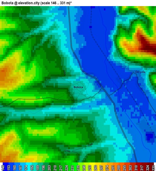
Below is the Elevation map of Bobota, which displays elevation range with different colors. Scale of the first map is from 146 to 331 m (479 to 1086 ft) with average elevation of 199.3 meters (=654 ft) [note 1]
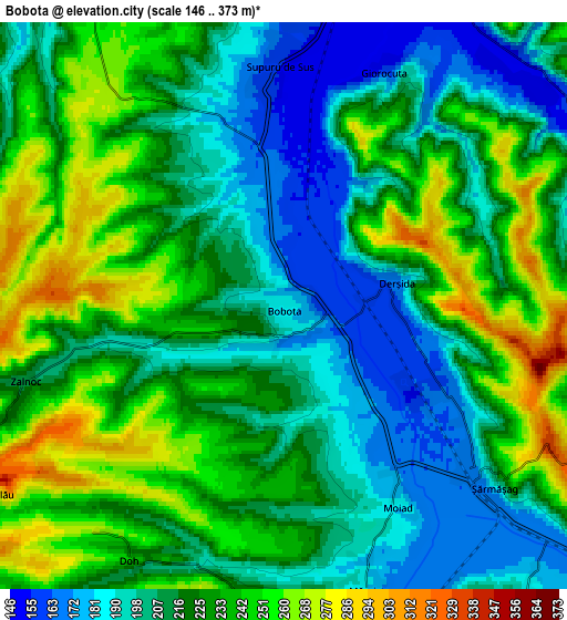
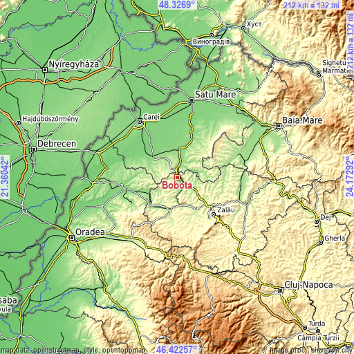
These maps also provides idea of topography and contour of this city, they are displayed at different zoom levels. More info about maps, scale and edge coordinates you can find below images.
| \ | Map #1 | Map #2 | Topo.Map |
| Scale [m] | 146..331 m | 146..373 m | × |
| Scale [ft] | 479..1086 ft | 479..1224 ft | × |
| Average | 199.3 m = 654 ft | 220.5 m = 723 ft | × |
| Width | 6.62 km = 4.1 mi | 13.23 km = 8.2 mi | 211.7 km = 131.5 mi |
| Height | 6.62 km = 4.1 mi | 13.23 km = 8.2 mi | 211.7 km = 131.5 mi |
| ↑Max Latitude | 47.413077° | 47.442806° | 48.3269° |
| Latitude at center | 47.38333° | 47.38333° | 47.38333° |
| ↓Min Latitude | 47.353567° | 47.323787° | 46.42257° |
| ← Min Longitude | 22.722725° | 22.678779° | 21.36042° |
| Longitude center | 22.76667° | 22.76667° | 22.76667° |
| →Max Longitude | 22.810615° | 22.854561° | 24.17292° |
Nearby cities:
Cities around Bobota sort by population:
• Şărmăşag elevation 234 m
6.2 km,  126°
126°
• Supuru de Jos 145 m
9.6 km,  15°
15°
• Măerişte 171 m
7.8 km,  161°
161°
• Bogdand 178 m
13.1 km,  73°
73°
• Chieşd 187 m
8.8 km,  90°
90°
• Cehal 228 m
12.5 km,  270°
270°
• Derșida 169 m
2.7 km,  78°
78°
• Dobra 142 m
13.2 km, 20°
• Săcăşeni 152 m
12.8 km,  330°
330°
• Giurtelecu Șimleului 204 m
9.9 km,  167°
167°
• Carastelec 217 m
10.5 km,  208°
208°
• Cehei 209 m
14.1 km,  177°
177°
Multilingual:
 En español:
Bobota elevación 184 m.
 En France:
Bobota élévation 184 m.


Sources and notes:
- [note 1] Map square and city borders are not equal. Map elevation data is calculated only from area inside that square.
- [src 1] Elevation data from geonames database provided with same terms of usage.
- [src 2] The elevation map of Bobota is generated using elevation data from NASA's 3 arcsec (90m) resolution SRTM data.
- [src 3] Base (background) map © OpenStreetMap contributors tiles are generated by Geofabrik and OpenTopoMap.
Copyright & License:
This Bobota Elevation Map is licensed under CC BY-SA. You may reuse any part from this page, if you give a proper credit by linking to this URL:
 More info on terms of use page.