Măerişte elevation
Măerişte (Sălaj, Comuna Măerişte), Romania elevation is 171 meters and Măerişte elevation in feet is 561 ft above sea level [src 1]. Măerişte is a seat of a second-order administrative division (feature code) with elevation that is 81 meters (266 ft) smaller than average city elevation in Romania.
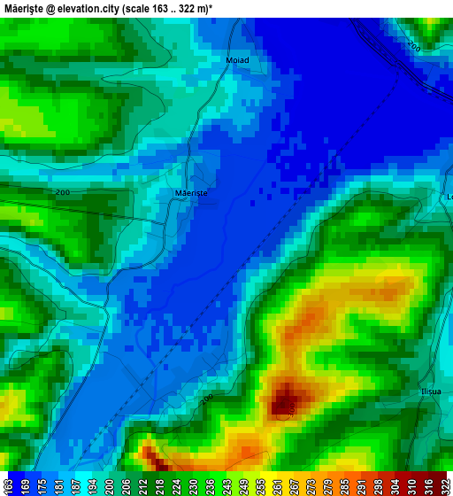
Below is the Elevation map of Măerişte, which displays elevation range with different colors. Scale of the first map is from 163 to 322 m (535 to 1056 ft) with average elevation of 203.9 meters (=669 ft) [note 1]
These maps also provides idea of topography and contour of this city, they are displayed at different zoom levels. More info about maps, scale and edge coordinates you can find below images.
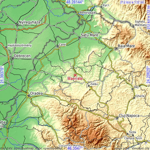
| \ | Map #1 | Topo.Map |
| Scale [m] | 163..322 m | × |
| Scale [ft] | 535..1056 ft | × |
| Average | 203.9 m = 669 ft | × |
| Width | 6.63 km = 4.1 mi | 212 km = 131.7 mi |
| Height | 6.63 km = 4.1 mi | 212 km = 131.7 mi |
| ↑Max Latitude | 47.346454° | 48.26144° |
| Latitude at center | 47.31667° | 47.31667° |
| ↓Min Latitude | 47.286869° | 46.3547° |
| ← Min Longitude | 22.756055° | 21.39375° |
| Longitude center | 22.8° | 22.8° |
| →Max Longitude | 22.843945° | 24.20625° |
Nearby cities:
Cities around Măerişte sort by population:
• Şimleu Silvaniei elevation 238 m
9.3 km,  180°
180°
• Şărmăşag 234 m
4.5 km,  34°
34°
• Bobota 184 m
7.8 km,  341°
341°
• Bocşa 204 m
9 km,  106°
106°
• Pericei 221 m
11.2 km,  145°
145°
• Chieşd 187 m
9.7 km,  40°
40°
• Derșida 169 m
7.9 km,  0°
0°
• Şamşud 229 m
11.9 km,  71°
71°
• Pusta 223 m
9.7 km,  216°
216°
• Giurtelecu Șimleului 204 m
2.2 km,  188°
188°
• Carastelec 217 m
7.8 km,  256°
256°
• Cehei 209 m
7 km,  195°
195°
Multilingual:
 En español:
Măerişte elevación 171 m.
 En France:
Măerişte élévation 171 m.
 Auf Deutsch:
Măerişte höhe über dem Meeresspiegel ist 171 m.

Sources and notes:
- [note 1] Map square and city borders are not equal. Map elevation data is calculated only from area inside that square.
- [src 1] Elevation data from geonames database provided with same terms of usage.
- [src 2] The elevation map of Măerişte is generated using elevation data from NASA's 3 arcsec (90m) resolution SRTM data.
- [src 3] Base (background) map © OpenStreetMap contributors tiles are generated by Geofabrik and OpenTopoMap.
Copyright & License:
This Măerişte Elevation Map is licensed under CC BY-SA. You may reuse any part from this page, if you give a proper credit by linking to this URL:
 More info on terms of use page.