Bradu elevation
Bradu (Arges, Comuna Bradu), Romania elevation is 294 meters and Bradu elevation in feet is 965 ft above sea level [src 1]. Bradu is a seat of a second-order administrative division (feature code) with elevation that is 42 meters (138 ft) bigger than average city elevation in Romania.
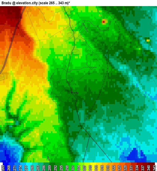
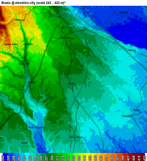
Below is the Elevation map of Bradu, which displays elevation range with different colors. Scale of the first map is from 265 to 343 m (869 to 1125 ft) with average elevation of 296.8 meters (=974 ft) [note 1]
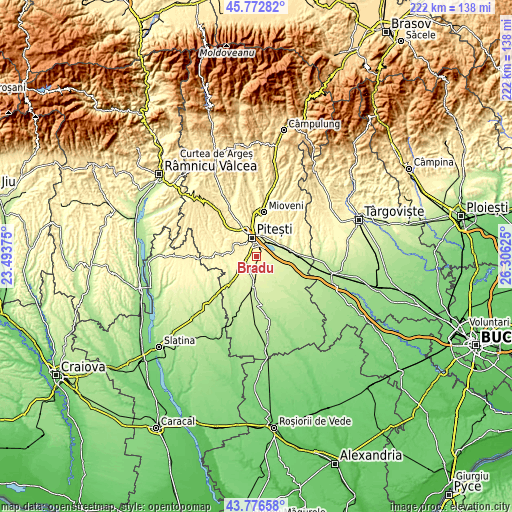
These maps also provides idea of topography and contour of this city, they are displayed at different zoom levels. More info about maps, scale and edge coordinates you can find below images.
| \ | Map #1 | Map #2 | Topo.Map |
| Scale [m] | 265..343 m | 242..422 m | × |
| Scale [ft] | 869..1125 ft | 794..1385 ft | × |
| Average | 296.8 m = 974 ft | 290.5 m = 953 ft | × |
| Width | 6.94 km = 4.3 mi | 13.87 km = 8.6 mi | 222 km = 137.9 mi |
| Height | 6.94 km = 4.3 mi | 13.87 km = 8.6 mi | 222 km = 137.9 mi |
| ↑Max Latitude | 44.814513° | 44.845679° | 45.77282° |
| Latitude at center | 44.78333° | 44.78333° | 44.78333° |
| ↓Min Latitude | 44.75213° | 44.720914° | 43.77658° |
| ← Min Longitude | 24.856055° | 24.812109° | 23.49375° |
| Longitude center | 24.9° | 24.9° | 24.9° |
| →Max Longitude | 24.943945° | 24.987891° | 26.30625° |
Nearby cities:
Cities around Bradu sort by population:
• Piteşti elevation 307 m
7.9 km,  340°
340°
• Ştefăneşti 284 m
9.9 km,  23°
23°
• Albota de Jos 312 m
5.6 km,  250°
250°
• Suseni 257 m
8.4 km,  151°
151°
• Oarja Sat 270 m
6 km,  110°
110°
• Oarja 269 m
6.5 km, 112°
• Albota 302 m
3.9 km,  270°
270°
• Geamăna 311 m
4.1 km,  350°
350°
• Vrănești 273 m
11 km,  50°
50°
• Mareș 310 m
8.7 km, 266°
• Golești 253 m
8.1 km,  39°
39°
• Văleni-Podgoria 283 m
10.8 km, 40°
Multilingual:
 En español:
Bradu elevación 294 m.
 En France:
Bradu élévation 294 m.


Sources and notes:
- [note 1] Map square and city borders are not equal. Map elevation data is calculated only from area inside that square.
- [src 1] Elevation data from geonames database provided with same terms of usage.
- [src 2] The elevation map of Bradu is generated using elevation data from NASA's 3 arcsec (90m) resolution SRTM data.
- [src 3] Base (background) map © OpenStreetMap contributors tiles are generated by Geofabrik and OpenTopoMap.
Copyright & License:
This Bradu Elevation Map is licensed under CC BY-SA. You may reuse any part from this page, if you give a proper credit by linking to this URL:
 More info on terms of use page.