Bratca elevation
Bratca (Bihor, Comuna Bratca), Romania elevation is 381 meters and Bratca elevation in feet is 1250 ft above sea level [src 1]. Bratca is a seat of a second-order administrative division (feature code) with elevation that is 129 meters (423 ft) bigger than average city elevation in Romania.
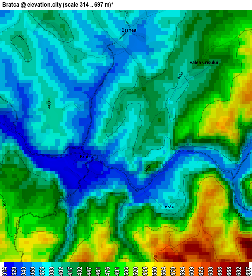
Below is the Elevation map of Bratca, which displays elevation range with different colors. Scale of the first map is from 314 to 697 m (1030 to 2287 ft) with average elevation of 427.7 meters (=1403 ft) [note 1]
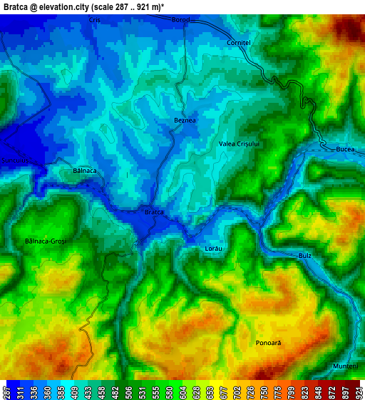
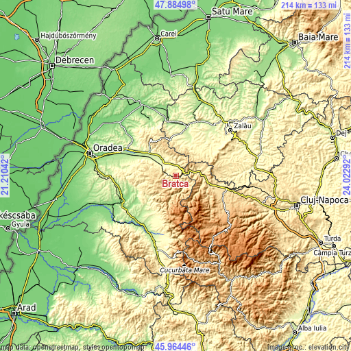
These maps also provides idea of topography and contour of this city, they are displayed at different zoom levels. More info about maps, scale and edge coordinates you can find below images.
| \ | Map #1 | Map #2 | Topo.Map |
| Scale [m] | 314..697 m | 287..921 m | × |
| Scale [ft] | 1030..2287 ft | 942..3022 ft | × |
| Average | 427.7 m = 1403 ft | 500.6 m = 1642 ft | × |
| Width | 6.67 km = 4.1 mi | 13.35 km = 8.3 mi | 213.5 km = 132.7 mi |
| Height | 6.67 km = 4.1 mi | 13.35 km = 8.3 mi | 213.5 km = 132.7 mi |
| ↑Max Latitude | 46.96333° | 46.993312° | 47.88498° |
| Latitude at center | 46.93333° | 46.93333° | 46.93333° |
| ↓Min Latitude | 46.903314° | 46.87328° | 45.96446° |
| ← Min Longitude | 22.572725° | 22.528779° | 21.21042° |
| Longitude center | 22.61667° | 22.61667° | 22.61667° |
| →Max Longitude | 22.660615° | 22.704561° | 24.02292° |
Nearby cities:
Cities around Bratca sort by population:
• Ciucea elevation 478 m
15.3 km,  83°
83°
• Vadu Crişului 277 m
9.4 km,  306°
306°
• Borod 379 m
5.7 km,  12°
12°
• Şuncuiuş 507 m
6.3 km,  270°
270°
• Auşeu 252 m
14.2 km,  321°
321°
• Măgeşti 252 m
15.7 km, 306°
• Bulz 568 m
5.4 km,  110°
110°
• Negreni 428 m
11.4 km, 78°
• Beznea 366 m
2.9 km,  4°
4°
• Luncșoara 303 m
12.8 km,  333°
333°
• Bălnaca 379 m
3.6 km,  289°
289°
• Groși 248 m
16.2 km, 320°
Multilingual:
 En español:
Bratca elevación 381 m.
 En France:
Bratca élévation 381 m.


Sources and notes:
- [note 1] Map square and city borders are not equal. Map elevation data is calculated only from area inside that square.
- [src 1] Elevation data from geonames database provided with same terms of usage.
- [src 2] The elevation map of Bratca is generated using elevation data from NASA's 3 arcsec (90m) resolution SRTM data.
- [src 3] Base (background) map © OpenStreetMap contributors tiles are generated by Geofabrik and OpenTopoMap.
Copyright & License:
This Bratca Elevation Map is licensed under CC BY-SA. You may reuse any part from this page, if you give a proper credit by linking to this URL:
 More info on terms of use page.