Brusturi elevation
Brusturi (Bihor, Comuna Brusturi), Romania elevation is 157 meters and Brusturi elevation in feet is 515 ft above sea level [src 1]. Brusturi is a seat of a second-order administrative division (feature code) with elevation that is 95 meters (312 ft) smaller than average city elevation in Romania.
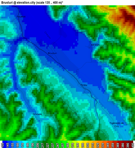
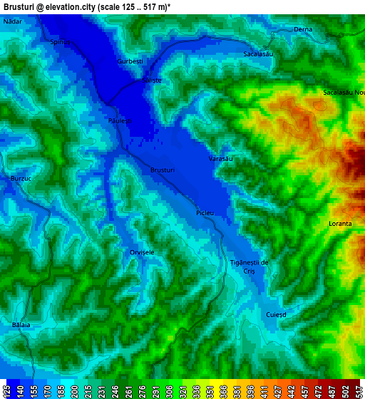
Below is the Elevation map of Brusturi, which displays elevation range with different colors. Scale of the first map is from 135 to 400 m (443 to 1312 ft) with average elevation of 195.4 meters (=641 ft) [note 1]
These maps also provides idea of topography and contour of this city, they are displayed at different zoom levels. More info about maps, scale and edge coordinates you can find below images.
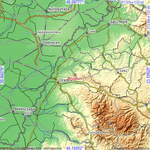
| \ | Map #1 | Map #2 | Topo.Map |
| Scale [m] | 135..400 m | 125..517 m | × |
| Scale [ft] | 443..1312 ft | 410..1696 ft | × |
| Average | 195.4 m = 641 ft | 231.8 m = 760 ft | × |
| Width | 6.65 km = 4.1 mi | 13.29 km = 8.3 mi | 212.7 km = 132.2 mi |
| Height | 6.65 km = 4.1 mi | 13.29 km = 8.3 mi | 212.7 km = 132.2 mi |
| ↑Max Latitude | 47.179878° | 47.209739° | 48.09777° |
| Latitude at center | 47.15° | 47.15° | 47.15° |
| ↓Min Latitude | 47.120105° | 47.090194° | 46.18502° |
| ← Min Longitude | 22.206055° | 22.162109° | 20.84375° |
| Longitude center | 22.25° | 22.25° | 22.25° |
| →Max Longitude | 22.293945° | 22.337891° | 23.65625° |
Nearby cities:
Cities around Brusturi sort by population:
• Tileagd elevation 172 m
10 km,  202°
202°
• Tăuteu 154 m
14.4 km,  25°
25°
• Ineu 156 m
12.5 km,  233°
233°
• Lugaşu de Jos 219 m
12 km,  140°
140°
• Derna 202 m
6.7 km, 34°
• Voivozi 190 m
12.9 km,  55°
55°
• Cuzap 196 m
13.8 km, 64°
• Spinuş 129 m
6.7 km,  325°
325°
• Sârbi 134 m
10.8 km,  296°
296°
• Burzuc 161 m
6 km,  275°
275°
• Pădurea Neagră 377 m
12.5 km,  82°
82°
• Mișca 168 m
12.6 km,  3°
3°
Multilingual:
 En español:
Brusturi elevación 157 m.
 En France:
Brusturi élévation 157 m.
 Auf Deutsch:
Brusturi höhe über dem Meeresspiegel ist 157 m.

Sources and notes:
- [note 1] Map square and city borders are not equal. Map elevation data is calculated only from area inside that square.
- [src 1] Elevation data from geonames database provided with same terms of usage.
- [src 2] The elevation map of Brusturi is generated using elevation data from NASA's 3 arcsec (90m) resolution SRTM data.
- [src 3] Base (background) map © OpenStreetMap contributors tiles are generated by Geofabrik and OpenTopoMap.
Copyright & License:
This Brusturi Elevation Map is licensed under CC BY-SA. You may reuse any part from this page, if you give a proper credit by linking to this URL:
 More info on terms of use page.