Cașoca elevation
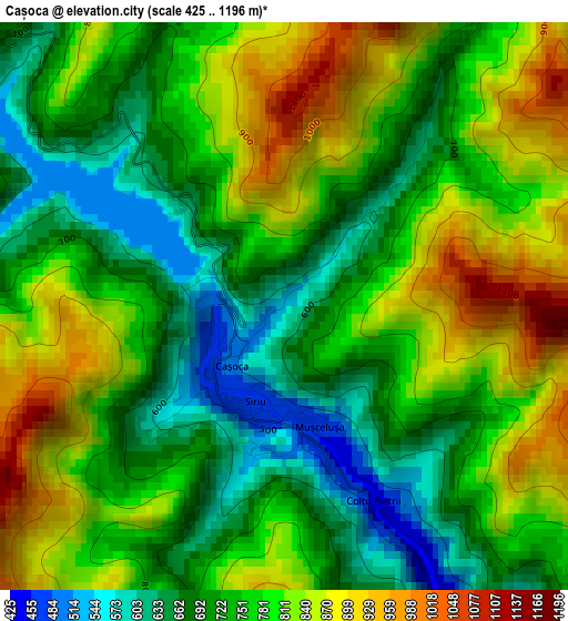
Cașoca (Buzău, Comuna Siriu), Romania elevation is 805 meters and Cașoca elevation in feet is 2641 ft above sea level [src 1]. Cașoca is a populated place (feature code) with elevation that is 553 meters (1814 ft) bigger than average city elevation in Romania.
Below is the Elevation map of Cașoca, which displays elevation range with different colors. Scale of the first map is from 425 to 1196 m (1394 to 3924 ft) with average elevation of 764 meters (=2507 ft) [note 1]
These maps also provides idea of topography and contour of this city, they are displayed at different zoom levels. More info about maps, scale and edge coordinates you can find below images.
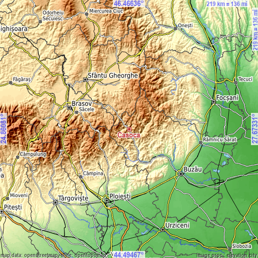
| \ | Map #1 | Topo.Map |
| Scale [m] | 425..1196 m | × |
| Scale [ft] | 1394..3924 ft | × |
| Average | 764 m = 2507 ft | × |
| Width | 6.85 km = 4.3 mi | 219.2 km = 136.2 mi |
| Height | 6.85 km = 4.3 mi | 219.2 km = 136.2 mi |
| ↑Max Latitude | 45.519939° | 46.46636° |
| Latitude at center | 45.48914° | 45.48914° |
| ↓Min Latitude | 45.458324° | 44.49467° |
| ← Min Longitude | 26.223115° | 24.86081° |
| Longitude center | 26.26706° | 26.26706° |
| →Max Longitude | 26.311005° | 27.67331° |
Nearby cities:
Cities around Cașoca sort by population:
• Nehoiu elevation 392 m
8.5 km,  162°
162°
• Gura Teghii 507 m
11.7 km,  93°
93°
• Chiojdu 598 m
16.3 km,  198°
198°
• Brăeşti 552 m
19.2 km,  108°
108°
• Lunca Priporului 395 m
6.4 km,  149°
149°
• Bâsca Rozilei 428 m
6.7 km,  125°
125°
• Colţi 539 m
14.9 km,  142°
142°
• Păltineni 338 m
11.3 km, 157°
• Bâsca Chiojdului 526 m
14.6 km,  206°
206°
• Lunca Jariștei 473 m
1.2 km,  231°
231°
• Furtunești 487 m
10.7 km, 107°
• Corbu 413 m
18.7 km,  184°
184°
Multilingual:
 En español:
Cașoca elevación 805 m.
 En France:
Cașoca élévation 805 m.


Sources and notes:
- [note 1] Map square and city borders are not equal. Map elevation data is calculated only from area inside that square.
- [src 1] Elevation data from geonames database provided with same terms of usage.
- [src 2] The elevation map of Cașoca is generated using elevation data from NASA's 3 arcsec (90m) resolution SRTM data.
- [src 3] Base (background) map © OpenStreetMap contributors tiles are generated by Geofabrik and OpenTopoMap.
Copyright & License:
This Cașoca Elevation Map is licensed under CC BY-SA. You may reuse any part from this page, if you give a proper credit by linking to this URL:
 More info on terms of use page.