Gura Teghii elevation
Gura Teghii (Buzău, Comuna Gura Teghii), Romania elevation is 507 meters and Gura Teghii elevation in feet is 1663 ft above sea level [src 1]. Gura Teghii is a seat of a second-order administrative division (feature code) with elevation that is 255 meters (837 ft) bigger than average city elevation in Romania.
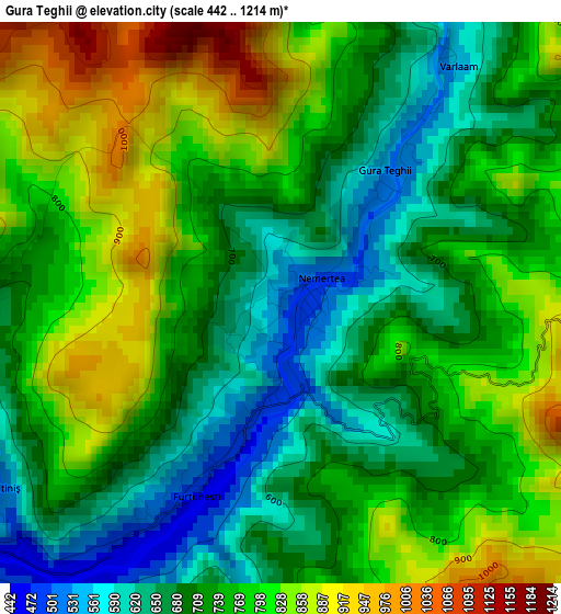
Below is the Elevation map of Gura Teghii, which displays elevation range with different colors. Scale of the first map is from 442 to 1214 m (1450 to 3983 ft) with average elevation of 744.9 meters (=2444 ft) [note 1]
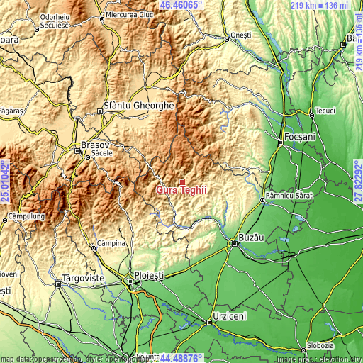
These maps also provides idea of topography and contour of this city, they are displayed at different zoom levels. More info about maps, scale and edge coordinates you can find below images.
| \ | Map #1 | Map #2 | Topo.Map |
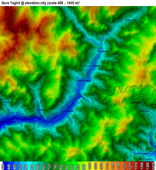
| Scale [m] | 442..1214 m | 406..1435 m | × |
| Scale [ft] | 1450..3983 ft | 1332..4708 ft | × |
| Average | 744.9 m = 2444 ft | 837.3 m = 2747 ft | × |
| Width | 6.85 km = 4.3 mi | 13.7 km = 8.5 mi | 219.3 km = 136.3 mi |
| Height | 6.85 km = 4.3 mi | 13.7 km = 8.5 mi | 219.2 km = 136.2 mi |
| ↑Max Latitude | 45.514132° | 45.544918° | 46.46065° |
| Latitude at center | 45.48333° | 45.48333° | 45.48333° |
| ↓Min Latitude | 45.452511° | 45.421675° | 44.48876° |
| ← Min Longitude | 26.372725° | 26.328779° | 25.01042° |
| Longitude center | 26.41667° | 26.41667° | 26.41667° |
| →Max Longitude | 26.460615° | 26.504561° | 27.82292° |
Nearby cities:
Cities around Gura Teghii sort by population:
• Nehoiu elevation 392 m
11.7 km,  230°
230°
• Lopătari 462 m
13 km,  90°
90°
• Brăeşti 552 m
8.6 km,  130°
130°
• Lunca Priporului 395 m
9.8 km,  239°
239°
• Bâsca Rozilei 428 m
7 km, 242°
• Colţi 539 m
11.4 km,  193°
193°
• Păltineni 338 m
12.1 km,  216°
216°
• Bozioru 414 m
12.3 km,  154°
154°
• Lunca Jariștei 473 m
12.6 km,  269°
269°
• Furtunești 487 m
3 km,  209°
209°
• Cașoca 805 m
11.7 km, 273°
• Chiliile 606 m
13.5 km,  105°
105°
Multilingual:
 En español:
Gura Teghii elevación 507 m.
 En France:
Gura Teghii élévation 507 m.
 Auf Deutsch:
Gura Teghii höhe über dem Meeresspiegel ist 507 m.

Sources and notes:
- [note 1] Map square and city borders are not equal. Map elevation data is calculated only from area inside that square.
- [src 1] Elevation data from geonames database provided with same terms of usage.
- [src 2] The elevation map of Gura Teghii is generated using elevation data from NASA's 3 arcsec (90m) resolution SRTM data.
- [src 3] Base (background) map © OpenStreetMap contributors tiles are generated by Geofabrik and OpenTopoMap.
Copyright & License:
This Gura Teghii Elevation Map is licensed under CC BY-SA. You may reuse any part from this page, if you give a proper credit by linking to this URL:
 More info on terms of use page.