Cocu elevation
Cocu (Arges, Comuna Cocu), Romania elevation is 413 meters and Cocu elevation in feet is 1355 ft above sea level [src 1]. Cocu is a seat of a second-order administrative division (feature code) with elevation that is 161 meters (528 ft) bigger than average city elevation in Romania.
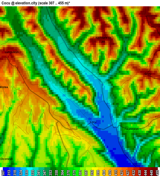
Below is the Elevation map of Cocu, which displays elevation range with different colors. Scale of the first map is from 307 to 455 m (1007 to 1493 ft) with average elevation of 382.4 meters (=1255 ft) [note 1]
These maps also provides idea of topography and contour of this city, they are displayed at different zoom levels. More info about maps, scale and edge coordinates you can find below images.
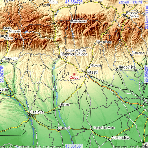
| \ | Map #1 | Topo.Map |
| Scale [m] | 307..455 m | × |
| Scale [ft] | 1007..1493 ft | × |
| Average | 382.4 m = 1255 ft | × |
| Width | 6.93 km = 4.3 mi | 221.6 km = 137.7 mi |
| Height | 6.93 km = 4.3 mi | 221.6 km = 137.7 mi |
| ↑Max Latitude | 44.897808° | 45.85472° |
| Latitude at center | 44.86667° | 44.86667° |
| ↓Min Latitude | 44.835515° | 43.86136° |
| ← Min Longitude | 24.606055° | 23.24375° |
| Longitude center | 24.65° | 24.65° |
| →Max Longitude | 24.693945° | 26.05625° |
Nearby cities:
Cities around Cocu sort by population:
• Başcov elevation 294 m
13.6 km,  74°
74°
• Poiana Lacului 355 m
8.6 km,  130°
130°
• Merişani 329 m
13.5 km,  33°
33°
• Moşoaia 366 m
10.7 km,  121°
121°
• Vedea 298 m
9.6 km,  195°
195°
• Băbana 366 m
5.4 km,  46°
46°
• Izvoru de Sus 362 m
5.6 km,  180°
180°
• Uda 446 m
8.6 km,  310°
310°
• Cotmeana 418 m
11.4 km,  346°
346°
• Drăganu-Olteni 378 m
9.1 km,  35°
35°
• Făgeţelu 354 m
13.1 km,  224°
224°
• Topana 338 m
11.9 km,  242°
242°
Multilingual:
 En español:
Cocu elevación 413 m.
 En France:
Cocu élévation 413 m.


Sources and notes:
- [note 1] Map square and city borders are not equal. Map elevation data is calculated only from area inside that square.
- [src 1] Elevation data from geonames database provided with same terms of usage.
- [src 2] The elevation map of Cocu is generated using elevation data from NASA's 3 arcsec (90m) resolution SRTM data.
- [src 3] Base (background) map © OpenStreetMap contributors tiles are generated by Geofabrik and OpenTopoMap.
Copyright & License:
This Cocu Elevation Map is licensed under CC BY-SA. You may reuse any part from this page, if you give a proper credit by linking to this URL:
 More info on terms of use page.