Cordun elevation
Cordun (Neamţ, Comuna Cordun), Romania elevation is 189 meters and Cordun elevation in feet is 620 ft above sea level [src 1]. Cordun is a seat of a second-order administrative division (feature code) with elevation that is 63 meters (207 ft) smaller than average city elevation in Romania.
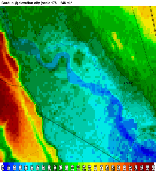
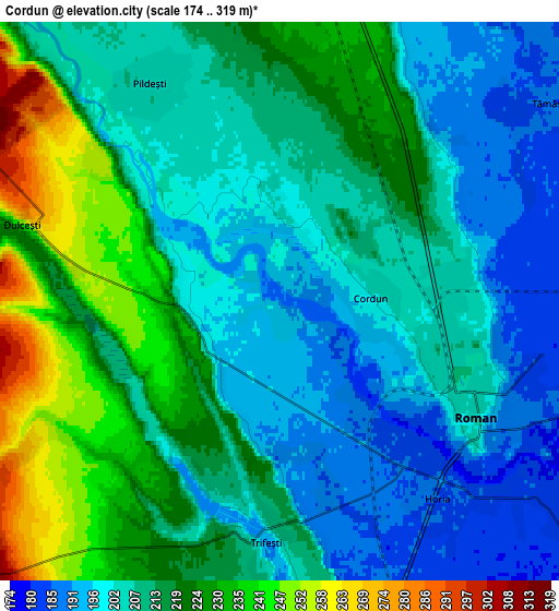
Below is the Elevation map of Cordun, which displays elevation range with different colors. Scale of the first map is from 178 to 248 m (584 to 814 ft) with average elevation of 202.5 meters (=664 ft) [note 1]
These maps also provides idea of topography and contour of this city, they are displayed at different zoom levels. More info about maps, scale and edge coordinates you can find below images.
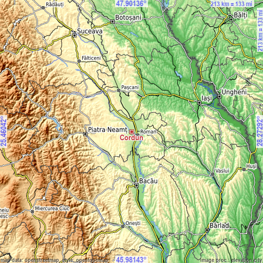
| \ | Map #1 | Map #2 | Topo.Map |
| Scale [m] | 178..248 m | 174..319 m | × |
| Scale [ft] | 584..814 ft | 571..1047 ft | × |
| Average | 202.5 m = 664 ft | 212.2 m = 696 ft | × |
| Width | 6.67 km = 4.1 mi | 13.34 km = 8.3 mi | 213.5 km = 132.7 mi |
| Height | 6.67 km = 4.1 mi | 13.34 km = 8.3 mi | 213.5 km = 132.7 mi |
| ↑Max Latitude | 46.97999° | 47.009964° | 47.90136° |
| Latitude at center | 46.95° | 46.95° | 46.95° |
| ↓Min Latitude | 46.919993° | 46.889969° | 45.98143° |
| ← Min Longitude | 26.822725° | 26.778779° | 25.46042° |
| Longitude center | 26.86667° | 26.86667° | 26.86667° |
| →Max Longitude | 26.910615° | 26.954561° | 28.27292° |
Nearby cities:
Cities around Cordun sort by population:
• Roman elevation 202 m
5.6 km,  125°
125°
• Săbăoani 223 m
7.5 km,  350°
350°
• Tămăşeni 186 m
6.3 km,  53°
53°
• Gherăeşti 210 m
8.3 km,  332°
332°
• Trifeşti 235 m
5.3 km,  225°
225°
• Dulceşti 233 m
7.8 km,  283°
283°
• Adjudeni 187 m
9.5 km,  41°
41°
• Pildești 206 m
6.1 km, 329°
• Horia 186 m
6.2 km,  140°
140°
• Cotu Vameș 184 m
8.3 km, 125°
• Miron Costin 243 m
5.7 km, 234°
• Traian 228 m
5.4 km,  31°
31°
Multilingual:
 En español:
Cordun elevación 189 m.
 En France:
Cordun élévation 189 m.


Sources and notes:
- [note 1] Map square and city borders are not equal. Map elevation data is calculated only from area inside that square.
- [src 1] Elevation data from geonames database provided with same terms of usage.
- [src 2] The elevation map of Cordun is generated using elevation data from NASA's 3 arcsec (90m) resolution SRTM data.
- [src 3] Base (background) map © OpenStreetMap contributors tiles are generated by Geofabrik and OpenTopoMap.
Copyright & License:
This Cordun Elevation Map is licensed under CC BY-SA. You may reuse any part from this page, if you give a proper credit by linking to this URL:
 More info on terms of use page.