Crângeni elevation
Crângeni (Teleorman, Comuna Crângeni), Romania elevation is 102 meters and Crângeni elevation in feet is 335 ft above sea level [src 1]. Crângeni is a seat of a second-order administrative division (feature code) with elevation that is 150 meters (492 ft) smaller than average city elevation in Romania.
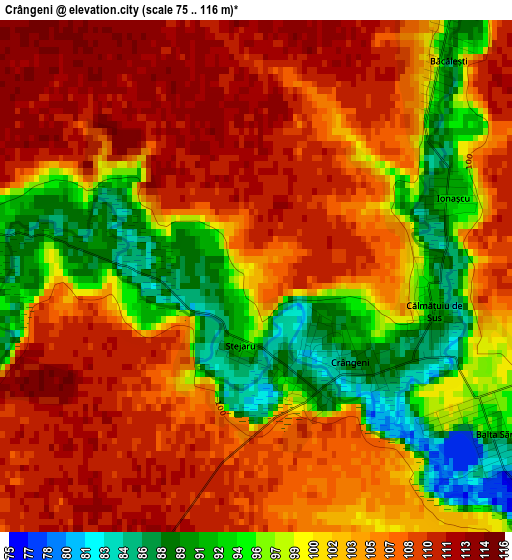
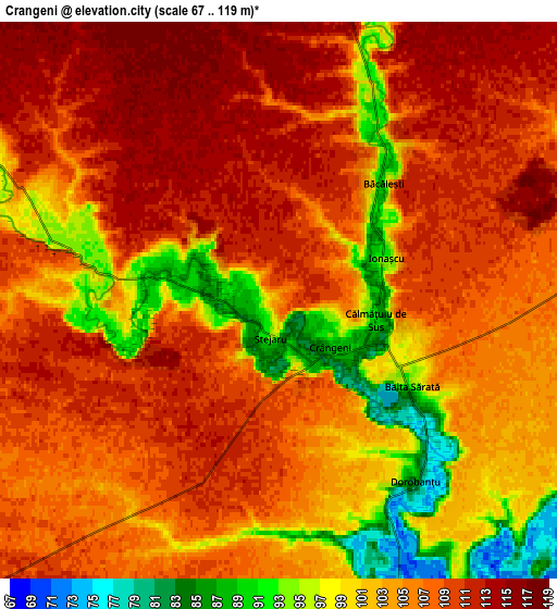
Below is the Elevation map of Crângeni, which displays elevation range with different colors. Scale of the first map is from 75 to 116 m (246 to 381 ft) with average elevation of 102.8 meters (=337 ft) [note 1]
These maps also provides idea of topography and contour of this city, they are displayed at different zoom levels. More info about maps, scale and edge coordinates you can find below images.
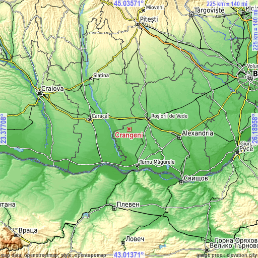
| \ | Map #1 | Map #2 | Topo.Map |
| Scale [m] | 75..116 m | 67..119 m | × |
| Scale [ft] | 246..381 ft | 220..390 ft | × |
| Average | 102.8 m = 337 ft | 105.3 m = 345 ft | × |
| Width | 7.03 km = 4.4 mi | 14.05 km = 8.7 mi | 224.8 km = 139.7 mi |
| Height | 7.03 km = 4.4 mi | 14.05 km = 8.7 mi | 224.8 km = 139.7 mi |
| ↑Max Latitude | 44.064915° | 44.096484° | 45.03571° |
| Latitude at center | 44.03333° | 44.03333° | 44.03333° |
| ↓Min Latitude | 44.001728° | 43.970109° | 43.01371° |
| ← Min Longitude | 24.739385° | 24.695439° | 23.37708° |
| Longitude center | 24.78333° | 24.78333° | 24.78333° |
| →Max Longitude | 24.827275° | 24.871221° | 26.18958° |
Nearby cities:
Cities around Crângeni sort by population:
• Plopii Slăviţeştí elevation 70 m
10.9 km,  227°
227°
• Radomireşti 106 m
12.2 km,  319°
319°
• Călmăţuiu 70 m
10 km,  138°
138°
• Mihăeşti 119 m
11.1 km,  0°
0°
• Călinești 109 m
9.1 km,  302°
302°
• Beciu 76 m
9.9 km,  251°
251°
• Băcălești 92 m
4 km,  41°
41°
• Sprâncenata 121 m
13.2 km,  294°
294°
• Brâncoveanca 67 m
12.6 km,  214°
214°
• Dudu 84 m
10.4 km, 234°
• Bușca 99 m
8.8 km,  9°
9°
• Călmățuiu de Sus 88 m
2.4 km,  108°
108°
Multilingual:
 En español:
Crângeni elevación 102 m.
 En France:
Crângeni élévation 102 m.
 Auf Deutsch:
Crângeni höhe über dem Meeresspiegel ist 102 m.

Sources and notes:
- [note 1] Map square and city borders are not equal. Map elevation data is calculated only from area inside that square.
- [src 1] Elevation data from geonames database provided with same terms of usage.
- [src 2] The elevation map of Crângeni is generated using elevation data from NASA's 3 arcsec (90m) resolution SRTM data.
- [src 3] Base (background) map © OpenStreetMap contributors tiles are generated by Geofabrik and OpenTopoMap.
Copyright & License:
This Crângeni Elevation Map is licensed under CC BY-SA. You may reuse any part from this page, if you give a proper credit by linking to this URL:
 More info on terms of use page.