Domnița elevation
Domnița (Iaşi, Comuna Ţibana), Romania elevation is 266 meters and Domnița elevation in feet is 873 ft above sea level [src 1]. Domnița is a populated place (feature code) with elevation that is 14 meters (46 ft) bigger than average city elevation in Romania.
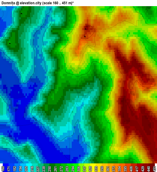
Below is the Elevation map of Domnița, which displays elevation range with different colors. Scale of the first map is from 160 to 451 m (525 to 1480 ft) with average elevation of 276.7 meters (=908 ft) [note 1]
These maps also provides idea of topography and contour of this city, they are displayed at different zoom levels. More info about maps, scale and edge coordinates you can find below images.
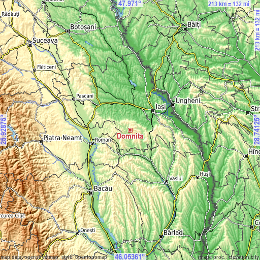
| \ | Map #1 | Topo.Map |
| Scale [m] | 160..451 m | × |
| Scale [ft] | 525..1480 ft | × |
| Average | 276.7 m = 908 ft | × |
| Width | 6.66 km = 4.1 mi | 213.2 km = 132.5 mi |
| Height | 6.66 km = 4.1 mi | 213.2 km = 132.5 mi |
| ↑Max Latitude | 47.05086° | 47.971° |
| Latitude at center | 47.02091° | 47.02091° |
| ↓Min Latitude | 46.990943° | 46.05361° |
| ← Min Longitude | 27.291055° | 25.92875° |
| Longitude center | 27.335° | 27.335° |
| →Max Longitude | 27.378945° | 28.74125° |
Nearby cities:
Cities around Domnița sort by population:
• Ţibăneşti elevation 150 m
11.6 km,  180°
180°
• Ţibana 162 m
4.2 km, 181°
• Voineşti 191 m
8 km,  50°
50°
• Mironeasa 271 m
8.6 km,  134°
134°
• Horleşti 115 m
10.9 km,  12°
12°
• Tansa 319 m
13.9 km,  213°
213°
• Gârbești 217 m
5 km, 212°
• Glodenii Gândului 218 m
8.2 km,  199°
199°
• Ipatele 214 m
13.1 km,  151°
151°
• Slobozia 250 m
7.3 km,  55°
55°
• Mănăstirea 247 m
12.9 km,  232°
232°
• Mădârjac 190 m
6.4 km,  300°
300°
Multilingual:
 En español:
Domnița elevación 266 m.
 En France:
Domnița élévation 266 m.


Sources and notes:
- [note 1] Map square and city borders are not equal. Map elevation data is calculated only from area inside that square.
- [src 1] Elevation data from geonames database provided with same terms of usage.
- [src 2] The elevation map of Domnița is generated using elevation data from NASA's 3 arcsec (90m) resolution SRTM data.
- [src 3] Base (background) map © OpenStreetMap contributors tiles are generated by Geofabrik and OpenTopoMap.
Copyright & License:
This Domnița Elevation Map is licensed under CC BY-SA. You may reuse any part from this page, if you give a proper credit by linking to this URL:
 More info on terms of use page.