Dumbrăviţa elevation
Dumbrăviţa (Maramureş, Comuna Dumbrăviţa), Romania elevation is 197 meters and Dumbrăviţa elevation in feet is 646 ft above sea level [src 1]. Dumbrăviţa is a seat of a second-order administrative division (feature code) with elevation that is 55 meters (180 ft) smaller than average city elevation in Romania.
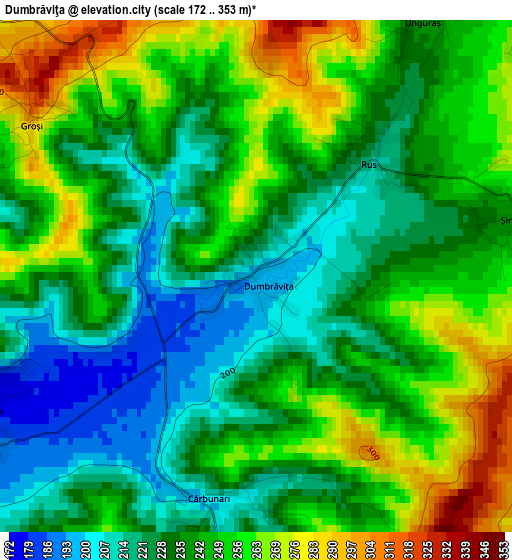
Below is the Elevation map of Dumbrăviţa, which displays elevation range with different colors. Scale of the first map is from 172 to 353 m (564 to 1158 ft) with average elevation of 240.4 meters (=789 ft) [note 1]
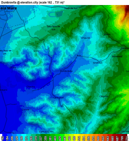
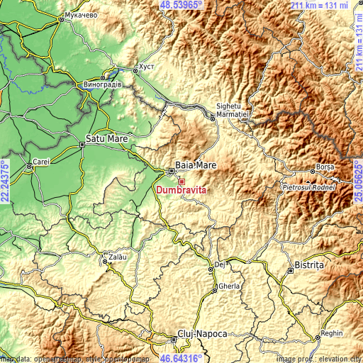
These maps also provides idea of topography and contour of this city, they are displayed at different zoom levels. More info about maps, scale and edge coordinates you can find below images.
| \ | Map #1 | Map #2 | Topo.Map |
| Scale [m] | 172..353 m | 162..731 m | × |
| Scale [ft] | 564..1158 ft | 531..2398 ft | × |
| Average | 240.4 m = 789 ft | 277.2 m = 909 ft | × |
| Width | 6.59 km = 4.1 mi | 13.18 km = 8.2 mi | 210.9 km = 131 mi |
| Height | 6.59 km = 4.1 mi | 13.18 km = 8.2 mi | 210.9 km = 131 mi |
| ↑Max Latitude | 47.629624° | 47.659231° | 48.53965° |
| Latitude at center | 47.6° | 47.6° | 47.6° |
| ↓Min Latitude | 47.570359° | 47.540702° | 46.64316° |
| ← Min Longitude | 23.606055° | 23.562109° | 22.24375° |
| Longitude center | 23.65° | 23.65° | 23.65° |
| →Max Longitude | 23.693945° | 23.737891° | 25.05625° |
Nearby cities:
Cities around Dumbrăviţa sort by population:
• Baia Mare elevation 220 m
8.8 km,  316°
316°
• Baia Sprie 350 m
7.6 km,  24°
24°
• Copalnic Mănăştur 321 m
11.4 km,  167°
167°
• Recea 190 m
10.7 km,  290°
290°
• Remetea Chioarului 181 m
10.5 km,  225°
225°
• Tăuții de Sus 298 m
6.3 km,  5°
5°
• Groşi 235 m
3.1 km,  306°
306°
• Coltău 169 m
9.4 km,  268°
268°
• Șisești 368 m
5.8 km,  48°
48°
• Șurdești 427 m
8.9 km,  88°
88°
• Coaș 200 m
8.3 km,  215°
215°
• Săcălășeni 170 m
6.7 km,  252°
252°
Multilingual:
 En español:
Dumbrăviţa elevación 197 m.
 En France:
Dumbrăviţa élévation 197 m.
 Auf Deutsch:
Dumbrăviţa höhe über dem Meeresspiegel ist 197 m.

Sources and notes:
- [note 1] Map square and city borders are not equal. Map elevation data is calculated only from area inside that square.
- [src 1] Elevation data from geonames database provided with same terms of usage.
- [src 2] The elevation map of Dumbrăviţa is generated using elevation data from NASA's 3 arcsec (90m) resolution SRTM data.
- [src 3] Base (background) map © OpenStreetMap contributors tiles are generated by Geofabrik and OpenTopoMap.
Copyright & License:
This Dumbrăviţa Elevation Map is licensed under CC BY-SA. You may reuse any part from this page, if you give a proper credit by linking to this URL:
 More info on terms of use page.