Găvănești elevation
Găvănești (Olt, Comuna Găvăneşti), Romania elevation is 141 meters and Găvănești elevation in feet is 463 ft above sea level [src 1]. Găvănești is a seat of a second-order administrative division (feature code) with elevation that is 111 meters (364 ft) smaller than average city elevation in Romania.
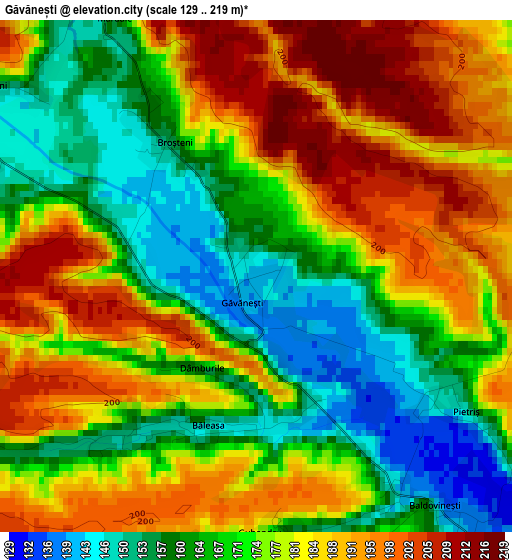
Below is the Elevation map of Găvănești, which displays elevation range with different colors. Scale of the first map is from 129 to 219 m (423 to 719 ft) with average elevation of 175.7 meters (=576 ft) [note 1]
These maps also provides idea of topography and contour of this city, they are displayed at different zoom levels. More info about maps, scale and edge coordinates you can find below images.
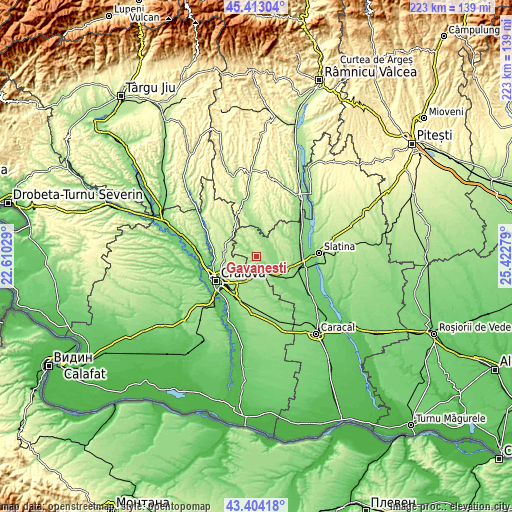
| \ | Map #1 | Topo.Map |
| Scale [m] | 129..219 m | × |
| Scale [ft] | 423..719 ft | × |
| Average | 175.7 m = 576 ft | × |
| Width | 6.98 km = 4.3 mi | 223.4 km = 138.8 mi |
| Height | 6.98 km = 4.3 mi | 223.4 km = 138.8 mi |
| ↑Max Latitude | 44.44862° | 45.41304° |
| Latitude at center | 44.41724° | 44.41724° |
| ↓Min Latitude | 44.385843° | 43.40418° |
| ← Min Longitude | 23.972595° | 22.61029° |
| Longitude center | 24.01654° | 24.01654° |
| →Max Longitude | 24.060485° | 25.42279° |
Nearby cities:
Cities around Găvănești sort by population:
• Balş elevation 133 m
10 km,  138°
138°
• Iancu Jianu 160 m
9.3 km,  8°
8°
• Pieleştí 162 m
10.7 km,  209°
209°
• Oboga 140 m
6.6 km,  90°
90°
• Bobiceşti 151 m
11.3 km,  109°
109°
• Baldovineşti 157 m
4.6 km, 144°
• Morunglav 220 m
9.7 km,  55°
55°
• Vulpeni 161 m
9.6 km,  304°
304°
• Dobreţu 177 m
10.6 km,  330°
330°
• Călui 158 m
5.5 km,  43°
43°
• Gura Căluiu 166 m
4.9 km,  17°
17°
• Gropșani 164 m
4.5 km,  305°
305°
Multilingual:
 En español:
Găvănești elevación 141 m.
 En France:
Găvănești élévation 141 m.
 Auf Deutsch:
Găvănești höhe über dem Meeresspiegel ist 141 m.

Sources and notes:
- [note 1] Map square and city borders are not equal. Map elevation data is calculated only from area inside that square.
- [src 1] Elevation data from geonames database provided with same terms of usage.
- [src 2] The elevation map of Găvănești is generated using elevation data from NASA's 3 arcsec (90m) resolution SRTM data.
- [src 3] Base (background) map © OpenStreetMap contributors tiles are generated by Geofabrik and OpenTopoMap.
Copyright & License:
This Găvănești Elevation Map is licensed under CC BY-SA. You may reuse any part from this page, if you give a proper credit by linking to this URL:
 More info on terms of use page.