Giubega elevation
Giubega (Dolj, Comuna Giubega), Romania elevation is 117 meters and Giubega elevation in feet is 384 ft above sea level [src 1]. Giubega is a seat of a second-order administrative division (feature code) with elevation that is 135 meters (443 ft) smaller than average city elevation in Romania.
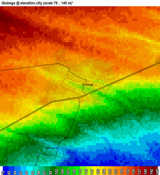
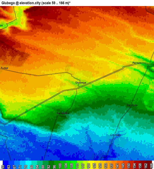
Below is the Elevation map of Giubega, which displays elevation range with different colors. Scale of the first map is from 79 to 145 m (259 to 476 ft) with average elevation of 116.1 meters (=381 ft) [note 1]
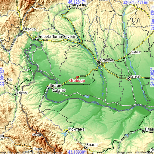
These maps also provides idea of topography and contour of this city, they are displayed at different zoom levels. More info about maps, scale and edge coordinates you can find below images.
| \ | Map #1 | Map #2 | Topo.Map |
| Scale [m] | 79..145 m | 59..166 m | × |
| Scale [ft] | 259..476 ft | 194..545 ft | × |
| Average | 116.1 m = 381 ft | 112.9 m = 370 ft | × |
| Width | 7.01 km = 4.4 mi | 14.03 km = 8.7 mi | 224.5 km = 139.5 mi |
| Height | 7.01 km = 4.4 mi | 14.03 km = 8.7 mi | 224.5 km = 139.5 mi |
| ↑Max Latitude | 44.158935° | 44.190454° | 45.12817° |
| Latitude at center | 44.1274° | 44.1274° | 44.1274° |
| ↓Min Latitude | 44.095848° | 44.064279° | 43.10938° |
| ← Min Longitude | 23.363625° | 23.319679° | 22.00132° |
| Longitude center | 23.40757° | 23.40757° | 23.40757° |
| →Max Longitude | 23.451515° | 23.495461° | 24.81382° |
Nearby cities:
Cities around Giubega sort by population:
• Băileşti elevation 55 m
13.1 km,  200°
200°
• Galicea Mare 76 m
9.1 km,  250°
250°
• Caraula 102 m
14 km,  296°
296°
• Sălcuţa 174 m
13.8 km,  8°
8°
• Izvoare 130 m
9.2 km,  284°
284°
• Întorsura 81 m
13.5 km,  97°
97°
• Siliştea Crucii 52 m
12.1 km,  149°
149°
• Vârtop 135 m
10 km,  331°
331°
• Perișor 119 m
5.7 km,  71°
71°
• Boureni 56 m
12.6 km,  170°
170°
• Cioroiași 72 m
6 km, 145°
• Galiciuica 93 m
3 km,  206°
206°
Multilingual:
 En español:
Giubega elevación 117 m.
 En France:
Giubega élévation 117 m.


Sources and notes:
- [note 1] Map square and city borders are not equal. Map elevation data is calculated only from area inside that square.
- [src 1] Elevation data from geonames database provided with same terms of usage.
- [src 2] The elevation map of Giubega is generated using elevation data from NASA's 3 arcsec (90m) resolution SRTM data.
- [src 3] Base (background) map © OpenStreetMap contributors tiles are generated by Geofabrik and OpenTopoMap.
Copyright & License:
This Giubega Elevation Map is licensed under CC BY-SA. You may reuse any part from this page, if you give a proper credit by linking to this URL:
 More info on terms of use page.