Livezi elevation
Livezi (Bacău, Comuna Livezi), Romania elevation is 270 meters and Livezi elevation in feet is 886 ft above sea level [src 1]. Livezi is a seat of a second-order administrative division (feature code) with elevation that is 18 meters (59 ft) bigger than average city elevation in Romania.
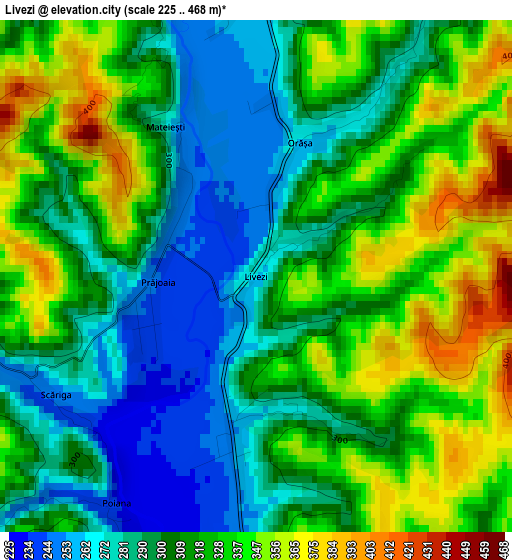
Below is the Elevation map of Livezi, which displays elevation range with different colors. Scale of the first map is from 225 to 468 m (738 to 1535 ft) with average elevation of 312.2 meters (=1024 ft) [note 1]
These maps also provides idea of topography and contour of this city, they are displayed at different zoom levels. More info about maps, scale and edge coordinates you can find below images.
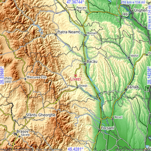
| \ | Map #1 | Topo.Map |
| Scale [m] | 225..468 m | × |
| Scale [ft] | 738..1535 ft | × |
| Average | 312.2 m = 1024 ft | × |
| Width | 6.74 km = 4.2 mi | 215.6 km = 134 mi |
| Height | 6.74 km = 4.2 mi | 215.6 km = 134 mi |
| ↑Max Latitude | 46.436684° | 47.36744° |
| Latitude at center | 46.40639° | 46.40639° |
| ↓Min Latitude | 46.37608° | 45.4281° |
| ← Min Longitude | 26.692185° | 25.32988° |
| Longitude center | 26.73613° | 26.73613° |
| →Max Longitude | 26.780075° | 28.14238° |
Nearby cities:
Cities around Livezi sort by population:
• Helegiu elevation 255 m
6.4 km,  170°
170°
• Gura Văii 246 m
8.1 km,  181°
181°
• Berzunţi 344 m
7.9 km,  264°
264°
• Livezi-Vale 246 m
1.2 km,  349°
349°
• Sănduleni 292 m
4.9 km,  357°
357°
• Drăgugești 285 m
5.2 km,  145°
145°
• Dragomir 347 m
8.1 km,  275°
275°
• Deleni 359 m
6.6 km, 152°
• Turluianu 303 m
8.6 km,  306°
306°
• Orășa 266 m
1.9 km,  18°
18°
• Verșești 280 m
5.4 km,  330°
330°
• Bârsăneşti 289 m
8.6 km,  198°
198°
Multilingual:
 En español:
Livezi elevación 270 m.
 En France:
Livezi élévation 270 m.


Sources and notes:
- [note 1] Map square and city borders are not equal. Map elevation data is calculated only from area inside that square.
- [src 1] Elevation data from geonames database provided with same terms of usage.
- [src 2] The elevation map of Livezi is generated using elevation data from NASA's 3 arcsec (90m) resolution SRTM data.
- [src 3] Base (background) map © OpenStreetMap contributors tiles are generated by Geofabrik and OpenTopoMap.
Copyright & License:
This Livezi Elevation Map is licensed under CC BY-SA. You may reuse any part from this page, if you give a proper credit by linking to this URL:
 More info on terms of use page.