Gura Văii elevation
Gura Văii (Bacău, Comuna Bârsăneşti), Romania elevation is 246 meters and Gura Văii elevation in feet is 807 ft above sea level [src 1]. Gura Văii is a populated place (feature code) with elevation that is 6 meters (20 ft) smaller than average city elevation in Romania.
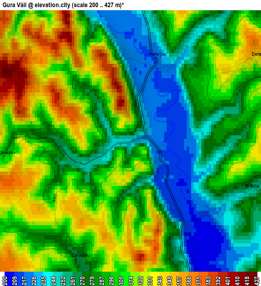
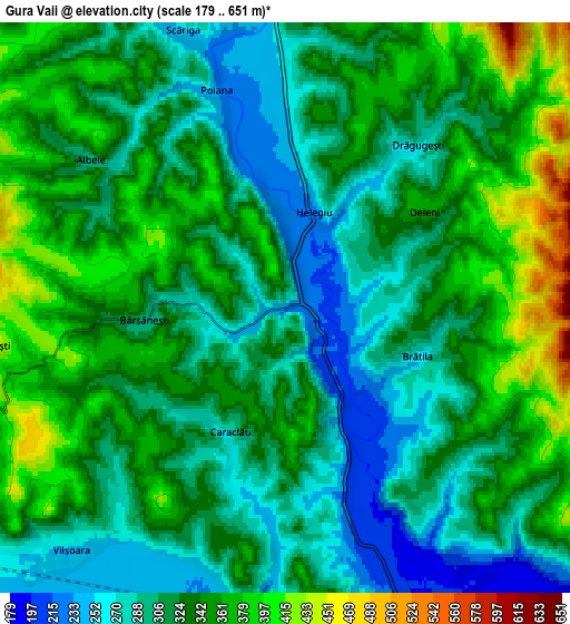
Below is the Elevation map of Gura Văii, which displays elevation range with different colors. Scale of the first map is from 200 to 427 m (656 to 1401 ft) with average elevation of 293.5 meters (=963 ft) [note 1]
These maps also provides idea of topography and contour of this city, they are displayed at different zoom levels. More info about maps, scale and edge coordinates you can find below images.
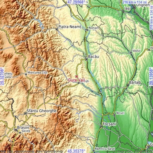
| \ | Map #1 | Map #2 | Topo.Map |
| Scale [m] | 200..427 m | 179..651 m | × |
| Scale [ft] | 656..1401 ft | 587..2136 ft | × |
| Average | 293.5 m = 963 ft | 326.2 m = 1070 ft | × |
| Width | 6.75 km = 4.2 mi | 13.5 km = 8.4 mi | 215.9 km = 134.2 mi |
| Height | 6.75 km = 4.2 mi | 13.5 km = 8.4 mi | 215.9 km = 134.2 mi |
| ↑Max Latitude | 46.363664° | 46.393981° | 47.29568° |
| Latitude at center | 46.33333° | 46.33333° | 46.33333° |
| ↓Min Latitude | 46.302979° | 46.272611° | 45.35375° |
| ← Min Longitude | 26.689385° | 26.645439° | 25.32708° |
| Longitude center | 26.73333° | 26.73333° | 26.73333° |
| →Max Longitude | 26.777275° | 26.821221° | 28.13958° |
Nearby cities:
Cities around Gura Văii sort by population:
• Helegiu elevation 255 m
2.3 km,  34°
34°
• Târgu Trotuş 242 m
9 km,  214°
214°
• Livezi-Vale 246 m
9.3 km,  0°
0°
• Drăgugești 285 m
5 km,  39°
39°
• Brătila 269 m
3.3 km,  109°
109°
• Tuta 232 m
9.1 km,  200°
200°
• Deleni 359 m
4 km,  55°
55°
• Brătești 445 m
7 km,  262°
262°
• Caraclău 276 m
3.2 km, 203°
• Viișoara 258 m
7.8 km,  224°
224°
• Livezi 270 m
8.1 km, 1°
• Bârsăneşti 289 m
2.6 km,  270°
270°
Multilingual:
 En español:
Gura Văii elevación 246 m.
 En France:
Gura Văii élévation 246 m.
 Auf Deutsch:
Gura Văii höhe über dem Meeresspiegel ist 246 m.

Sources and notes:
- [note 1] Map square and city borders are not equal. Map elevation data is calculated only from area inside that square.
- [src 1] Elevation data from geonames database provided with same terms of usage.
- [src 2] The elevation map of Gura Văii is generated using elevation data from NASA's 3 arcsec (90m) resolution SRTM data.
- [src 3] Base (background) map © OpenStreetMap contributors tiles are generated by Geofabrik and OpenTopoMap.
Copyright & License:
This Gura Văii Elevation Map is licensed under CC BY-SA. You may reuse any part from this page, if you give a proper credit by linking to this URL:
 More info on terms of use page.