Manoleasa elevation
Manoleasa (Botoşani, Comuna Manoleasa), Romania elevation is 146 meters and Manoleasa elevation in feet is 479 ft above sea level [src 1]. Manoleasa is a seat of a second-order administrative division (feature code) with elevation that is 106 meters (348 ft) smaller than average city elevation in Romania.
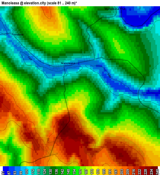
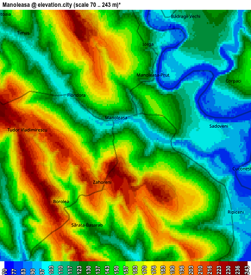
Below is the Elevation map of Manoleasa, which displays elevation range with different colors. Scale of the first map is from 81 to 240 m (266 to 787 ft) with average elevation of 153.8 meters (=505 ft) [note 1]
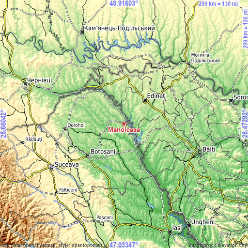
These maps also provides idea of topography and contour of this city, they are displayed at different zoom levels. More info about maps, scale and edge coordinates you can find below images.
| \ | Map #1 | Map #2 | Topo.Map |
| Scale [m] | 81..240 m | 70..243 m | × |
| Scale [ft] | 266..787 ft | 230..797 ft | × |
| Average | 153.8 m = 505 ft | 146.5 m = 481 ft | × |
| Width | 6.54 km = 4.1 mi | 13.08 km = 8.1 mi | 209.3 km = 130.1 mi |
| Height | 6.54 km = 4.1 mi | 13.08 km = 8.1 mi | 209.3 km = 130.1 mi |
| ↑Max Latitude | 48.012736° | 48.042126° | 48.91603° |
| Latitude at center | 47.98333° | 47.98333° | 47.98333° |
| ↓Min Latitude | 47.953907° | 47.924467° | 47.03347° |
| ← Min Longitude | 27.022725° | 26.978779° | 25.66042° |
| Longitude center | 27.06667° | 27.06667° | 27.06667° |
| →Max Longitude | 27.110615° | 27.154561° | 28.47292° |
Nearby cities:
Cities around Manoleasa sort by population:
• Săveni elevation 83 m
15.3 km,  256°
256°
• Avrămeni 233 m
9.4 km,  293°
293°
• Vlăsineşti 116 m
14.7 km,  247°
247°
• Dângeni 85 m
16.6 km,  206°
206°
• Dobârceni 195 m
18.5 km,  180°
180°
• Mihălăşeni 90 m
11.1 km, 180°
• Hăneşti 75 m
9.7 km,  219°
219°
• Ripiceni 118 m
6.2 km,  126°
126°
• Mitoc 90 m
13.2 km,  349°
349°
• Sârbi 102 m
11.9 km, 247°
• Adășeni 188 m
13.5 km,  314°
314°
• Iacobeni 94 m
17.8 km, 220°
Multilingual:
 En español:
Manoleasa elevación 146 m.
 En France:
Manoleasa élévation 146 m.
 Auf Deutsch:
Manoleasa höhe über dem Meeresspiegel ist 146 m.

Sources and notes:
- [note 1] Map square and city borders are not equal. Map elevation data is calculated only from area inside that square.
- [src 1] Elevation data from geonames database provided with same terms of usage.
- [src 2] The elevation map of Manoleasa is generated using elevation data from NASA's 3 arcsec (90m) resolution SRTM data.
- [src 3] Base (background) map © OpenStreetMap contributors tiles are generated by Geofabrik and OpenTopoMap.
Copyright & License:
This Manoleasa Elevation Map is licensed under CC BY-SA. You may reuse any part from this page, if you give a proper credit by linking to this URL:
 More info on terms of use page.