Murgeşti elevation
Murgeşti (Buzău, Comuna Murgeşti), Romania elevation is 292 meters and Murgeşti elevation in feet is 958 ft above sea level [src 1]. Murgeşti is a seat of a second-order administrative division (feature code) with elevation that is 40 meters (131 ft) bigger than average city elevation in Romania.
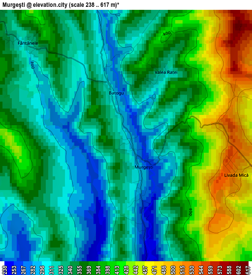
Below is the Elevation map of Murgeşti, which displays elevation range with different colors. Scale of the first map is from 238 to 617 m (781 to 2024 ft) with average elevation of 360.6 meters (=1183 ft) [note 1]
These maps also provides idea of topography and contour of this city, they are displayed at different zoom levels. More info about maps, scale and edge coordinates you can find below images.
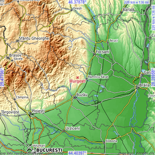
| \ | Map #1 | Topo.Map |
| Scale [m] | 238..617 m | × |
| Scale [ft] | 781..2024 ft | × |
| Average | 360.6 m = 1183 ft | × |
| Width | 6.86 km = 4.3 mi | 219.6 km = 136.5 mi |
| Height | 6.86 km = 4.3 mi | 219.6 km = 136.5 mi |
| ↑Max Latitude | 45.430848° | 46.37878° |
| Latitude at center | 45.4° | 45.4° |
| ↓Min Latitude | 45.369135° | 44.40397° |
| ← Min Longitude | 26.839385° | 25.47708° |
| Longitude center | 26.88333° | 26.88333° |
| →Max Longitude | 26.927275° | 28.28958° |
Nearby cities:
Cities around Murgeşti sort by population:
• Beceni elevation 311 m
8 km,  256°
256°
• Topliceni 201 m
9.3 km,  78°
78°
• Grebănu 251 m
6.8 km,  105°
105°
• Vadu Sorești 208 m
9.5 km,  182°
182°
• Racoviţeni 324 m
3.9 km,  160°
160°
• Plevna 182 m
10.4 km,  103°
103°
• Valea Părului 228 m
9.2 km,  244°
244°
• Băbeni 252 m
9.1 km,  55°
55°
• Izvoru Dulce 233 m
10.5 km,  231°
231°
• Dedulești 198 m
10.2 km,  40°
40°
• Mărgăriteşti 402 m
5.4 km,  313°
313°
• Pardoşi 324 m
3.9 km, 160°
Multilingual:
 En español:
Murgeşti elevación 292 m.
 En France:
Murgeşti élévation 292 m.
 Auf Deutsch:
Murgeşti höhe über dem Meeresspiegel ist 292 m.

Sources and notes:
- [note 1] Map square and city borders are not equal. Map elevation data is calculated only from area inside that square.
- [src 1] Elevation data from geonames database provided with same terms of usage.
- [src 2] The elevation map of Murgeşti is generated using elevation data from NASA's 3 arcsec (90m) resolution SRTM data.
- [src 3] Base (background) map © OpenStreetMap contributors tiles are generated by Geofabrik and OpenTopoMap.
Copyright & License:
This Murgeşti Elevation Map is licensed under CC BY-SA. You may reuse any part from this page, if you give a proper credit by linking to this URL:
 More info on terms of use page.