Olteni elevation
Olteni (Teleorman, Comuna Olteni), Romania elevation is 75 meters and Olteni elevation in feet is 246 ft above sea level [src 1]. Olteni is a seat of a second-order administrative division (feature code) with elevation that is 177 meters (581 ft) smaller than average city elevation in Romania.
Below is the Elevation map of Olteni, which displays elevation range with different colors. Scale of the first map is from 66 to 109 m (217 to 358 ft) with average elevation of 88.7 meters (=291 ft) [note 1]
These maps also provides idea of topography and contour of this city, they are displayed at different zoom levels. More info about maps, scale and edge coordinates you can find below images.
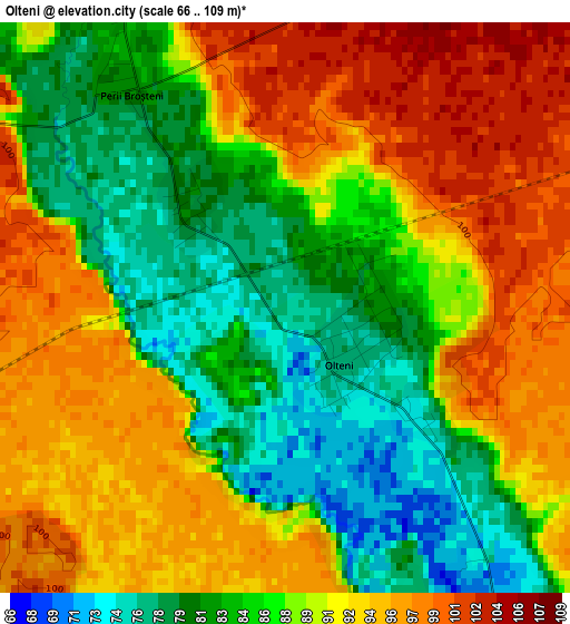
| \ | Map #1 | Topo.Map |
| Scale [m] | 66..109 m | × |
| Scale [ft] | 217..358 ft | × |
| Average | 88.7 m = 291 ft | × |
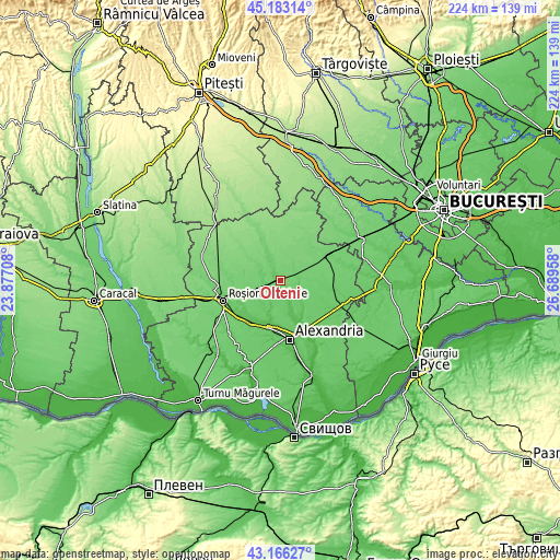
| Width | 7.01 km = 4.4 mi | 224.3 km = 139.4 mi |
| Height | 7.01 km = 4.4 mi | 224.2 km = 139.3 mi |
| ↑Max Latitude | 44.214835° | 45.18314° |
| Latitude at center | 44.18333° | 44.18333° |
| ↓Min Latitude | 44.151808° | 43.16627° |
| ← Min Longitude | 25.239385° | 23.87708° |
| Longitude center | 25.28333° | 25.28333° |
| →Max Longitude | 25.327275° | 26.68958° |
Nearby cities:
Cities around Olteni sort by population:
• Orbeasca de Sus elevation 70 m
4.6 km,  144°
144°
• Băbăiţa 93 m
8.2 km,  103°
103°
• Trivalea-Moşteni 90 m
10.1 km,  336°
336°
• Vârtoapele de Jos 82 m
6.6 km,  270°
270°
• Gălăţeni 105 m
6.5 km,  55°
55°
• Orbeasca de Jos 65 m
7.8 km,  151°
151°
• Frăsinet 80 m
7.9 km,  92°
92°
• Talpa-Trivalea 119 m
11.1 km,  0°
0°
• Bâscoveni 110 m
9.1 km,  41°
41°
• Vârtoapele de Sus 83 m
6.7 km,  278°
278°
• Perii Broșteni 79 m
2.7 km,  325°
325°
• Gărăgău 99 m
9.2 km,  305°
305°
Multilingual:
 En español:
Olteni elevación 75 m.
 En France:
Olteni élévation 75 m.


Sources and notes:
- [note 1] Map square and city borders are not equal. Map elevation data is calculated only from area inside that square.
- [src 1] Elevation data from geonames database provided with same terms of usage.
- [src 2] The elevation map of Olteni is generated using elevation data from NASA's 3 arcsec (90m) resolution SRTM data.
- [src 3] Base (background) map © OpenStreetMap contributors tiles are generated by Geofabrik and OpenTopoMap.
Copyright & License:
This Olteni Elevation Map is licensed under CC BY-SA. You may reuse any part from this page, if you give a proper credit by linking to this URL:
 More info on terms of use page.