Vârtoapele de Sus elevation
Vârtoapele de Sus (Teleorman, Comuna Vârtoape), Romania elevation is 83 meters and Vârtoapele de Sus elevation in feet is 272 ft above sea level [src 1]. Vârtoapele de Sus is a populated place (feature code) with elevation that is 169 meters (554 ft) smaller than average city elevation in Romania.
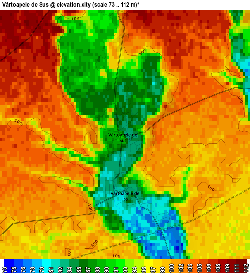
Below is the Elevation map of Vârtoapele de Sus, which displays elevation range with different colors. Scale of the first map is from 73 to 112 m (240 to 367 ft) with average elevation of 96.9 meters (=318 ft) [note 1]
These maps also provides idea of topography and contour of this city, they are displayed at different zoom levels. More info about maps, scale and edge coordinates you can find below images.
| \ | Map #1 | Topo.Map |
| Scale [m] | 73..112 m | × |
| Scale [ft] | 240..367 ft | × |
| Average | 96.9 m = 318 ft | × |
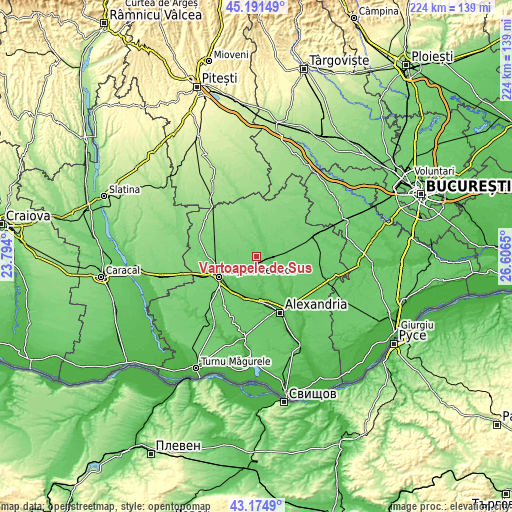
| Width | 7.01 km = 4.4 mi | 224.2 km = 139.3 mi |
| Height | 7.01 km = 4.4 mi | 224.2 km = 139.3 mi |
| ↑Max Latitude | 44.223321° | 45.19149° |
| Latitude at center | 44.19182° | 44.19182° |
| ↓Min Latitude | 44.160302° | 43.1749° |
| ← Min Longitude | 25.156305° | 23.794° |
| Longitude center | 25.20025° | 25.20025° |
| →Max Longitude | 25.244195° | 26.6065° |
Nearby cities:
Cities around Vârtoapele de Sus sort by population:
• Orbeasca de Sus elevation 70 m
10.4 km,  116°
116°
• Trivalea-Moşteni 90 m
8.7 km,  17°
17°
• Olteni 75 m
6.7 km,  98°
98°
• Vârtoapele de Jos 82 m
0.9 km,  181°
181°
• Talpa-Trivalea 119 m
12.1 km,  33°
33°
• Săceni 113 m
11.6 km,  293°
293°
• Necşeşti 101 m
7.6 km,  328°
328°
• Deparați 94 m
10.1 km,  9°
9°
• Sfinţeşti 101 m
8 km,  263°
263°
• Perii Broșteni 79 m
5.2 km,  75°
75°
• Rădoiești-Deal 81 m
7.1 km,  228°
228°
• Gărăgău 99 m
4.5 km,  348°
348°
Multilingual:
 En español:
Vârtoapele de Sus elevación 83 m.
 En France:
Vârtoapele de Sus élévation 83 m.
 Auf Deutsch:
Vârtoapele de Sus höhe über dem Meeresspiegel ist 83 m.

Sources and notes:
- [note 1] Map square and city borders are not equal. Map elevation data is calculated only from area inside that square.
- [src 1] Elevation data from geonames database provided with same terms of usage.
- [src 2] The elevation map of Vârtoapele de Sus is generated using elevation data from NASA's 3 arcsec (90m) resolution SRTM data.
- [src 3] Base (background) map © OpenStreetMap contributors tiles are generated by Geofabrik and OpenTopoMap.
Copyright & License:
This Vârtoapele de Sus Elevation Map is licensed under CC BY-SA. You may reuse any part from this page, if you give a proper credit by linking to this URL:
 More info on terms of use page.