Ozun elevation
Ozun (Covasna, Comuna Ozun), Romania elevation is 513 meters and Ozun elevation in feet is 1683 ft above sea level [src 1]. Ozun is a seat of a second-order administrative division (feature code) with elevation that is 261 meters (856 ft) bigger than average city elevation in Romania.
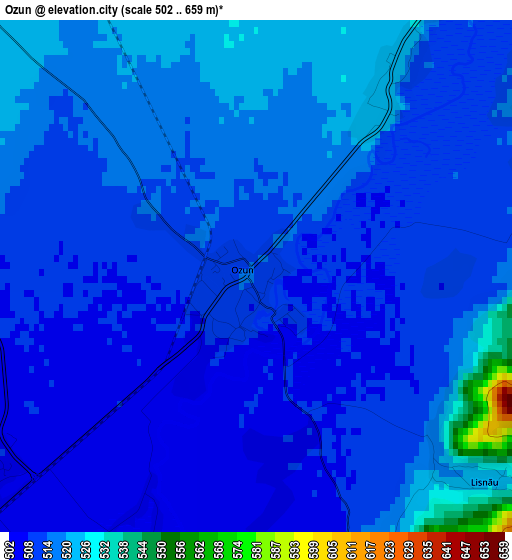
Below is the Elevation map of Ozun, which displays elevation range with different colors. Scale of the first map is from 502 to 659 m (1647 to 2162 ft) with average elevation of 514.3 meters (=1687 ft) [note 1]
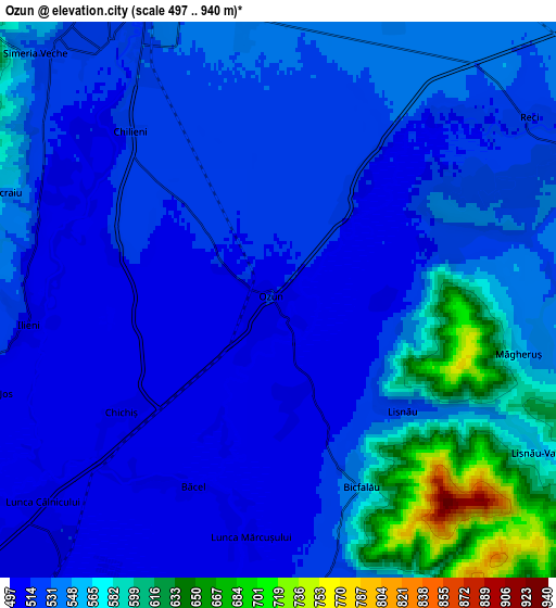
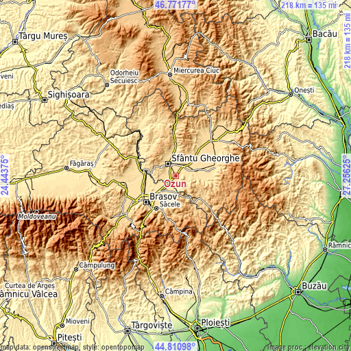
These maps also provides idea of topography and contour of this city, they are displayed at different zoom levels. More info about maps, scale and edge coordinates you can find below images.
| \ | Map #1 | Map #2 | Topo.Map |
| Scale [m] | 502..659 m | 497..940 m | × |
| Scale [ft] | 1647..2162 ft | 1631..3084 ft | × |
| Average | 514.3 m = 1687 ft | 539.9 m = 1771 ft | × |
| Width | 6.81 km = 4.2 mi | 13.63 km = 8.5 mi | 218 km = 135.5 mi |
| Height | 6.81 km = 4.2 mi | 13.63 km = 8.5 mi | 218 km = 135.5 mi |
| ↑Max Latitude | 45.830629° | 45.861241° | 46.77177° |
| Latitude at center | 45.8° | 45.8° | 45.8° |
| ↓Min Latitude | 45.769354° | 45.738692° | 44.81098° |
| ← Min Longitude | 25.806055° | 25.762109° | 24.44375° |
| Longitude center | 25.85° | 25.85° | 25.85° |
| →Max Longitude | 25.893945° | 25.937891° | 27.25625° |
Nearby cities:
Cities around Ozun sort by population:
• Sfântu Gheorghe elevation 552 m
9 km,  325°
325°
• Prejmer 523 m
11.3 km,  214°
214°
• Tunelu-Teliu 543 m
11.1 km,  180°
180°
• Teliu 543 m
11.3 km, 177°
• Boroşneu Mare 526 m
11.8 km,  80°
80°
• Ghidfalău 555 m
11.1 km,  0°
0°
• Dobârlău 610 m
7.9 km,  160°
160°
• Moacşa 533 m
11.7 km,  50°
50°
• Reci 531 m
8.5 km, 49°
• Ilieni 523 m
6.5 km,  270°
270°
• Chichiş 506 m
4.3 km,  244°
244°
• Valea Mare 777 m
12.2 km,  107°
107°
Multilingual:
 En español:
Ozun elevación 513 m.
 En France:
Ozun élévation 513 m.


Sources and notes:
- [note 1] Map square and city borders are not equal. Map elevation data is calculated only from area inside that square.
- [src 1] Elevation data from geonames database provided with same terms of usage.
- [src 2] The elevation map of Ozun is generated using elevation data from NASA's 3 arcsec (90m) resolution SRTM data.
- [src 3] Base (background) map © OpenStreetMap contributors tiles are generated by Geofabrik and OpenTopoMap.
Copyright & License:
This Ozun Elevation Map is licensed under CC BY-SA. You may reuse any part from this page, if you give a proper credit by linking to this URL:
 More info on terms of use page.