Sfântu Gheorghe elevation
Sfântu Gheorghe (Covasna, Municipiul Sfântu Gheorghe), Romania elevation is 552 meters and Sfântu Gheorghe elevation in feet is 1811 ft above sea level [src 1]. Sfântu Gheorghe is a seat of a first-order administrative division (feature code) with elevation that is 300 meters (984 ft) bigger than average city elevation in Romania.
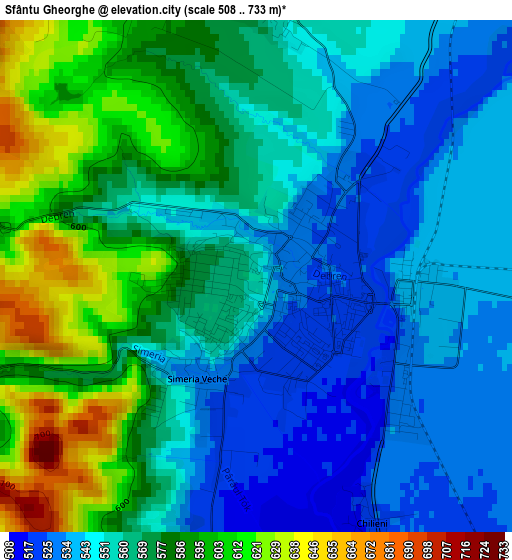
Below is the Elevation map of Sfântu Gheorghe, which displays elevation range with different colors. Scale of the first map is from 508 to 733 m (1667 to 2405 ft) with average elevation of 565.5 meters (=1855 ft) [note 1]
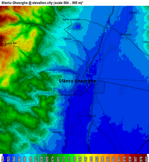
These maps also provides idea of topography and contour of this city, they are displayed at different zoom levels. More info about maps, scale and edge coordinates you can find below images.
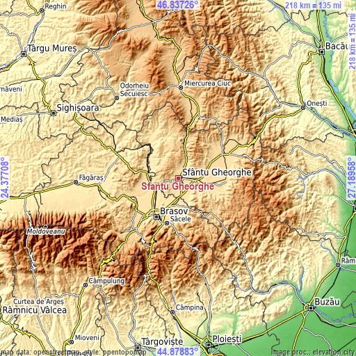
| \ | Map #1 | Map #2 | Topo.Map |
| Scale [m] | 508..733 m | 504..995 m | × |
| Scale [ft] | 1667..2405 ft | 1654..3264 ft | × |
| Average | 565.5 m = 1855 ft | 596.3 m = 1956 ft | × |
| Width | 6.8 km = 4.2 mi | 13.61 km = 8.5 mi | 217.8 km = 135.3 mi |
| Height | 6.8 km = 4.2 mi | 13.61 km = 8.5 mi | 217.7 km = 135.3 mi |
| ↑Max Latitude | 45.897262° | 45.927837° | 46.83726° |
| Latitude at center | 45.86667° | 45.86667° | 45.86667° |
| ↓Min Latitude | 45.836061° | 45.805435° | 44.87883° |
| ← Min Longitude | 25.739385° | 25.695439° | 24.37708° |
| Longitude center | 25.78333° | 25.78333° | 25.78333° |
| →Max Longitude | 25.827275° | 25.871221° | 27.18958° |
Nearby cities:
Cities around Sfântu Gheorghe sort by population:
• Ozun elevation 513 m
9 km,  145°
145°
• Bod 494 m
15.2 km,  222°
222°
• Vâlcele 640 m
8 km,  256°
256°
• Valea Crişului 613 m
5.7 km,  346°
346°
• Ghidfalău 555 m
6.4 km,  54°
54°
• Bodoc 539 m
10.6 km,  29°
29°
• Moacşa 533 m
14.2 km,  90°
90°
• Reci 531 m
11.8 km,  99°
99°
• Ilieni 523 m
7.5 km,  189°
189°
• Chichiş 506 m
9.4 km,  172°
172°
• Araci 500 m
11.7 km,  238°
238°
• Arcuș 574 m
3.8 km, 352°
Multilingual:
 En español:
Sfântu Gheorghe elevación 552 m.
 En France:
Sfântu Gheorghe élévation 552 m.
 Auf Deutsch:
Sfântu Gheorghe höhe über dem Meeresspiegel ist 552 m.

Sources and notes:
- [note 1] Map square and city borders are not equal. Map elevation data is calculated only from area inside that square.
- [src 1] Elevation data from geonames database provided with same terms of usage.
- [src 2] The elevation map of Sfântu Gheorghe is generated using elevation data from NASA's 3 arcsec (90m) resolution SRTM data.
- [src 3] Base (background) map © OpenStreetMap contributors tiles are generated by Geofabrik and OpenTopoMap.
Copyright & License:
This Sfântu Gheorghe Elevation Map is licensed under CC BY-SA. You may reuse any part from this page, if you give a proper credit by linking to this URL:
 More info on terms of use page.