Pechea elevation
Pechea (Galaţi, Comuna Pechea), Romania elevation is 44 meters and Pechea elevation in feet is 144 ft above sea level [src 1]. Pechea is a seat of a second-order administrative division (feature code) with elevation that is 208 meters (682 ft) smaller than average city elevation in Romania.
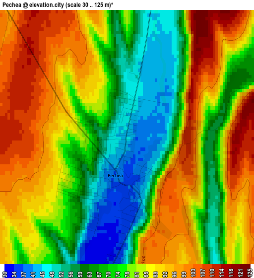
Below is the Elevation map of Pechea, which displays elevation range with different colors. Scale of the first map is from 30 to 125 m (98 to 410 ft) with average elevation of 79.4 meters (=260 ft) [note 1]
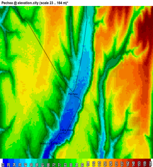
These maps also provides idea of topography and contour of this city, they are displayed at different zoom levels. More info about maps, scale and edge coordinates you can find below images.
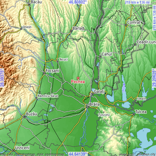
| \ | Map #1 | Map #2 | Topo.Map |
| Scale [m] | 30..125 m | 23..164 m | × |
| Scale [ft] | 98..410 ft | 75..538 ft | × |
| Average | 79.4 m = 260 ft | 93.8 m = 308 ft | × |
| Width | 6.83 km = 4.2 mi | 13.67 km = 8.5 mi | 218.7 km = 135.9 mi |
| Height | 6.83 km = 4.2 mi | 13.67 km = 8.5 mi | 218.7 km = 135.9 mi |
| ↑Max Latitude | 45.66405° | 45.694754° | 46.60802° |
| Latitude at center | 45.63333° | 45.63333° | 45.63333° |
| ↓Min Latitude | 45.602593° | 45.571839° | 44.64139° |
| ← Min Longitude | 27.756055° | 27.712109° | 26.39375° |
| Longitude center | 27.8° | 27.8° | 27.8° |
| →Max Longitude | 27.843945° | 27.887891° | 29.20625° |
Nearby cities:
Cities around Pechea sort by population:
• Tudor Vladimirescu elevation 20 m
13.8 km,  237°
237°
• Piscu 14 m
15.7 km,  199°
199°
• Rediu 111 m
9.6 km,  15°
15°
• Griviţa 76 m
14.9 km,  308°
308°
• Schela 66 m
14.9 km,  174°
174°
• Slobozia Conachi 70 m
5.7 km,  193°
193°
• Cuza Vodă 35 m
4.2 km, 187°
• Costache Negri 48 m
9.8 km,  318°
318°
• Cuca 164 m
12.9 km,  30°
30°
• Suhurlui 67 m
10.8 km,  11°
11°
• Cișmele 59 m
16.5 km,  142°
142°
• Scânteiești 120 m
15.3 km,  68°
68°
Multilingual:
 En español:
Pechea elevación 44 m.
 En France:
Pechea élévation 44 m.


Sources and notes:
- [note 1] Map square and city borders are not equal. Map elevation data is calculated only from area inside that square.
- [src 1] Elevation data from geonames database provided with same terms of usage.
- [src 2] The elevation map of Pechea is generated using elevation data from NASA's 3 arcsec (90m) resolution SRTM data.
- [src 3] Base (background) map © OpenStreetMap contributors tiles are generated by Geofabrik and OpenTopoMap.
Copyright & License:
This Pechea Elevation Map is licensed under CC BY-SA. You may reuse any part from this page, if you give a proper credit by linking to this URL:
 More info on terms of use page.