Griviţa elevation
Griviţa (Galaţi, Comuna Griviţa), Romania elevation is 76 meters and Griviţa elevation in feet is 249 ft above sea level [src 1]. Griviţa is a seat of a second-order administrative division (feature code) with elevation that is 176 meters (577 ft) smaller than average city elevation in Romania.
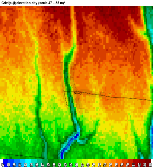
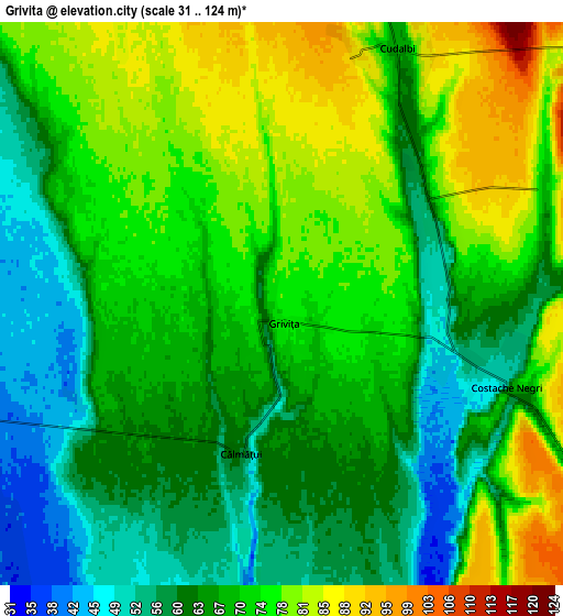
Below is the Elevation map of Griviţa, which displays elevation range with different colors. Scale of the first map is from 47 to 85 m (154 to 279 ft) with average elevation of 71.6 meters (=235 ft) [note 1]
These maps also provides idea of topography and contour of this city, they are displayed at different zoom levels. More info about maps, scale and edge coordinates you can find below images.
| \ | Map #1 | Map #2 | Topo.Map |
| Scale [m] | 47..85 m | 31..124 m | × |
| Scale [ft] | 154..279 ft | 102..407 ft | × |
| Average | 71.6 m = 235 ft | 68.8 m = 226 ft | × |
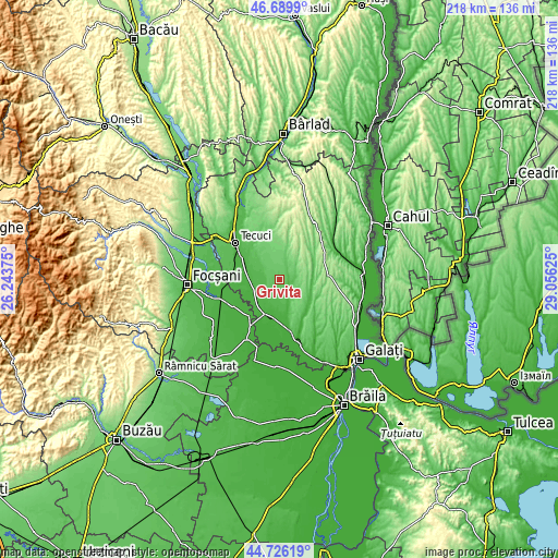
| Width | 6.82 km = 4.2 mi | 13.65 km = 8.5 mi | 218.3 km = 135.6 mi |
| Height | 6.82 km = 4.2 mi | 13.65 km = 8.5 mi | 218.3 km = 135.6 mi |
| ↑Max Latitude | 45.747345° | 45.778002° | 46.6899° |
| Latitude at center | 45.71667° | 45.71667° | 45.71667° |
| ↓Min Latitude | 45.685979° | 45.65527° | 44.72619° |
| ← Min Longitude | 27.606055° | 27.562109° | 26.24375° |
| Longitude center | 27.65° | 27.65° | 27.65° |
| →Max Longitude | 27.693945° | 27.737891° | 29.05625° |
Nearby cities:
Cities around Griviţa sort by population:
• Pechea elevation 44 m
14.9 km,  128°
128°
• Iveşti 21 m
11 km,  250°
250°
• Cudalbi 97 m
8.4 km,  27°
27°
• Umbrăreşti 21 m
14.2 km,  270°
270°
• Barcea 23 m
14.7 km,  284°
284°
• Bucești 34 m
11.7 km,  232°
232°
• Rediu 111 m
14.2 km,  90°
90°
• Costache Negri 48 m
5.5 km,  109°
109°
• Hanu Conachi 21 m
15.1 km,  196°
196°
• Umbrărești-Deal 19 m
14.4 km,  262°
262°
• Valea Mărului 107 m
13.9 km,  13°
13°
• Suhurlui 67 m
13.8 km,  84°
84°
Multilingual:
 En español:
Griviţa elevación 76 m.
 En France:
Griviţa élévation 76 m.


Sources and notes:
- [note 1] Map square and city borders are not equal. Map elevation data is calculated only from area inside that square.
- [src 1] Elevation data from geonames database provided with same terms of usage.
- [src 2] The elevation map of Griviţa is generated using elevation data from NASA's 3 arcsec (90m) resolution SRTM data.
- [src 3] Base (background) map © OpenStreetMap contributors tiles are generated by Geofabrik and OpenTopoMap.
Copyright & License:
This Griviţa Elevation Map is licensed under CC BY-SA. You may reuse any part from this page, if you give a proper credit by linking to this URL:
 More info on terms of use page.