Pârjol elevation
Pârjol (Bacău, Comuna Pârjol), Romania elevation is 395 meters and Pârjol elevation in feet is 1296 ft above sea level [src 1]. Pârjol is a seat of a second-order administrative division (feature code) with elevation that is 143 meters (469 ft) bigger than average city elevation in Romania.
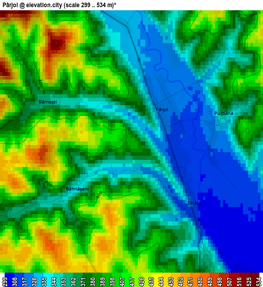
Below is the Elevation map of Pârjol, which displays elevation range with different colors. Scale of the first map is from 299 to 534 m (981 to 1752 ft) with average elevation of 376.6 meters (=1236 ft) [note 1]
These maps also provides idea of topography and contour of this city, they are displayed at different zoom levels. More info about maps, scale and edge coordinates you can find below images.
| \ | Map #1 | Map #2 | Topo.Map |
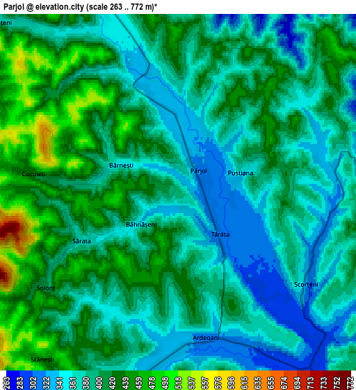
| Scale [m] | 299..534 m | 263..772 m | × |
| Scale [ft] | 981..1752 ft | 863..2533 ft | × |
| Average | 376.6 m = 1236 ft | 395.8 m = 1299 ft | × |
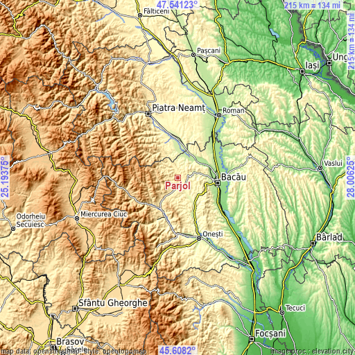
| Width | 6.72 km = 4.2 mi | 13.43 km = 8.3 mi | 214.9 km = 133.5 mi |
| Height | 6.72 km = 4.2 mi | 13.43 km = 8.3 mi | 214.9 km = 133.5 mi |
| ↑Max Latitude | 46.613525° | 46.643703° | 47.54123° |
| Latitude at center | 46.58333° | 46.58333° | 46.58333° |
| ↓Min Latitude | 46.553118° | 46.522889° | 45.6082° |
| ← Min Longitude | 26.556055° | 26.512109° | 25.19375° |
| Longitude center | 26.6° | 26.6° | 26.6° |
| →Max Longitude | 26.643945° | 26.687891° | 28.00625° |
Nearby cities:
Cities around Pârjol sort by population:
• Balcani elevation 432 m
6.7 km,  325°
325°
• Măgireşti 443 m
8.3 km,  207°
207°
• Solonţ 588 m
7.4 km,  239°
239°
• Frumoasa 371 m
9.9 km, 333°
• Scorţeni 299 m
5.3 km,  134°
134°
• Strugari 314 m
10.5 km,  121°
121°
• Ardeoani 327 m
5.6 km,  180°
180°
• Pustiana 363 m
2.5 km,  72°
72°
• Schitu Frumoasa 406 m
10.4 km,  304°
304°
• Cucuieți 428 m
5.5 km,  277°
277°
• Bucșești 453 m
11.1 km,  186°
186°
• Ludași 340 m
4.3 km,  338°
338°
Multilingual:
 En español:
Pârjol elevación 395 m.
 En France:
Pârjol élévation 395 m.


Sources and notes:
- [note 1] Map square and city borders are not equal. Map elevation data is calculated only from area inside that square.
- [src 1] Elevation data from geonames database provided with same terms of usage.
- [src 2] The elevation map of Pârjol is generated using elevation data from NASA's 3 arcsec (90m) resolution SRTM data.
- [src 3] Base (background) map © OpenStreetMap contributors tiles are generated by Geofabrik and OpenTopoMap.
Copyright & License:
This Pârjol Elevation Map is licensed under CC BY-SA. You may reuse any part from this page, if you give a proper credit by linking to this URL:
 More info on terms of use page.