Măgireşti elevation
Măgireşti (Bacău, Comuna Măgireşti), Romania elevation is 443 meters and Măgireşti elevation in feet is 1453 ft above sea level [src 1]. Măgireşti is a seat of a second-order administrative division (feature code) with elevation that is 191 meters (627 ft) bigger than average city elevation in Romania.
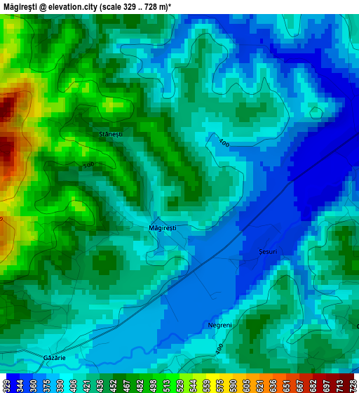
Below is the Elevation map of Măgireşti, which displays elevation range with different colors. Scale of the first map is from 329 to 728 m (1079 to 2388 ft) with average elevation of 424.9 meters (=1394 ft) [note 1]
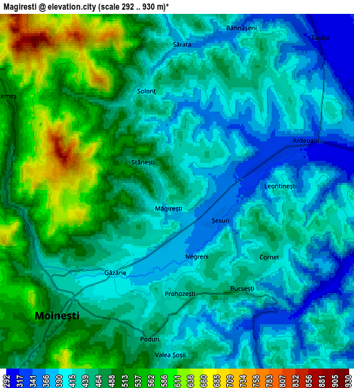
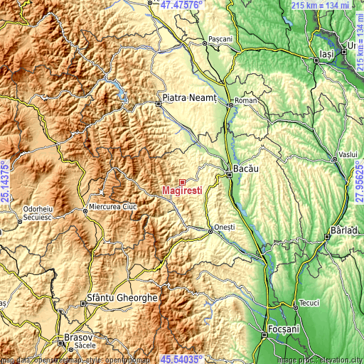
These maps also provides idea of topography and contour of this city, they are displayed at different zoom levels. More info about maps, scale and edge coordinates you can find below images.
| \ | Map #1 | Map #2 | Topo.Map |
| Scale [m] | 329..728 m | 292..930 m | × |
| Scale [ft] | 1079..2388 ft | 958..3051 ft | × |
| Average | 424.9 m = 1394 ft | 456.3 m = 1497 ft | × |
| Width | 6.72 km = 4.2 mi | 13.45 km = 8.4 mi | 215.2 km = 133.7 mi |
| Height | 6.72 km = 4.2 mi | 13.45 km = 8.4 mi | 215.2 km = 133.7 mi |
| ↑Max Latitude | 46.546902° | 46.577118° | 47.47576° |
| Latitude at center | 46.51667° | 46.51667° | 46.51667° |
| ↓Min Latitude | 46.486421° | 46.456155° | 45.54035° |
| ← Min Longitude | 26.506055° | 26.462109° | 25.14375° |
| Longitude center | 26.55° | 26.55° | 26.55° |
| →Max Longitude | 26.593945° | 26.637891° | 27.95625° |
Nearby cities:
Cities around Măgireşti sort by population:
• Moineşti elevation 476 m
6.6 km,  225°
225°
• Poduri 449 m
5.7 km,  192°
192°
• Pârjol 395 m
8.3 km,  27°
27°
• Solonţ 588 m
4.5 km,  325°
325°
• Ardeoani 327 m
4.3 km,  64°
64°
• Cernu 340 m
5.8 km,  152°
152°
• Cucuieți 428 m
8.3 km,  348°
348°
• Valea Arinilor 459 m
3.8 km,  236°
236°
• Bucșești 453 m
4.4 km, 145°
• Valea Șoșii 409 m
6.1 km,  180°
180°
• Găzărie 400 m
3.9 km,  218°
218°
• Prohozești 434 m
3.9 km, 178°
Multilingual:
 En español:
Măgireşti elevación 443 m.
 En France:
Măgireşti élévation 443 m.
 Auf Deutsch:
Măgireşti höhe über dem Meeresspiegel ist 443 m.

Sources and notes:
- [note 1] Map square and city borders are not equal. Map elevation data is calculated only from area inside that square.
- [src 1] Elevation data from geonames database provided with same terms of usage.
- [src 2] The elevation map of Măgireşti is generated using elevation data from NASA's 3 arcsec (90m) resolution SRTM data.
- [src 3] Base (background) map © OpenStreetMap contributors tiles are generated by Geofabrik and OpenTopoMap.
Copyright & License:
This Măgireşti Elevation Map is licensed under CC BY-SA. You may reuse any part from this page, if you give a proper credit by linking to this URL:
 More info on terms of use page.