Pustiana elevation
Pustiana (Bacău, Comuna Pârjol), Romania elevation is 363 meters and Pustiana elevation in feet is 1191 ft above sea level [src 1]. Pustiana is a populated place (feature code) with elevation that is 111 meters (364 ft) bigger than average city elevation in Romania.
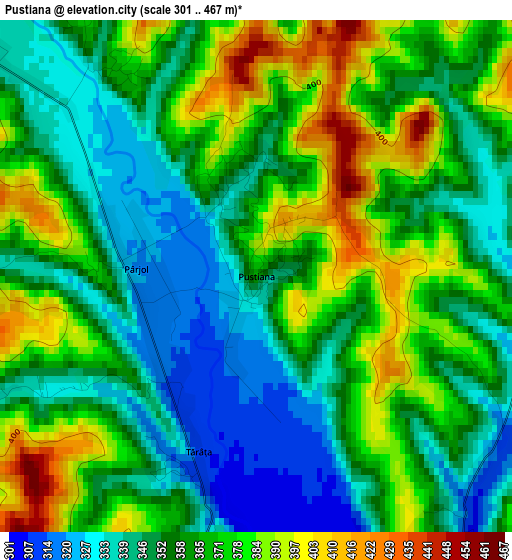
Below is the Elevation map of Pustiana, which displays elevation range with different colors. Scale of the first map is from 301 to 467 m (988 to 1532 ft) with average elevation of 361.6 meters (=1186 ft) [note 1]
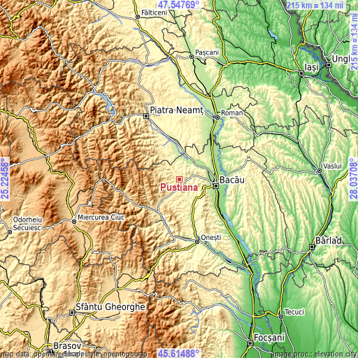
These maps also provides idea of topography and contour of this city, they are displayed at different zoom levels. More info about maps, scale and edge coordinates you can find below images.
| \ | Map #1 | Topo.Map |
| Scale [m] | 301..467 m | × |
| Scale [ft] | 988..1532 ft | × |
| Average | 361.6 m = 1186 ft | × |
| Width | 6.72 km = 4.2 mi | 214.9 km = 133.5 mi |
| Height | 6.72 km = 4.2 mi | 214.9 km = 133.5 mi |
| ↑Max Latitude | 46.620091° | 47.54769° |
| Latitude at center | 46.5899° | 46.5899° |
| ↓Min Latitude | 46.559692° | 45.61488° |
| ← Min Longitude | 26.586885° | 25.22458° |
| Longitude center | 26.63083° | 26.63083° |
| →Max Longitude | 26.674775° | 28.03708° |
Nearby cities:
Cities around Pustiana sort by population:
• Balcani elevation 432 m
7.8 km,  308°
308°
• Blăgeşti 329 m
10.5 km,  8°
8°
• Pârjol 395 m
2.5 km,  252°
252°
• Măgireşti 443 m
10.2 km,  217°
217°
• Solonţ 588 m
9.8 km,  243°
243°
• Frumoasa 371 m
10.6 km,  320°
320°
• Scorţeni 299 m
4.7 km,  161°
161°
• Strugari 314 m
9.1 km,  133°
133°
• Ardeoani 327 m
6.7 km,  200°
200°
• Buda 212 m
11.3 km,  36°
36°
• Cucuieți 428 m
7.8 km,  269°
269°
• Ludași 340 m
5.1 km, 309°
Multilingual:
 En español:
Pustiana elevación 363 m.
 En France:
Pustiana élévation 363 m.
 Auf Deutsch:
Pustiana höhe über dem Meeresspiegel ist 363 m.

Sources and notes:
- [note 1] Map square and city borders are not equal. Map elevation data is calculated only from area inside that square.
- [src 1] Elevation data from geonames database provided with same terms of usage.
- [src 2] The elevation map of Pustiana is generated using elevation data from NASA's 3 arcsec (90m) resolution SRTM data.
- [src 3] Base (background) map © OpenStreetMap contributors tiles are generated by Geofabrik and OpenTopoMap.
Copyright & License:
This Pustiana Elevation Map is licensed under CC BY-SA. You may reuse any part from this page, if you give a proper credit by linking to this URL:
 More info on terms of use page.