Poienari elevation
Poienari (Neamţ, Comuna Poienari), Romania elevation is 235 meters and Poienari elevation in feet is 771 ft above sea level [src 1]. Poienari is a populated place (feature code) with elevation that is 17 meters (56 ft) smaller than average city elevation in Romania.
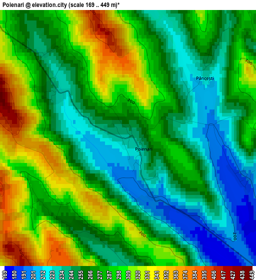
Below is the Elevation map of Poienari, which displays elevation range with different colors. Scale of the first map is from 169 to 449 m (554 to 1473 ft) with average elevation of 275.3 meters (=903 ft) [note 1]
These maps also provides idea of topography and contour of this city, they are displayed at different zoom levels. More info about maps, scale and edge coordinates you can find below images.
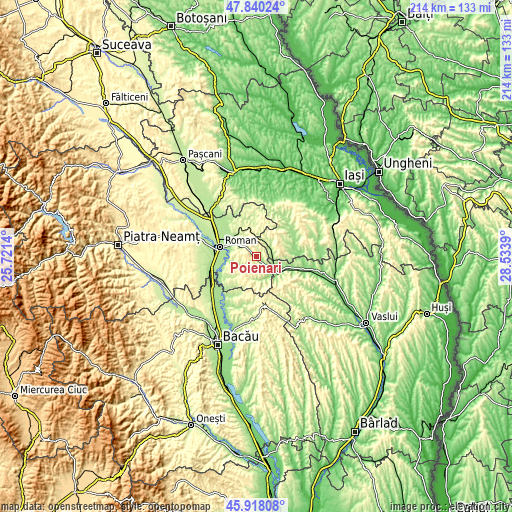
| \ | Map #1 | Topo.Map |
| Scale [m] | 169..449 m | × |
| Scale [ft] | 554..1473 ft | × |
| Average | 275.3 m = 903 ft | × |
| Width | 6.68 km = 4.2 mi | 213.7 km = 132.8 mi |
| Height | 6.68 km = 4.2 mi | 213.7 km = 132.8 mi |
| ↑Max Latitude | 46.917795° | 47.84024° |
| Latitude at center | 46.88777° | 46.88777° |
| ↓Min Latitude | 46.857728° | 45.91808° |
| ← Min Longitude | 27.083705° | 25.7214° |
| Longitude center | 27.12765° | 27.12765° |
| →Max Longitude | 27.171595° | 28.5339° |
Nearby cities:
Cities around Poienari sort by population:
• Poienile elevation 196 m
6.6 km,  39°
39°
• Băceşti 153 m
9.1 km,  117°
117°
• Valea Ursului 278 m
8.6 km,  203°
203°
• Oniceni 334 m
8.1 km,  167°
167°
• Tansa 319 m
8.6 km,  68°
68°
• Bozieni 272 m
6.3 km,  164°
164°
• Ion Creangă 187 m
11.4 km,  260°
260°
• Suhuleț 423 m
10.1 km,  79°
79°
• Mănăstirea 247 m
8.8 km, 38°
• Gâdinţi 198 m
9.8 km,  301°
301°
• Dagâţa 196 m
6.6 km, 39°
• Pânceşti 237 m
2.6 km,  48°
48°
Multilingual:
 En español:
Poienari elevación 235 m.
 En France:
Poienari élévation 235 m.
 Auf Deutsch:
Poienari höhe über dem Meeresspiegel ist 235 m.

Sources and notes:
- [note 1] Map square and city borders are not equal. Map elevation data is calculated only from area inside that square.
- [src 1] Elevation data from geonames database provided with same terms of usage.
- [src 2] The elevation map of Poienari is generated using elevation data from NASA's 3 arcsec (90m) resolution SRTM data.
- [src 3] Base (background) map © OpenStreetMap contributors tiles are generated by Geofabrik and OpenTopoMap.
Copyright & License:
This Poienari Elevation Map is licensed under CC BY-SA. You may reuse any part from this page, if you give a proper credit by linking to this URL:
 More info on terms of use page.