Poienile elevation
Poienile (Iaşi, Comuna Dagâţa), Romania elevation is 196 meters and Poienile elevation in feet is 643 ft above sea level [src 1]. Poienile is a populated place (feature code) with elevation that is 56 meters (184 ft) smaller than average city elevation in Romania.
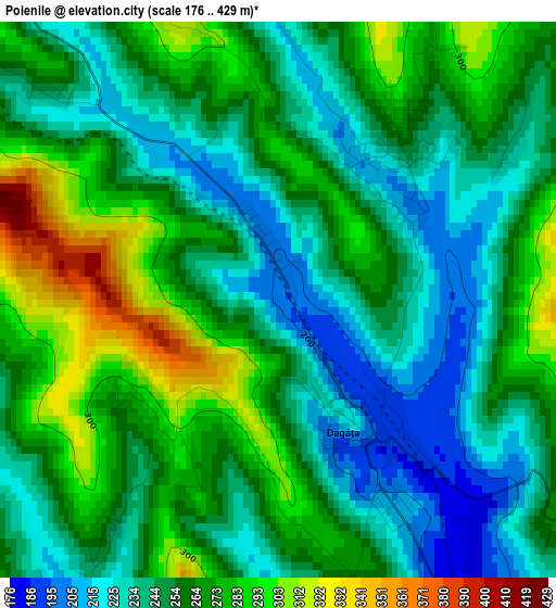
Below is the Elevation map of Poienile, which displays elevation range with different colors. Scale of the first map is from 176 to 429 m (577 to 1407 ft) with average elevation of 256.8 meters (=843 ft) [note 1]
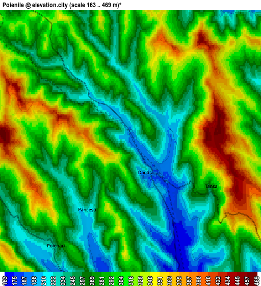
These maps also provides idea of topography and contour of this city, they are displayed at different zoom levels. More info about maps, scale and edge coordinates you can find below images.
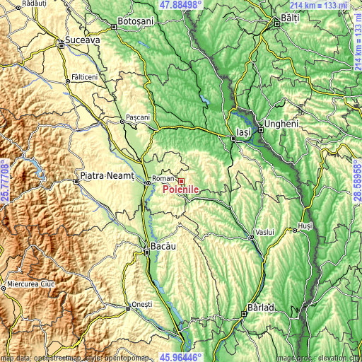
| \ | Map #1 | Map #2 | Topo.Map |
| Scale [m] | 176..429 m | 163..469 m | × |
| Scale [ft] | 577..1407 ft | 535..1539 ft | × |
| Average | 256.8 m = 843 ft | 287.4 m = 943 ft | × |
| Width | 6.67 km = 4.1 mi | 13.35 km = 8.3 mi | 213.5 km = 132.7 mi |
| Height | 6.67 km = 4.1 mi | 13.35 km = 8.3 mi | 213.5 km = 132.7 mi |
| ↑Max Latitude | 46.96333° | 46.993312° | 47.88498° |
| Latitude at center | 46.93333° | 46.93333° | 46.93333° |
| ↓Min Latitude | 46.903314° | 46.87328° | 45.96446° |
| ← Min Longitude | 27.139385° | 27.095439° | 25.77708° |
| Longitude center | 27.18333° | 27.18333° | 27.18333° |
| →Max Longitude | 27.227275° | 27.271221° | 28.58958° |
Nearby cities:
Cities around Poienile sort by population:
• Ţibăneşti elevation 150 m
11.5 km,  99°
99°
• Băceşti 153 m
10 km,  157°
157°
• Poienari 235 m
6.6 km,  219°
219°
• Tansa 319 m
4.2 km,  116°
116°
• Bozieni 272 m
11.4 km,  192°
192°
• Gârbești 217 m
10.5 km,  57°
57°
• Stăniţa 223 m
11.2 km,  325°
325°
• Glodenii Gândului 218 m
9 km,  77°
77°
• Suhuleț 423 m
6.6 km, 120°
• Mănăstirea 247 m
2.2 km,  34°
34°
• Pânceşti 237 m
4.1 km,  214°
214°
• Dagâţa 196 m
0 km,  0°
0°
Multilingual:
 En español:
Poienile elevación 196 m.
 En France:
Poienile élévation 196 m.
 Auf Deutsch:
Poienile höhe über dem Meeresspiegel ist 196 m.

Sources and notes:
- [note 1] Map square and city borders are not equal. Map elevation data is calculated only from area inside that square.
- [src 1] Elevation data from geonames database provided with same terms of usage.
- [src 2] The elevation map of Poienile is generated using elevation data from NASA's 3 arcsec (90m) resolution SRTM data.
- [src 3] Base (background) map © OpenStreetMap contributors tiles are generated by Geofabrik and OpenTopoMap.
Copyright & License:
This Poienile Elevation Map is licensed under CC BY-SA. You may reuse any part from this page, if you give a proper credit by linking to this URL:
 More info on terms of use page.