Poporogi elevation
Poporogi (Teleorman, Comuna Tătărăştii de Jos), Romania elevation is 114 meters and Poporogi elevation in feet is 374 ft above sea level [src 1]. Poporogi is a section of populated place (feature code) with elevation that is 138 meters (453 ft) smaller than average city elevation in Romania.
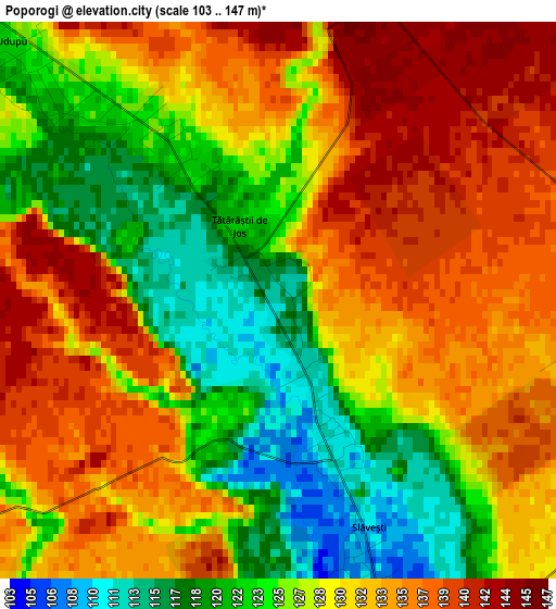
Below is the Elevation map of Poporogi, which displays elevation range with different colors. Scale of the first map is from 103 to 147 m (338 to 482 ft) with average elevation of 129.2 meters (=424 ft) [note 1]
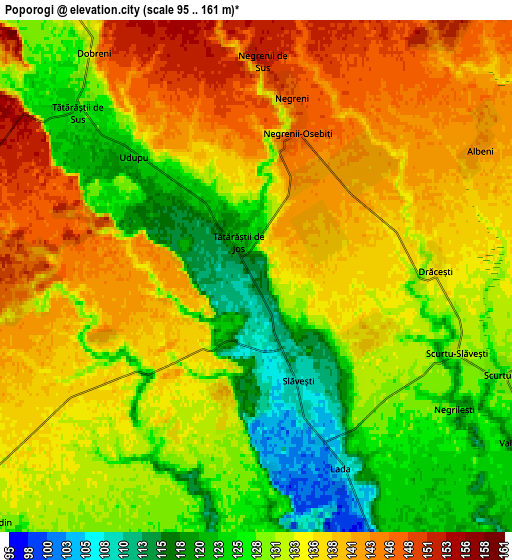
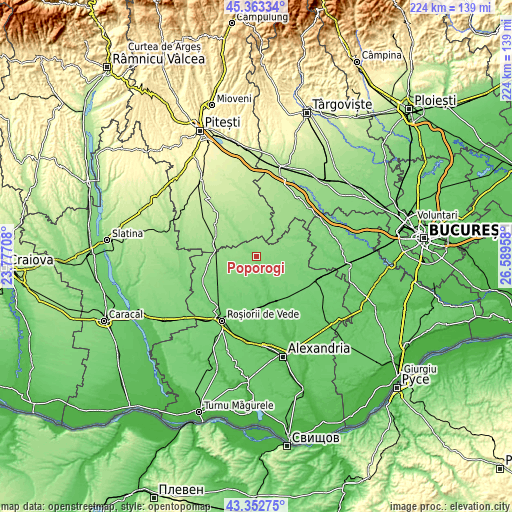
These maps also provides idea of topography and contour of this city, they are displayed at different zoom levels. More info about maps, scale and edge coordinates you can find below images.
| \ | Map #1 | Map #2 | Topo.Map |
| Scale [m] | 103..147 m | 95..161 m | × |
| Scale [ft] | 338..482 ft | 312..528 ft | × |
| Average | 129.2 m = 424 ft | 133.2 m = 437 ft | × |
| Width | 6.99 km = 4.3 mi | 13.97 km = 8.7 mi | 223.6 km = 138.9 mi |
| Height | 6.99 km = 4.3 mi | 13.97 km = 8.7 mi | 223.5 km = 138.9 mi |
| ↑Max Latitude | 44.398077° | 44.429468° | 45.36334° |
| Latitude at center | 44.36667° | 44.36667° | 44.36667° |
| ↓Min Latitude | 44.335246° | 44.303805° | 43.35275° |
| ← Min Longitude | 25.139385° | 25.095439° | 23.77708° |
| Longitude center | 25.18333° | 25.18333° | 25.18333° |
| →Max Longitude | 25.227275° | 25.271221° | 26.58958° |
Nearby cities:
Cities around Poporogi sort by population:
• Trivalea-Moşteni elevation 90 m
11.8 km,  160°
160°
• Poeni 135 m
12.5 km,  72°
72°
• Dobreni 127 m
7.7 km,  316°
316°
• Talpa-Trivalea 119 m
12.2 km,  139°
139°
• Scurtu Mare 131 m
6.9 km,  105°
105°
• Tătărăștii de Jos 122 m
1 km,  332°
332°
• Udupu 125 m
4.5 km, 317°
• Necşeşti 101 m
13.2 km,  191°
191°
• Deparați 94 m
10 km, 162°
• Tătărăștii de Sus 123 m
6.7 km,  313°
313°
• Talpa-Ogrăzile 118 m
12.4 km, 135°
• Popeşti 134 m
10.7 km, 321°
Multilingual:
 En español:
Poporogi elevación 114 m.
 En France:
Poporogi élévation 114 m.
 Auf Deutsch:
Poporogi höhe über dem Meeresspiegel ist 114 m.

Sources and notes:
- [note 1] Map square and city borders are not equal. Map elevation data is calculated only from area inside that square.
- [src 1] Elevation data from geonames database provided with same terms of usage.
- [src 2] The elevation map of Poporogi is generated using elevation data from NASA's 3 arcsec (90m) resolution SRTM data.
- [src 3] Base (background) map © OpenStreetMap contributors tiles are generated by Geofabrik and OpenTopoMap.
Copyright & License:
This Poporogi Elevation Map is licensed under CC BY-SA. You may reuse any part from this page, if you give a proper credit by linking to this URL:
 More info on terms of use page.