Rogoz elevation
Rogoz (Maramureş, Oraș Târgu Lăpuş), Romania elevation is 351 meters and Rogoz elevation in feet is 1152 ft above sea level [src 1]. Rogoz is a populated place (feature code) with elevation that is 99 meters (325 ft) bigger than average city elevation in Romania.
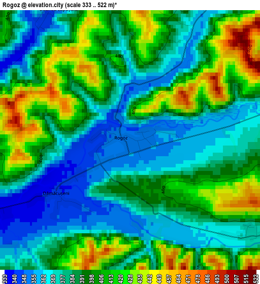
Below is the Elevation map of Rogoz, which displays elevation range with different colors. Scale of the first map is from 333 to 522 m (1093 to 1713 ft) with average elevation of 393.2 meters (=1290 ft) [note 1]
These maps also provides idea of topography and contour of this city, they are displayed at different zoom levels. More info about maps, scale and edge coordinates you can find below images.
| \ | Map #1 | Topo.Map |
| Scale [m] | 333..522 m | × |
| Scale [ft] | 1093..1713 ft | × |
| Average | 393.2 m = 1290 ft | × |
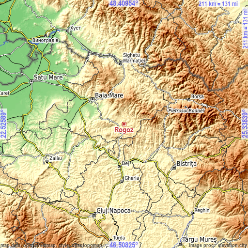
| Width | 6.61 km = 4.1 mi | 211.4 km = 131.4 mi |
| Height | 6.61 km = 4.1 mi | 211.4 km = 131.4 mi |
| ↑Max Latitude | 47.497189° | 48.40954° |
| Latitude at center | 47.46749° | 47.46749° |
| ↓Min Latitude | 47.437774° | 46.50825° |
| ← Min Longitude | 23.888195° | 22.52589° |
| Longitude center | 23.93214° | 23.93214° |
| →Max Longitude | 23.976085° | 25.33839° |
Nearby cities:
Cities around Rogoz sort by population:
• Suciu de Sus elevation 418 m
8.5 km,  116°
116°
• Lăpuş 390 m
7.3 km,  60°
60°
• Cerneşti 306 m
14.7 km,  291°
291°
• Cupşeni 488 m
9.2 km,  0°
0°
• Groșii Țibleșului 491 m
10.2 km,  75°
75°
• Ungureni 387 m
8.9 km,  9°
9°
• Suciu de Jos 379 m
4.5 km, 122°
• Libotin 374 m
5 km,  32°
32°
• Breaza 515 m
16.2 km,  142°
142°
• Borcut 343 m
7.1 km,  283°
283°
• Dămăcușeni 341 m
2.1 km,  236°
236°
• Târgu Lăpuş 333 m
5.3 km,  251°
251°
Multilingual:
 En español:
Rogoz elevación 351 m.
 En France:
Rogoz élévation 351 m.


Sources and notes:
- [note 1] Map square and city borders are not equal. Map elevation data is calculated only from area inside that square.
- [src 1] Elevation data from geonames database provided with same terms of usage.
- [src 2] The elevation map of Rogoz is generated using elevation data from NASA's 3 arcsec (90m) resolution SRTM data.
- [src 3] Base (background) map © OpenStreetMap contributors tiles are generated by Geofabrik and OpenTopoMap.
Copyright & License:
This Rogoz Elevation Map is licensed under CC BY-SA. You may reuse any part from this page, if you give a proper credit by linking to this URL:
 More info on terms of use page.